Fishing Boat With Beautiful Sunset Sky. Fishing Boat Anchored At Blue Economy Maritime Security Science and Technology

Digital Transformation for Ocean Governance: The Role of UDA in Monitoring and Regulation

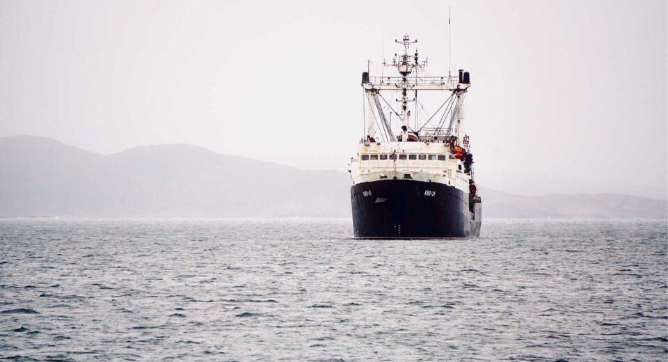
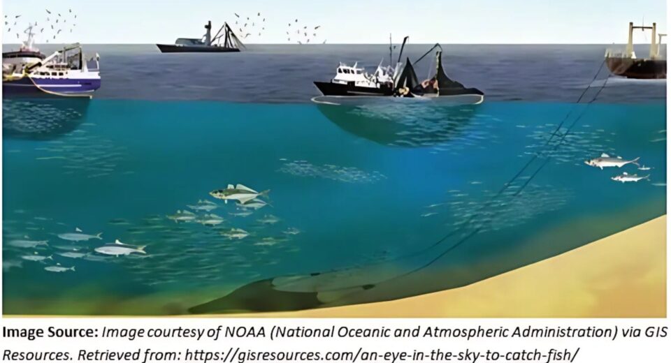
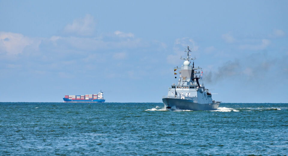
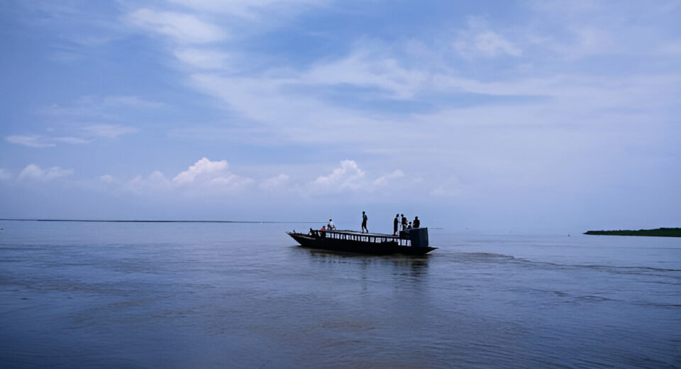
By: Mahak, St. Stephen’s College, DU  Key Highlights Advancements in UDA technologies are lifting the veil on the ocean’s depths and offering new insights into a previously opaque realm. UDA is not just for defense, but a game changer for combating illicit activities like IUU fishing, disrupting smuggling routes and protecting vital undersea infrastructure.   AI and autonomous systems transform raw underwater data into actionable intelligence to ensure better policies, smarter regulations and good ocean governance for nations like India. Robust UDA capabilities are crucial for India’s strategic autonomy, its Blue Economy ambitions, and its leadership in ensuring stability and environmental awareness in the Indo-Pacific region. The world’s oceans, covering over 70% of the Earth’s surface, are vast, dynamic, and incredibly opaque. For centuries, our ability to truly understand and govern their depths has been limited to just surface observations and fragmented data. But that is rapidly changing. We are now in an era where Underwater Domain Awareness (UDA) is transforming how we see and manage the seas beneath us. UDA is not just about submarines and naval strategy, but it is a foundational pillar for effective ocean governance. It gives us an unprecedented look into the subsurface by driving a digital revolution in how we monitor, regulate, and sustainably manage our marine water and even interconnected freshwater systems. Think of it as the ‘Eye below’ that helps nations, especially those with extensive coastlines like India in shifting from just reacting to problems to proactively looking after their precious aquatic territories. This article will explore how UDA’s technological leaps are enhancing our ability to monitor and enforce regulations by paving the way for a new era of robust ocean governance. The Opaque Challenge: The Need for UDA for Better Governance The underwater world is inherently challenging to monitor. Its sheer size, extreme depths, and constantly changing environment make traditional surveillance quite difficult and expensive. Threats often lurk unseen, all the way from clandestine activities to environmental degradation. For instance, consider Illegal, Unreported, and Unregulated (IUU) fishing. It is a global menace and besides depleting fish stocks and harming honest fishers, it is often linked to organized crime. Traditional methods like sending out patrol boats are like searching for a needle in a haystack. Similarly, narcotics smuggling increasingly exploits the subsurface, using ingenious methods to hide contraband. Moreover, below the waves, vital undersea infrastructure like internet cables and energy pipelines is vulnerable to accidental damage or even sabotage, compromising global communication and energy flows. Crucially, historical data from the underwater domain has been scarce and isolated. This lack of a holistic view has severely hampered our ability to draft effective policies and enforce them. This is where UDA steps in by building on surface-level Maritime Domain Awareness (MDA) by adding that vital third dimension of understanding. UDA’s Tech Revolution: Powering a Digital Shift The digital transformation in ocean governance is powered by incredible advances in UDA technologies. These innovations collect, process, and analyze massive amounts of underwater data, helping people see what was once hidden. 1: Autonomous Underwater Vehicles (AUVs) and Unmanned Underwater Vehicles (UUVs)- Robotic platforms that are the workhorses of modern UDA. They can operate independently for long periods, carrying sensors like sonar, cameras, and environmental probes. They map the seafloor, detect underwater objects, monitor marine life, and even identify sounds from vessels. Their ability to cover vast areas without human risk and at lower costs than manned vessels makes them indispensable. India is heavily investing in these capabilities. The Autonomous Systems Industry Alliance (ASIA), which was formed recently with US partners, focuses on co-developing and co-producing advanced autonomous systems, including potential UUVs, highlighting a strategic push towards self-reliance and technological leadership. 2: Advanced Sonar and Hydrophone Networks- Modern sonar systems and listening networks (Hydrophones) offer vastly improved detection and classification. Passive acoustic monitoring (listening to sounds) provides continuous and stealthy surveillance, while active sonar, though more detectable, gives precise imaging. Integrating these networks with fiber optic cables allows for real-time data transmission to the shore. 3: Artificial Intelligence (AI) and Machine Learning (ML)- The sheer volume of data from UDA sensors is too much for humans alone so AI and ML algorithms are necessary for the following tasks-     Automated Target Recognition- Instantly identifying and classifying objects or sounds such as differentiating a fishing trawler from a submarine or even marine mammals.        Anomaly Detection- Spotting unusual patterns or behaviors that might indicate illegal activities.        Data Fusion- Combining data from different sources (Sound, visuals, environmental and satellite) to create a comprehensive picture.    Predictive Analytics- Forecasting potential movements or environmental changes based on historical and real time data. AI and ML are true game changers, turning vast oceans of data into precise and actionable intelligence. 4: High Bandwidth Underwater Communications- Getting real-time data from underwater platforms to decision makers ashore needs robust communication links. Advances in acoustic and optical communication are making this possible. 5: Satellite Integration and Data Dissemination- While UDA focuses on the subsurface, combining its insights with satellite-based MDA platforms creates a truly multi-layered understanding. Processed UDA insights can be pushed to secure networks, giving various stakeholders a holistic view of the conditions. Initiatives like the Indo Pacific Maritime Domain Awareness (IPMDA), a Quad program, aim to fuse data from various sources to provide partner nations with a clearer picture of regional maritime activities, which would significantly benefit from integrated UDA inputs. UDA in Action- Monitoring Illicit Activities The digital shift driven by UDA is drastically improving our ability to fight various illicit activities that threaten maritime security, economic stability, and environmental health. Combatting IUU Fishing-UDA provides a much-needed advantage as AUVs with acoustic sensors can patrol protected zones, detecting the unique sounds of illegal fishing gear or trawlers. AI analyzes these patterns to flag suspicious activity, thereby prompting the deployment of patrol vessels. This allows for far more targeted and efficient enforcement, protecting marine resources as well as the livelihoods of legitimate fishers. India’s National Fisheries Policy

Yarlung Tsangpo Grand Canyon E28093 Tibet Geopolitics and IR Issue Briefs

Shared Waters, Shared Futures? The Brahmaputra in India–China Relations

By Atul Mangal, IIT Delhi Key Highlights “If World War III ever happens, it will be fought over water.” In June 2000, it was observed that the Siang River, which is the Brahmaputra’s name in Arunachal Pradesh, rose by 30 meters and flooded almost the entire town.   The concept of Underwater Domain Awareness can play a pivotal role in ensuring long-term sustainability and regional security in the Brahmaputra basin. The future of the Brahmaputra must be guided by cooperation, not competition; by shared responsibility, not unilateral ambition. “On July 19, 2025, Chinese Premier Li Qiang officially launched construction of the world’s largest hydropower dam at the Great Bend of the Yarlung Tsangpo — just before it enters Arunachal Pradesh as the Brahmaputra. Costing over $167 billion, the megaproject is expected to produce 300 billion kilowatt-hours of electricity annually. While China celebrates it as a project of the century, India views it as a potential threat to water security.” In recent years, water has increasingly become a strategic asset, and nowhere is this more visible than in the transboundary flows of the Brahmaputra. “If World War III ever happens, it will be fought over water”: a warning that feels uncomfortably close to reality in this region. Introduction The Brahmaputra River originates from the Kailash range of the Himalayas at an elevation of 5,300 m. It flows through China (known as Yarlung Tsangpo), India, and Bangladesh (known as Jamuna), and its basin also includes Bhutan. It is the ninth-largest river in the world by discharge and the 15th longest. Its average depth is 30 m, and the maximum depth is 135 m at Sadiya town of Assam. It supports about 130 million people across the four nations. “The Brahmaputra River is considered the lifeline for northeast India. It supports the region in terms of livelihood, economy, and ecology, contributing to the overall development of the region.” Significance of the River In India, the Brahmaputra basin extends through the states of Arunachal Pradesh, Assam, Meghalaya, West Bengal, Nagaland, and Sikkim. Nearly 80% of the basin area is covered by Arunachal Pradesh and Assam alone. The river is a major source of livelihood for most of the people of this region. The river supports agriculture, fisheries, aquaculture, tourism, and sand mining. It also helps connect regions through inland navigation and transportation of goods through National Waterway 2. It helps in hydroelectricity generation for the country. Ecologically, it is a key environmental hotspot in South Asia. It supports diverse ecosystems, rich biodiversity, and essential hydrological functions. The basin is a part of two biodiversity hotspots—the Himalaya and the Indo-Burma, which are two of 34 such hotspots of mega biodiversity on the planet recognized by the World Conservation Union (IUCN). It is home to India’s most significant wildlife protected areas, including Kaziranga National Park and Manas National Park. The river has more than 217 fish species belonging to 35 families. It also supports several endangered aquatic animals, including the Gangetic turtle, soft-leathered turtle, river dolphin, and Indian gharial. Challenges in the basin Besides its importance, there are a lot of challenges present in the basin. These can be divided into 3 major categories- environmental challenges, socio-economic challenges, and geo-political challenges. Environmentally, the region is prone to frequent flooding, severe riverbank erosion, sedimentation, and increasing pollution. These issues are being intensified by climate change, which is making extreme weather events more common and unpredictable. Socio-economically, the area struggles with poor infrastructure, high population pressure, poverty, and unsustainable fishing practices, all of which add stress to the ecosystem and the people depending on it.   Geopolitically, the situation is complicated by transboundary disputes, the construction of upstream dams, and limited regional cooperation, especially between the neighboring countries. Chinese Interventions and Regional Concerns Tensions around the Brahmaputra have escalated due to China’s unilateral interventions upstream. Some of the incidents observed are mentioned below. In June 2000, it was observed that the Siang River, which is the Brahmaputra’s name in Arunachal Pradesh, rose by 30 meters and flooded almost the entire town. Due to this, a lot of property was destroyed, and several lives were lost. It happened due to the collapse of a hydropower dam in Tibet. In February 2012, the Siang River experienced a significant drop in water level. Investigations carried out by the district authorities found that the Siang River was dry because the Chinese authorities had blocked the Yarlung Tsangpo river.   In 2016, China blocked the Xiabuqu River, which is a tributary of the Yarlung Tsangpo (Brahmaputra) River, as part of a hydro project. China’s Ministry of Foreign Affairs has clarified that the reservoir capacity of the project is less than 0.02% of the average annual runoff of the Yarlung Tsangpo River. “Recently, China has started the construction of the Medog Hydropower Project at the Great Bend region of the Yarlung Tsangpo. It is proposed to be the World’s largest hydropower project. It is expected to generate 300 billion kilowatt-hours of electricity annually.” The dam has raised serious concerns in India and Bangladesh about reduced water flow and downstream ecological damage. In India, the river runs through the northeastern states, which are sensitive border areas. This makes controlling and managing its waters important for national security and regional stability. This raises concerns that the dam could be weaponized and could be used strategically to manipulate water flow during times of conflict or tension. Such a dam could increase the risk of artificial floods or droughts in northeast India, especially during times of conflict. China has previously been accused of leveraging upstream dams to serve political agendas. In 2021, the water flow of the Mekong River was cut by 50% for three weeks. It was justified for maintaining the power line, but it affected the millions of people living along the waterways in the Southeast Asian countries of Cambodia, Laos, Myanmar, Thailand, and Vietnam. There will also be a negative impact on agriculture in India due to this dam. The fertile silt can be

Postersfffafa Blue Economy Underwater Heritage

Marginalisation and Revival of Indigenous Technical Knowledge in Indian Maritime Policy

Authored by: Diya Rao Jaini, St. Stephen’s College Key Highlights The distinction between traditional and modern scientific knowledge arises from the infusion of power in the dissemination and perception of knowledge. Varsha Mathew, MRC Intern, through fieldwork in Cherthala, Kerala, notes how fishermen used stars to navigate before the advent of technology (2025).   Coastal commons are natural resources and spaces which can be accessed and used by all members of a community. Introduction Indigenous technical knowledge is an essential source to consult for the development of comprehensive interventions in maritime policy. There is a multiplicity of definitions which emerge from a discussion on indigenous technical knowledge. These raise questions of power, marginalisation and exclusion – themes which remain relevant to understanding the role of indigenous technical knowledge in the process of policy formulation. Through an analysis of historiography around the definition of ‘indigenous technical knowledge’ and its connotations, this article identifies two issues associated with its use in knowledge dissemination and suggests ways in which this knowledge can be incorporated in maritime policy. Though it is important to acknowledge its importance, one must be cautioned against the romanticisation of indigenous technical knowledge. Like any other source, it must be treated with care, and corroborated with other data to produce comprehensive work. Arriving at a Definition An important assumption to dispel when defining indigenous knowledge is that it is simply composed of observations, and disseminated through folklore and wisdom. Indigenous knowledge is local knowledge – unique to a particular culture or society, and is the basis for decision making at the local level. It develops in contrast to an international knowledge system, which is generated by universities, research institutions and private firms.Indigenous technical knowledge is a body of knowledge built by a group of people through generations of living in close contact with nature (Johnson, 1992). It includes a system of classification, empirical observations about the local environment and a system of self-management which governs the use of resources. The quantity and quality of indigenous technical knowledge varies across the members of the community, and varies with age, gender, social status and profession. Though indigenous technical knowledge is rooted in the past, it is cumulative and dynamic. It uses the experience of earlier generations to adapt to contemporary technological and socio-economic changes. Indigenous technical knowledge gained international recognition through documents like the World Conservation Strategy and Our Common Future. These reports emphasised the need to use locals’ environmental expertise to manage local resources. Johnson highlights the need to develop a science based on the priorities of local people and creating a technological base which blends traditional and modern approaches to solve problems. Such comprehensive solutions can help achieve the sustainable management of natural resources (1992). Van der Bleikand and van Veldhuizen hold that indigenous knowledge consists of ideas, experiences, practices, and information either generated locally or elsewhere, but transformed elsewhere and incorporated into local lifestyles. It includes local, technological, cultural, and socio-economic aspects (1993). Chadwick notes the interaction between people and the environment as central to shaping indigenous knowledge. Complex conditions inform the environment, including physical, biological, economic and socio-cultural norms. The stakeholder responds to these conditions, which inform their knowledge of the environment (1998). These definitions note the centrality of transformation and dynamism in indigenous knowledge, and highlight its adaptability to contemporary circumstantial requirements. They also view the holder of indigenous knowledge as an active stakeholder who actively produces this knowledge through experience and observations, and present requirements. Two primary issues emerge from a discussion of the definitions of indigenous knowledge. It is crucial to acknowledge the epistemological framework in which indigenous knowledge operates to understand why its use as a source is approached with hesitation. This framework can be located in the nexus of knowledge and power. Secondly, there is a notable disjunct between policy and reality. While there has been significant movement in the inclusion of indigenous knowledge sources in policy making, the reach of these policies remains limited – thus failing to benefit some of the primary stakeholders for whom the policy was drafted in the first place. Power-Knowledge Nexus The distinction between traditional and modern scientific knowledge arises from the infusion of power in the dissemination and perception of knowledge. The objective of discussing this distinction is to understand how knowledge is categorised, how these categories are employed, and the limitations of their use. While indigenous technical knowledge is characterised by terms like ‘local’, ‘indigenous’, and ‘traditional’ – all of which connote different emphases – scientific knowledge is associated with standards like prediction, rationality, and objective, testable explanation. Mazzochi notes the tendency to pedestalise modern science and thus reinforce these hierarchies (2018). The popular perception that indigenous technical knowledge consists solely of wisdom through stories and folklore, and therefore lacks objectivity and rationality, fuels these hierarchies. It is seen as subordinate to Western science because of an imbalance of power. Cultural barriers also prevent the mutual acknowledgment of the value of indigenous technical knowledge and Western science by each other. The reconciling of two distinct world views comes with many issues. While Western science is based on reductionism, positivism, and objectivity, indigenous technical knowledge is more holistic, subjective, and experiential. Since it is predominantly an oral-based knowledge system, it is also more difficult to transmit ideas to those who do not share the same tradition and experience (Johnson, 1992). To be able to effectively use indigenous technical knowledge as a source, it is essential to understand that Western science and indigenous systems follow radically different methods of knowledge creation and validation. Indigenous technical knowledge is generated, recorded, and transmitted differently than Western scientific knowledge. Therefore, analysing one using the criteria prescribed by the other is precarious and may lead to inappropriate research results (Mazzochi, 2018). It is key to study the possibilities for collaboration between local communities and policymakers, to allow for and strengthen the development of more inclusive, locally-informed policies. Disjunct between Policy and Reality Despite efforts to integrate traditional knowledge into policy

Gadrk Blue Economy Issue Briefs Science and Technology

Hunting the Invisible: How AI and Satellite Radar Are Spotting India’s Dark Ships

By: Deepak Kumar (IIT Kharagpur) Key Highlights India’s maritime security is threatened by thousands of small, unregistered, and AIS-off vessels that evade traditional monitoring systems. Conventional methods and generic AI models struggle to detect small, low-contrast boats that dominate India’s fishing fleet.   SAR imagery provides all-weather, day-night coverage, but needs specialized AI to detect small vessels effectively. Our SAR-specific AI solution bridges this gap by detecting suspicious ships even in AIS-dark zones using open satellite data. This empowers India’s maritime agencies to protect coastal security, enforce regulations, and strengthen initiatives like Maritime Domain Awareness and the Blue Economy. India is surrounded by water on three sides. India’s coastline stretches approximately 11,099 km, with an Exclusive Economic Zone (EEZ) of around 2.3 million km², and coastal and maritime surveillance requirements have expanded dramatically. Given the rise in untracked, AIS-off vessels involved in illegal fishing and environmental risks, safeguarding this maritime expanse is a necessity. The ocean is India’s lifeline, from coastal fishing and trade to national defense and marine biodiversity.Yet, a major security concern continues to slip past the radar—“dark ships”, or vessels that sail without broadcasting their identity via AIS (Automatic Identification System). These vessels are invisible to conventional monitoring systems, making them a serious threat.Our project explores how machine learning combined with satellite-based Synthetic Aperture Radar (SAR) can fill the surveillance gap and help India detect what was previously hidden at sea. What Are Dark Ships—and Why They Matter? Dark ships are vessels that either do not carry an AIS device or intentionally switch it off to avoid detection. AIS is designed to transmit a ship’s ID, position, speed, and heading to nearby ships and coastal authorities.But AIS is not foolproof. It’s voluntary for small fishing boats and easily disabled on larger vessels. These gaps in visibility create dangerous loopholes. Ships that don’t broadcast AIS are essentially invisible to monitoring authorities. And in regions with dense fishing activity, like India’s east coast or the Arabian Sea, the invisibility comes with consequences.Illegal fishing in India’s EEZ is already a major concern. Reports show that over 40% of fish stocks are either fully exploited or overfished (FAO, 2022). Meanwhile, the National Crime Records Bureau has documented multiple instances of smuggling through fishing boats, many of which operate without transponders India’s Maritime Blind Spot: What the Numbers Say? India continues to face a large-scale gap in AIS coverage, particularly among small vessels. Here’s what the data reveals:       ● India has over 2.5 lakh registered fishing boats (Ministry of Fisheries, 2022)    ● Nearly half of India’s fishing boats still lack Automatic Identification System (AIS) or Vessel Monitoring System (VMS) devices     ● This gap is especially profound among smaller, traditional vessels, which make up a significant portion of the active fleet, leaving many boats untracked. This means that hundreds of thousands of vessels operating daily in Indian waters are completely untraceable by standard maritime monitoring systems. This invisibility creates a “blind spot” that is exploited for illegal fishing, smuggling, and other unauthorized activities, while also complicating rescue operations and maritime safety efforts. “India’s coastline is patrolled by technology, but vast stretches remain blind to the movement of thousands of small fishing boats—creating a critical gap that fuels illegal fishing, threatens marine ecosystems and resources, and weakens maritime security.” Why Existing Solutions Fall Short? Multiple technologies monitor India’s coastline, but each has critical blind spots—especially for small, unregistered fishing boats:      ● AIS Tracking: Depends entirely on vessels choosing to broadcast their position. Easily disabled or spoofed.      ● Coastal Surveillance Radars (CSRN): Effective within ~50 km of the shoreline. Not useful in deep-sea zones.      ● Optical Satellites (Sentinel-2, Planet): High-resolution but ineffective during cloudy weather or at night less impactful in Indian monsoon zones.      ● SAR Data (Sentinel-1): Can see through clouds and at night, but raw SAR images are complex and noisy, requiring advanced preprocessing and calibration to identify ships.     ● Traditional Algorithms (CFAR): Fail in coastal clutter, struggle to detect small and low-reflective vessels like fiberglass fishing boats.      ● Generic Machine Learning Models: YOLO or Faster R-CNN and other structured models perform well on large ships but often struggle with small vessels due to feature loss, noisy sea backgrounds, and poor scale handling—especially in complex coastal regions. These models are fast and powerful but not tuned for the subtle signatures of small, AIS-off ships. “Traditional SAR ship detection methods—like thresholding and classic algorithms—were designed for large, metal vessels and open seas, but they often miss small, low-reflectivity boats in cluttered coastal environments, leaving significant gaps in maritime surveillance and security.” The SAR-based AI Solution: Making the Invisible Visible Synthetic Aperture Radar (SAR) imagery offers a unique advantage—it captures Earth’s surface regardless of light or weather, making it ideal for maritime surveillance. But SAR images are grainy and complex, especially around coastlines. Identifying a small vessel in a noisy sea background is like “finding a needle in a foggy, choppy haystack.” This is where machine learning enters. By training a model on thousands of annotated SAR images, the system learns to identify patterns, shapes, and brightness variations associated with ship targets—even small, low-contrast ones. Our solution utilizes C-band SAR data from Sentinel-1, providing regular imagery over India’s coastal waters. We preprocess these images into 800×800 tiles, filtering noise and normalizing contrast. Then, we apply a deep learning model optimized specifically for SAR ship detection. The model: custom-built to spot what others miss We use a customized version of YOLOv8n, a popular deep learning model for object detection. But we didn’t just apply it out of the box. Instead, we tailored the model for SAR-based maritime detection by integrating specialized modules, each playing a vital role:      ● SR Module: Helps the model extract richer features from the SAR image by using multi-path filters. This increases detection clarity, even for blurred or distorted shapes.      ● SPD Module: Keeps the fine-grained details that matter—especially for tiny boats

Final Cover New Blue Economy Issue Briefs Science and Technology

Understanding Local Sediment Transport: Lessons from the Vishwamitri River Erosion

  • September 26, 2025
  • 0 Comments

By: Mehak, Former MRC Intern from St. Stephen’s College, DU (Supported by Romit Kaware, MRC Research Fellow) Key Highlights India’s vast and ecologically varied river network presents incredibly complex sedimentmanagement challenges Underwater Domain Awareness (UDA) provides a transformative framework for sediment management in India.   The Vishwamitri case should act as a turning point by catalyzing a shift toward data driven and system wide river management across India Moving towards an integrated, adaptive, and collaborative approach to sediment management is essential to protect India’s vital river systems. The Vishwamitri River in Vadodara, Gujarat, recently experienced unexpected and significant erosion after a large-scale dredging and desilting project. This incident serves as a crucial reminder that before undertaking major river engineering work, it is absolutely vital to thoroughly understand how the river’s natural sediment (Like sand, silt, and gravel) moves and settles. The erosion occurred even in areas where efforts were made to stabilize the banks, highlighting the dangers of not fully grasping a river’s natural behavior and the need for a more comprehensive and science-driven approach to river management and flood control. Happenings at the Vishwamitri River- After the dredging operations concluded, parts of the Vishwamitri River’s banks, which had never eroded before, began to show signs of damage. The Vadodara Municipal Corporation (VMC) had initiated a massive project to remove over 1.5 million cubic meters of silt from the river. The goal was to increase the river’s flow capacity and reduce the risk of flooding in the city of Vadodara. However, the monsoon season arrived shortly after the dredging, limiting the effectiveness of stabilization measures like planting vetiver grass and using coir geotextiles (Natural fabric mats). As a result, erosion was observed even where these bioengineering techniques were applied thereby raising serious questions about their effectiveness and the overall strategy for managing the riverbanks. An expert committee overseeing the project also noted that the construction of new expressways and bullet trains was obstructing the river’s natural water flow. They highlighted that the interventions were mostly focused only on the riverbanks, completely overlooking the broader floodplain and the complex ways sediment moves within it. The removal of natural vegetation along the banks, combined with the failure to clear debris and address illegal encroachments, further increased the risk of erosion and harmed the river’s natural balance. The Vishwamitri River’s sediment movement is naturally influenced by monsoon rains, urban development, large infrastructure projects, and how the land has been used historically. The recent dredging, while intended to help with floods, didn’t fully consider these local complexities. This led to rapid erosion in some areas, clearly showing that a ‘One size fits all’ approach doesn’t work as river interventions must be specifically tailored to each river’s unique characteristics. Importance of Sediment Transport Studies Sediment transport involves the movement of sand, silt, and other particles by water and is a fundamental process that shapes a river. It directly affects the riverbed’s depth, the stability of its banks, the health of aquatic life, and how well flood control measures actually work. When sediment is removed through dredging without a complete understanding of how it naturally moves and settles in that specific area, the river’s delicate balance is disrupted. This can lead to unexpected and accelerated erosion in some places, while causing excessive buildup of sediment in others. Such imbalances harm both the river’s ecosystem and human-built infrastructure. Sediment transport studies are vital tools for river management. They allow experts to predict how a river will react to human interventions like dredging, dam construction or changes to it’s banks. These studies provide crucial insights into where sediment will go by identifying areas likely to erode or accumulate and assessing the potential impact on buildings, bridges and natural habitats. Without reliable data from these studies, efforts to stabilize riverbanks can be ineffective or even make things worse as the Vishwamitri River case clearly demonstrated. Such detailed analyses help guide the correct application of mitigation measures, whether it’s using natural bioengineering techniques or building structures like gabion walls (Mesh cages filled with rocks). The way sediment flows is a dynamic process that is influenced by factors such as the amount of water flowing in the river, the supply of new sediment, changes in land use around the river, and variations in climate. Therefore, long-term monitoring and advanced computer modeling are essential. This ensures that river management can adapt to changing conditions and prevent negative outcomes such as rivers running dry downstream due to a lack of sediment or excessive buildup upstream. A comprehensive understanding of sediment dynamics requires a detailed investigation into both historical and current conditions, including where the sediment comes from, what it is made of, and how it behaves under different water flows. Advanced hydrodynamic and sediment transport models are indispensable for accurately forecasting a river's response to any engineering intervention. The Role of Underwater Domain Awareness (UDA) in Sediment Management- Effective and long-term sediment management needs to move beyond quick fixes like routine dredging. While dredging can temporarily increase a river’s capacity and reduce flood risks, it often has unintended negative consequences downstream, including bank erosion, loss of natural habitats, and disruption of the sediment supply that healthy rivers need. Sustainable sediment management requires a holistic and basin-wide approach that considers everything, such as how rivers behave upstream and downstream, land use patterns, and the combined effects of multiple human interventions. Nature- based solutions like replanting vegetation, restoring wetlands, and allowing controlled reconnection with floodplains offer promising alternatives for managing sediment flow more naturally. In this context, Underwater Domain Awareness (UDA) provides a transformative framework for sediment management in India. UDA promotes an integrated model for gathering, analyzing and using data for decision making. This approach brings together inputs from government agencies, academic institutions, industries and local communities. By combining hydrological data (Water flow), sediment samples, remote sensing (Satellite data) and ecological assessments, UDA helps create a multi level and interdisciplinary understanding of how sediment processes work. This holistic perspective is critical for accurately

Dddw Blue Economy Science and Technology

Harnessing Ocean Data for Smarter Fishing

Authored by: Thummalapelli Jeevan KumarFormer MRC Intern, IIT Kharagpur Key Highlights Fishermen using PFZ technology reduce search time by 70% and save massive amounts of fuel—900,000 liters saved in Maharashtra’s Raigad district alone, cutting over 2,400 tons of carbon emissions. PFZ technology evolved from basic 1970s temperature mapping to today’s AI-powered systems achieving 95% accuracy, even working through cloud cover that blocks traditional satellite views.   With 28 million Indians depending on fishing and fish stocks moving offshore due to climate change, PFZ technology balances economic needs with marine conservation. The user-friendly web application converts complex ocean data into simple interactive maps that anyone—from fishermen to government officials—can easily understand and use. The Challenge of Finding Fish Imagine waking up at 4 AM, loading your boat with nets and fuel, and heading out to sea with nothing but hope and experience guiding you. This is the reality for millions of fishermen, especially in India, where over 28 million people depend on fishing to feed their families. But here’s the thing—the ocean doesn’t come with a map showing where the fish are hiding. Fishermen often spend entire days searching, burning through expensive fuel, only to return with empty nets. It’s heartbreaking and financially devastating. And as fish populations decline and move to new areas, this guessing game becomes even harder. What if there was a better way? What if fishermen could know exactly where to go before they even left the dock? A New Way to Fish: Potential Fishing Zones Enter Potential Fishing Zones, or PFZs—a breakthrough that’s changing how we fish. Think of the ocean like a giant cookbook, where certain ingredients create the perfect recipe for fish to gather. Scientists have learned to read these “ingredients”—things like water temperature and the green stuff in the water (chlorophyll) that fish love to eat. When these conditions are just right, fish naturally flock to those areas. It’s like finding the ocean’s hot spots for seafood. In Maharashtra’s Raigad district, fishermen who started using this information saved 900,000 liters of fuel and cut their carbon emissions by over 2,400 tons. That’s not just good for their wallets—it’s good for our planet too. How We Got Here: Five Decades of Ocean Detective Work The scientific exploration of Potential Fishing Zones (PFZs) has undergone trans formative shifts over the past five decades, evolving from rudimentary observational methods to sophisticated data-driven modelling frameworks. This evolution reflects advances in remote sensing technology, computational capabilities, and ecological understanding, fundamentally reshaping how fisheries identify productive fishing grounds. The Temperature Detective Era (1970s-1990s) Back in the 1970s, scientists discovered something fascinating: fish love to hang out where warm and cold water meet—like invisible highways in the ocean. Using satellite images that could measure water temperature, they started making the first fishing maps. American tuna fishermen were among the first to try this in 1971. It worked, but it was just the beginning. Adding the Missing Piece (1990s-2000s) By the 1990s, scientists realized they were missing something crucial—food. New satellites could detect chlorophyll, the green stuff that feeds tiny ocean plants, which feed the fish. Suddenly, the picture became clearer. It wasn’t just about temperature anymore; it was about where the ocean’s dinner table was set. In India, this breakthrough helped fishermen cut their search time by 70%. Imagine getting your work done in three hours instead of ten—that’s life-changing. Getting Fancy with Data (2010s) As technology improved, scientists started looking at more ocean clues: how high or low the water was, how salty it was, underwater currents, and wind patterns. They built computer models that could juggle all these factors at once. For example, they discovered that albacore tuna prefer water between 18-21.5°C with specific chlorophyll levels. It was like creating a precise recipe book for different types of fish. The AI Revolution (2020s-Present) The current era leverages machine learning (ML) to decode complex oceanographic interactions. Support Vector Machines (SVM), Naive Bayes, and Artificial Neural Networks (ANN) now dominate PFZ modelling, achieving accuracies >95% by fusing satellite data with auxiliary sources like Vessel Monitoring Systems (VMS) and underwater imagery. Hybrid architectures (e.g., CNN-LSTM networks) integrate temporal dynamics, they can even work when clouds block satellite views—a common problem in places like the Bay of Bengal. We’ve gone from simple temperature maps to AI systems that think like experienced fishermen, but with the memory of thousands of fishing trips. Our Journey to Build a Better PFZ Model When we set out to create a better way to predict Potential Fishing Zones, our goal was to keep things simple yet effective for fishermen. We started by exploring a connection between chlorophyll levels—a measure of phytoplankton, which is fish food—and fish biomass. It seemed like a solid idea, but we quickly hit a wall. The relationships were far too complex, tangled up with environmental factors like ocean currents and salinity that were hard to measure consistently with the data we had. On top of that, building a model to predict fish biomass required detailed historical catch data, which was often incomplete or inconsistent. So, we took a step back and shifted to a more practical approach: a rank-based model using two reliable and widely available parameters—Sea Surface Temperature (SST) and Chlorophyll-a (Chl-a) concentration—from NASA’s Ocean Color program. This model is designed to be straightforward, user-friendly, and grounded in science. Here’s how it works: Trusted Data Sources: We rely on high-quality, publicly available satellite data from NASA’s Ocean Color program. This ensures our model is sustainable and accessible, without needing specialized or restricted datasets. Simple Ranking System: Instead of wrestling with complex equations, we used fisheries science to identify the best SST and Chl-a ranges for fish aggregation—think warm waters and food-rich zones. Areas with ideal conditions get a top rank of 5, while less favorable conditions are ranked from 4 down to 1. It’s an intuitive system: higher ranks mean better fishing spots.   Smart Weighting: Not all parameters are equally important for every fish species or region. Our model assigns

Missile Boat During Naval Exercises And Parade, Guided Missile Destroyer, Warship In Baltic Sea Blue Economy ESG and Climate Risk Geopolitics and IR Maritime Security

Uplifting Coastal Communities in the Philippines: Harnessing Underwater Technology and Innovations

By: Joan Andrea ToledoBoard Director, Indo-Pacific Alliance, Philippines Key Highlights The Bajau Laut community will be able to reduce food insecurity through the provision of Indian indigenous technology and expertise through the technical assistance of the Indo-Pacific Alliance and the Maritime Research Center of India. In the Philippines, the integration of Artificial Intelligence (AI) into the fisheries sector offers transformative opportunities for enhancing the livelihoods of ordinary fisherfolk.   Fishermen can be trained to utilize these localized AI models, which can help them achieve higher, more stable incomes by adapting to fluctuating market conditions. Introduction The Bajau people have been crisscrossing the waters of the Sulu Sea for centuries. To the Bajau, a “border” is merely the farthest distance they can reach by boat. They are exceptional divers; they can stay underwater for up to 10 minutes at depths of 200 feet. Their diet consists of seafood (The Guardian, August 10, 2023). The Bajau Laut communities in the Davao Region and Northern Mindanao comprise a large section of undocumented Filipinos. They do not see the necessity of obtaining a Philippine national identification document, as they frequently cross borders. Due to their lack of national documents, they are unable to get social security benefits, health and education benefits, as well as financial and food aid assistance during typhoons. Given this situation, the Indo-Pacific Alliance, an ocean think tank in the Philippines, wants to establish a partnership with the Maritime Research Center, headed by its Founder and Director, Dr (Cdr) Arnab Das, aims to learn about Indian indigenous technologies to assist ocean-dependent communities, such as the Bajau Laut. Indian maritime security experts have been at the forefront of technologies that uplift the livelihood of fishing communities. Food Security Food Security is national security. A foremost concern of the Philippines is ensuring food security for coastal and fishing communities. These communities regularly rely on aquatic animals from marine and freshwater environments, whether taken from wild capture or produced in a cultured setting. These types of food remain an important source of protein and micronutrients for them. Filipinos generally source most of the aquatic food or fish they consume from the ocean. However, fish supply deficits are an increasing problem (Jocson, 2022). To meet food demand, the Philippines has become a net fish importer in 2022 (Bureau of Fisheries and Aquatic Resources, 2022). For example, in a study on fish demand, the Philippines requires 1.67 million metric tons more fish per year by 2050 to at least maintain its current per capita fish consumption of 34.27 kg annually. The mismanagement of inland and marine fisheries will further widen the gap in fish supply. However, efforts in rebuilding overfished fisheries, restoring degraded habitats crucial to supporting productive fisheries, addressing current threats to fisheries sustainability, and expanding sustainable marine aquaculture will help meet the future fish demand in the Philippines (Cabral et. al., 2023). Given this critical food security situation, a national response has been implemented. Philippine President Ferdinand Marcos, Jr., has directed the Department of Agriculture to increase the country’s fish supply, repair the fish habitats, and buy larger boats in order to help fishing communities and cooperatives regain better productivity. Having bigger boats will allow them to fish more and be more efficient. President Marcos wanted to provide the fishermen with livestock and seaweed farming to increase their income. He further directed the department to provide additional cold storage and postharvest facilities, apply policies that will reduce the prices of agricultural commodities and enhance agricultural production, present proposed amendments to the Philippine Fisheries Code, and draft an Executive Order on Strategic Agriculture and Fisheries Development Zones (Manila Bulletin, January 16, 2024). Furthermore, a strategic solution to this food security concern is to promote the sustainable fish production potential of marine and inland capture fisheries and to focus on improving the aquaculture production trajectory. Additionally, mariculture production can expand, and sourcing most of the fish is highly feasible; however, it will need essential technology, infrastructure, research, and investments. Indo-Pacific Alliance Partnership with the Maritime Research Center, India The Indo-Pacific Alliance, a Philippine-based Ocean think tank, wants to establish a close partnership with the Maritime Research Center, India, in order to learn, understand, and implement Indian indigenous technologies that foster sustainable livelihood opportunities as well as enable optimal wild fisheries production from inland and marine environments for ocean-dependent communities. In the Philippines, the integration of Artificial Intelligence (AI) into the fisheries sector offers transformative opportunities for enhancing the livelihoods of ordinary fisherfolk. For instance, the Maritime Research Center has developed AI-driven models to assist fishermen in accessing real-time market prices for their aquatic catch in local fish markets. This empowers them to make informed decisions about when and where to sell their fish, maximizing their earnings based on market demand. Fishermen can be trained to utilize these localized AI models, which can help them achieve higher, more stable incomes by adapting to fluctuating market conditions. Another promising solution is the development of a technology system that allows fishermen to upload data about fishing conditions in traditional fishing grounds. This system can track fish stock trends over time, providing valuable insights into the availability of aquatic species in particular areas. By integrating AI-powered analytics, this system could predict optimal fishing times and locations, thereby enhancing the daily catch. To further augment productivity, AI can be incorporated into radar and sonar technologies. When equipped with these devices, fishermen can gain real-time insights into the location and abundance of fish, enabling them to target productive fishing grounds more efficiently. These sonar and radar devices can be linked to cloud-based platforms that offer real-time analysis of fish stock, providing predictive data on fish movement patterns. This technology would be especially valuable for remote or underserved communities, such as the Bajau people, who rely on traditional fishing practices but have limited access to advanced tools. By combining local knowledge with AI analytics, these communities can greatly increase their catch and income potential. Moreover, the installation of GPS-enabled technology on fishing

Bramhaputra River Short Report

Reimagining River Security: The Brahmaputra’s Future Between Dams, Diplomacy, and Data

Key Highlights The Brahmaputra River Basin (BRB) is one of South Asia’s most ecologically rich yet geopolitically fragile freshwater systems. Originating from the Angsi Glacier in the Tibetan Plateau, the Brahmaputra River spans approximately 2,900 kilometres, traversing China (as the Yarlung Tsangpo), India, and Bangladesh before merging with the Ganges and emptying into the Bay of Bengal. The river sustains an estimated 130 million people across its basin, providing water for agriculture, energy generation, drinking, and livelihoods while also supporting rich ecological diversity. In recent years, the BRB has become a site of accelerating environmental risk, strategic tension, and institutional fragmentation. This short report offers an overview of literature published on the BRB, a structured analysis of the challenges facing the Brahmaputra. It proposes a coordinated governance strategy rooted in the Underwater Domain Awareness (UDA) framework. Focusing on water security, river management, the China factor and the Indian approach, as well as climate stress, upstream damming, transboundary mistrust, and sediment instability, the report highlights the urgent need for integrated data systems, basin-wide collaboration, and community-driven resilience planning. Introduction One of the goals of India’s ‘Atmanirbhar Bharat’ launched by Hon’ble Raksha Mantri in September 2022 is Civil-Military Fusion (CMF). The concerted effort by the Ministry of Defence (MoD) has not just increased the indigenous components of defence acquisition, but India’s defence exports have reached an all-time high of ₹15,920 crore in FY 2022-23. Indian Navy’s consistent endeavour has been appreciated by Hon’ble Prime Minister during the recent ‘Swavlamban’ Seminar. However, changes in the nature and character of warfare have forced all countries to revisit their maritime defence strategies. Sabotage, grey-zone conflict, and asymmetric warfare are altering the balance of threat, even when the balance of power between countries remains relatively unchanged. Routine underwater commercial activities are being targeted and weaponised, increasing vulnerabilities to critical national infrastructure. Against this backdrop, the importance of Underwater Domain Awareness (UDA) need not be overstated. However, the mere absorption of advanced underwater technologies would be inadequate for optimal defence for critical underwater national assets, constituting an effective deterrence, or conducting an offensive/covert action against an adversary. There will be a need to synthesise the existing Organisations, Innovations, and Logistics, or the OIL of CMF for enhancing the UDA. This paper seeks to examine the application of CMF in UDA. It studies the scope of increasingly vulnerable maritime infrastructure like oil and gas pipelines, electricity grids, and underwater communication networks that have emerged as the new frontlines of potential conflict. In addition, it identifies the possible vulnerabilities of adversaries in the immediate neighbourhood. The paper further explores the increased weaponisation of liminal technologies that could morph UDA from the benign realms of Science and Technology (S&T) to geopolitical and strategic contestation for monopoly in the years ahead. Therefore, the National Security Council will also have to identify new technologies requiring collaboration under the India-US Initiative on Critical and Emerging Technologies (iCET) in UDA domain. Finally, the paper suggests for enhancing India’s maritime security, minor structural changes that would be necessary by synthesising Organisations, such as International Fusion Centre – Indian Ocean Region (IFC-IOR), The Coast Guard, National Institute of Ocean Technology (NIOT), Ministry of Petroleum and Natural Gas (MoPNG), Ministry of Communications (MoC), and Ministry of Electronics & Information Technology (MoEIT). Read Full Article Here Tejaswini Kaktikar About Author Tejaswini Kaktikar is an undergraduate student of Anthropology at University College London, with research interests at the intersection of environment, culture, and governance. Her current work focuses on the Brahmaputra River Basin, examining water security, river management, and strategic environmental policy through an anthropological lens. By combining cultural perspectives with ecological concerns, she aims to contribute to more inclusive and sustainable approaches to environmental challenges.

Missile Boat During Naval Exercises And Parade, Guided Missile Destroyer, Warship In Baltic Sea Geopolitics and IR Maritime Security

China’s Underwater Expansion: Implications for Indo-Pacific Maritime Security

Key Highlights UDA holds immense strategic significance, encompassing undersea cables, a vast range of rich mineral resources, advanced submarine operations, and sophisticated information-sharing capabilities. China has emerged as a frontrunner, steadily expanding its capabilities and asserting influence in the UDA, through a variety of unmanned and manned naval operations.   China currently owns around 59 submarines, and according to reports by the NTI, it is expected to grow its fleet to 65. The United States of America and India have already started to intensify their cooperation in the UDA Technologies. The Indo-Pacific region is more than just a geographical territory or a diplomatic alliance, it is the epitome of 21st-century strategic rivalry. While countries continue to assert their maritime influence through surface-level naval operations, enhancing their domain awareness through cooperation, and port development, one crucial horizon remains often overlooked in the discourse of this strategic space: the underwater domain. This submerged landscape, hidden beneath the waves, holds immense strategic significance, encompassing undersea cables, a vast range of rich mineral resources, advanced submarine operations, and sophisticated information-sharing capabilities. Among various regional powers, China has emerged as a frontrunner, steadily expanding its capabilities and asserting influence in this invisible battlefield beneath the sea through a variety of unmanned and manned naval operations, underwater warfare, hypersonic warfare equipment, sea infrastructure, sending comprehensive scientific research ships for deep sea global exploration especially in the colder seas, and additionally to keep surveillance of submarines of the US, Japan, and other nations, deployed to monitor the Chinese themselves. Introduction When discussing China, we often associate the word ‘expansionist’ with its territorial ambitions in the changing global dynamics. However, it is equally significant that while analyzing a nation’s strategic missions, one must look through the lens of its history in establishing its reign of nauticalism. As early as the 13th and 14th centuries, historians recount Chinese civilizations and dynasties using robust materials and advanced techniques, producing ships and seafaring vessels, which resulted in the flourishing of Quangzhou in the Yang dynasty, home to a sturdy fleet of seafaring vessels. In 1346, an explorer recounted witnessing such advanced-built ships easily able to carry up to 1000 passengers in their fleet. What we call the Maritime Silk Road today has been a product of various sea and ship routes used by these vessels from Quanzhou to the Indian Ocean, into the Red Sea, establishing its significance in trade. Or something else. It is geopolitically significant to note China’s history of strategic expansion or influence in this domain from its early seafaring legacy to its extended underwater narrative to establish an underwater data center, bringing advanced AI supporting technologies and systems into the picture. “The People’s Liberation Army Navy (PLAN) of China, which is responsible for overseeing the nation’s maritime security, also handles its undersea strategic operations and developments in underwater warfare such as submarines, torpedoes, mines, as well as Sound Navigation and Ranging system technologies which detects submarines and other underwater threats emerging using sound wave radiations. It currently owns around 59 submarines, and according to reports by the NTI, it is expected to grow its fleet to 65. Current Developments Recently, beneath the waves, a new frontier in data technologies has emerged with China unveiling the world’s first operational underwater AI data center, making a yet again historic leap in the consolidation of data infrastructure and emerging technological systems. As information warfare shapes modern geopolitics, China’s early advantage places it ahead in a competition most Indo-Pacific nations have yet to enter. An underwater data center refers to a sealed, pressure-resistant module containing the server infrastructure; being submerged in the sea, it reduces the need for air-based HVAC technologies, truly being a vision of the future. Additionally, the region has also expanded its technologies to great lengths, such as successfully building a supersonic missile, being boron-powered, working as an anti-submarine missile, with capabilities to travel faster than a torpedo. According to the South China Morning Post, such missiles would be able to perfectly change course at will or crash dive in order to evade underwater defence systems without losing momentum. Conclusion Like the dragon it embodies, China has surged beneath the oceans, expanding silently and strategically with precision and purpose, much unlike the Indo-Pacific countries, which remain adrift, yet to even anchor their ambitions in the underwater realm. Although, at the same time the talks of the maritime domain awareness, especially this domain, in the QUAD i.e. the Quadrilateral Security Dialogue, consisting of India, Japan, Australia and the United States, emerging as an outcome of the nation’s great growing influencing also acting as a wakeup call in this imbalanced strategic space. The United States and India have already started to intensify cooperation for UDA technologies, including the Sea Picket autonomous surveillance system, the unmanned Wave Glider, and more undersea vehicles manufactured by Ocean Aero, as well as negotiating on the Sagar Defence engineering for its co-production. While it seems like a strategic win for India, which in many ways it is, the nation must realize that it needs to act swiftly and decisively, building robust UDA technologies, if it hopes to keep pace with its formidable neighbour. Such are the consequences one has to go through having a dragon that truly never sleeps, as their neighboring nation, as it looms beneath and beyond the surface. References China’s ocean expansion Chinas underwater initiatives and seabed exploration aspirations   China’s growing capability in underwater warfare implications for the indo pacific China’s first underwater ai data center and the rise of subsea computing China’s subsea data centre could power China begins building underwater data centre China to display unmanned, intelligent, underwater, hypersonic at upcoming military parade Exposed undersea pla navy officer reflections on chinas not so silent service Cristee Arora About Author Cristee is a second-year political science student and a research intern at the Indo-Pacific Studies Center. She is also a member of Global Youth and the Indian Foreign Policy Project and has previously worked in policy analysis under the

Weather: Heavy Rains In Telangana ESG and Climate Risk Science and Technology

Up to Our Necks: Contours and Consequences of Urban Flooding

How should increasingly frequent instances of urban flooding shape our approach to development? Can the lessons learnt from the flooding of our cities be our first defence against climate change? Key Highlights Urban flooding has become much more common across the world in the last two decades due to the effects of climate change. Management of the problem has to begin with the drainage systems of our cities, and how equipped such systems are to deal with the intensity and increased volume of rainfall. Ø Challenges to effective management of drainage systems come from encroachment of wetlands, citizens’ apathy around garbage disposal, construction practices in the real estate industry, and laxity and corruption in urban administration. Challenges to effective management of drainage systems come from encroachment of wetlands, citizens’ apathy around garbage disposal, construction practices in the real estate industry, and laxity and corruption in urban administration. Technology for stormwater management must include mapping and zoning based on GIS-based satellite imagery, capacity planning of drainage systems with reference to the IDF rainfall curve, and plotting lakes and wetlands into primary, secondary, and tertiary channels of urban water conveyance. Valuable lessons for urban planners can be taken from the Sponge City principles that have been developed in China for the absorption and reuse of rainwater in cities like Shanghai. Any average urban Indian in 2025 does not need the Intergovernmental Panel on Climate Change (IPCC) reports, the Lancet Countdown, or the WMO State of Climate Services report to tell them about increasing instances of urban flooding. Every year, we have more widespread, visible and critical episodes of urban flooding that cripple infrastructure and cause great harm to homes and workspaces. The lives of thousands of people are affected, in addition to the deaths and casualties reported from flood-related accidents. Of course, it is not as if urban flooding is only a few decades old. As a person whose childhood in the 1970s and 80s in Mumbai was gifted with at least one or two “rain holidays” in July, I was still struck by the impact of the flooding on 26th July, 2005, when high tide in the Arabian sea, and 944mm of rainfall left thousands of people marooned miles away from their homes. On that day, cars were floating on roads, and flyovers had become parking lots for cars, with people huddled in them, sheltering from the swirling waters below. Urban flooding – a global phenomenon Since that day, flooding has hit New York (2012), and flooding in September 2024 covered a large part of Europe. This included Spain, Austria, where a dozen dams were breached, the Czech Republic, Croatia, Germany, Hungary, Italy, Poland, Romania, and Slovakia. Extreme climate events are forcing countries across the world to look at ways to prevent urban flooding, earlier reported regularly only from a low-lying country like Bangladesh or a riverside city like Shanghai. When we look at how gleaming models of development in our country, like the IT hubs of Bengaluru and Gurugram, get submerged every year during the rainy season, the problem acquires a different character. It is evident that, even when modern buildings and offices are being planned, less attention has been given to the environment that is meant to support them. “In October 2024, an under-construction site at the Manyata Tech Park in Bengaluru city was dubbed the “Manyata Tech Falls,” after a video of water pouring off a flooded road into a steep trench went viral on social media. This was after a single night of intense rain, and called into question the preparedness of builders and developers as well as authorities who have sanctioned large tracts of land for development without ensuring that environmental safeguards are in place.” Drains as definers of urban planning The draining of water during periods of intense rain is the most important element of urban flood management. Since those days of my childhood in 1970s Mumbai, the subject of whether the stormwater drains of the city had been cleaned and dredged thoroughly from the months of March to May, to prepare for the monsoon’s arrival in June, used to make headlines in the newspapers. Was the BMC sufficiently prepared? This was very much a part of the public discourse. What the 2015 floods of Mumbai showed, however, was that stormwater drains that were over a century old, and covered only a small area of the city, were inadequate to deal with the immense volume of water within a period of a few hours. They also highlighted the many other factors that contribute to flooding: waste clogging natural drainage channels, reduced seepage of water on the increasingly impervious soil in cities due to the use of non-porous construction materials,   encroachment on lakes and natural water bodies within urban areas, and lax implementation of regulatory mechanisms like the Environment Impact Assessment or EIA. Urban geographer and political ecologist Malini Ranganathan, who has closely studied the flood risks in post-colonial Bangalore, found the draining of water to be a complex web of what were marked on maps, “… as “rivers”, “irrigation canals”, “raja kaluves” (large drains), “katcha (unfinished) drains”, “sanitary drains”, “box drains”, and even “roads” and “residential layouts”.” What makes her findings significant is being able to see drains as central to the city in the form of assemblages of fixity (social orders, state forms, intransigent discourses, settlements, solid waste) and flow (irrigation water, stormwater, sewage, capital). As she puts it, “… in the new millennium, flood risk is the product of an intensifying alignment between storm drains and the flow/fixity of real estate capital. Specifically, the dizzying flow of speculative and global real estate capital through Bangalore’s storm drains and the fixity of resulting informal developments in wetlands have rendered the flow of stormwater especially unpredictable and risky.” As was proved in the floods of September 2022, the flow of rainwater was so intense that it dwarfed the fixity of a gated community of villas in Bellandur, where billionaires live in homes costing