
Authored by: Thummalapelli Jeevan Kumar
Former MRC Intern, IIT Kharagpur
Fishermen using PFZ technology reduce search time by 70% and save massive amounts of fuel—900,000 liters saved in Maharashtra’s Raigad district alone, cutting over 2,400 tons of carbon emissions.
PFZ technology evolved from basic 1970s temperature mapping to today’s AI-powered systems achieving 95% accuracy, even working through cloud cover that blocks traditional satellite views.
With 28 million Indians depending on fishing and fish stocks moving offshore due to climate change, PFZ technology balances economic needs with marine conservation.
- The user-friendly web application converts complex ocean data into simple interactive maps that anyone—from fishermen to government officials—can easily understand and use.
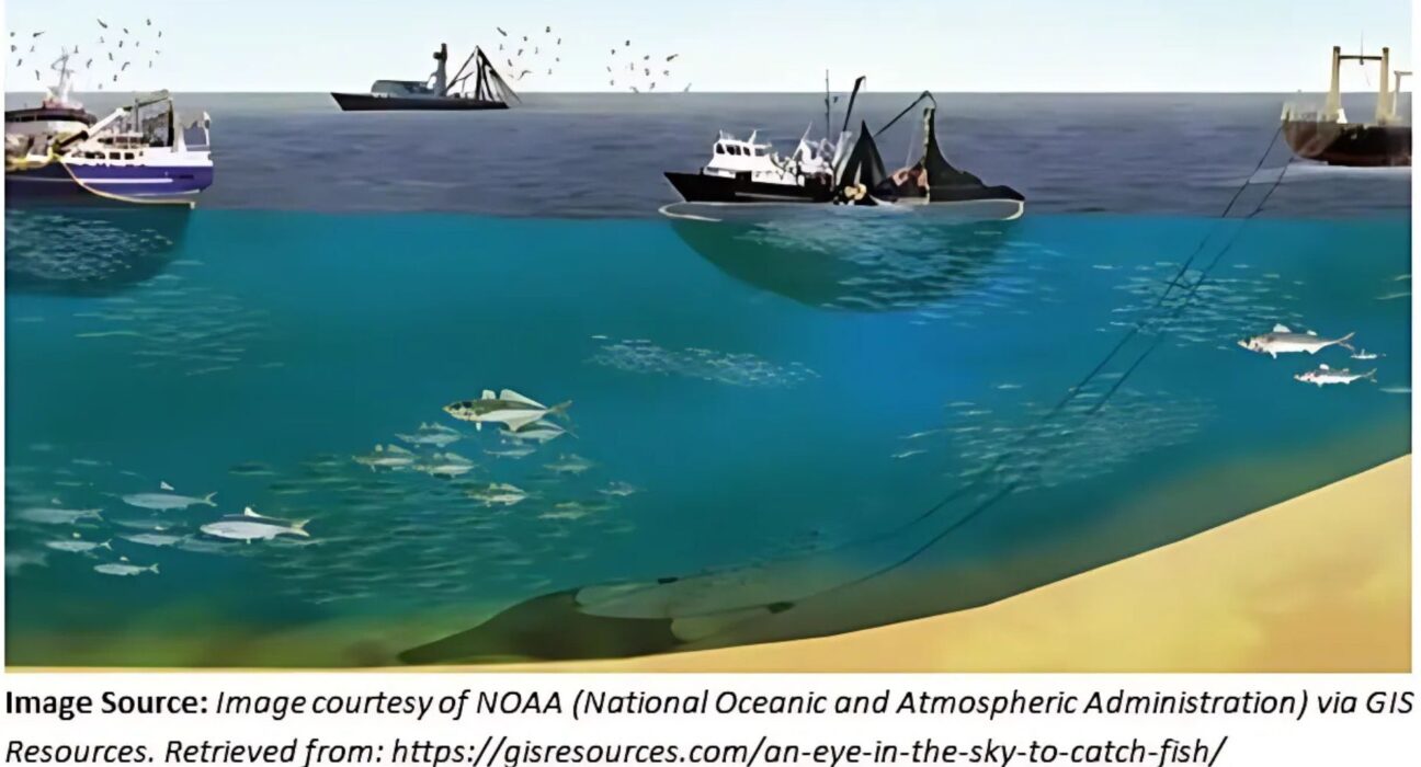
The Challenge of Finding Fish
Imagine waking up at 4 AM, loading your boat with nets and fuel, and heading out to sea with nothing but hope and experience guiding you. This is the reality for millions of fishermen, especially in India, where over 28 million people depend on fishing to feed their families.
But here’s the thing—the ocean doesn’t come with a map showing where the fish are hiding. Fishermen often spend entire days searching, burning through expensive fuel, only to return with empty nets. It’s heartbreaking and financially devastating. And as fish populations decline and move to new areas, this guessing game becomes even harder.
What if there was a better way? What if fishermen could know exactly where to go before they even left the dock?
A New Way to Fish: Potential Fishing Zones
Enter Potential Fishing Zones, or PFZs—a breakthrough that’s changing how we fish. Think of the ocean like a giant cookbook, where certain ingredients create the perfect recipe for fish to gather. Scientists have learned to read these “ingredients”—things like water temperature and the green stuff in the water (chlorophyll) that fish love to eat.
When these conditions are just right, fish naturally flock to those areas. It’s like finding the ocean’s hot spots for seafood. In Maharashtra’s Raigad district, fishermen who started using this information saved 900,000 liters of fuel and cut their carbon emissions by over 2,400 tons. That’s not just good for their wallets—it’s good for our planet too.
How We Got Here: Five Decades of Ocean Detective Work
The scientific exploration of Potential Fishing Zones (PFZs) has undergone trans formative shifts over the past five decades, evolving from rudimentary observational methods to sophisticated data-driven modelling frameworks. This evolution reflects advances in remote sensing technology, computational capabilities, and ecological understanding, fundamentally reshaping how fisheries identify productive fishing grounds.
The Temperature Detective Era (1970s-1990s)
Back in the 1970s, scientists discovered something fascinating: fish love to hang out where warm and cold water meet—like invisible highways in the ocean. Using satellite images that could measure water temperature, they started making the first fishing maps. American tuna fishermen were among the first to try this in 1971. It worked, but it was just the beginning.
Adding the Missing Piece (1990s-2000s)
By the 1990s, scientists realized they were missing something crucial—food. New satellites could detect chlorophyll, the green stuff that feeds tiny ocean plants, which feed the fish. Suddenly, the picture became clearer. It wasn’t just about temperature anymore; it was about where the ocean’s dinner table was set.
Getting Fancy with Data (2010s)
As technology improved, scientists started looking at more ocean clues: how high or low the water was, how salty it was, underwater currents, and wind patterns. They built computer models that could juggle all these factors at once. For example, they discovered that albacore tuna prefer water between 18-21.5°C with specific chlorophyll levels. It was like creating a precise recipe book for different types of fish.
The AI Revolution (2020s-Present)
The current era leverages machine learning (ML) to decode complex oceanographic interactions. Support Vector Machines (SVM), Naive Bayes, and Artificial Neural Networks (ANN) now dominate PFZ modelling, achieving accuracies >95% by fusing satellite data with auxiliary sources like Vessel Monitoring Systems (VMS) and underwater imagery. Hybrid architectures (e.g., CNN-LSTM networks) integrate temporal dynamics, they can even work when clouds block satellite views—a common problem in places like the Bay of Bengal.
We’ve gone from simple temperature maps to AI systems that think like experienced fishermen, but with the memory of thousands of fishing trips.
Our Journey to Build a Better PFZ Model
When we set out to create a better way to predict Potential Fishing Zones, our goal was to keep things simple yet effective for fishermen. We started by exploring a connection between chlorophyll levels—a measure of phytoplankton, which is fish food—and fish biomass. It seemed like a solid idea, but we quickly hit a wall. The relationships were far too complex, tangled up with environmental factors like ocean currents and salinity that were hard to measure consistently with the data we had. On top of that, building a model to predict fish biomass required detailed historical catch data, which was often incomplete or inconsistent.
So, we took a step back and shifted to a more practical approach: a rank-based model using two reliable and widely available parameters—Sea Surface Temperature (SST) and Chlorophyll-a (Chl-a) concentration—from NASA’s Ocean Color program. This model is designed to be straightforward, user-friendly, and grounded in science. Here’s how it works:
- Trusted Data Sources: We rely on high-quality, publicly available satellite data from NASA’s Ocean Color program. This ensures our model is sustainable and accessible, without needing specialized or restricted datasets.
- Simple Ranking System: Instead of wrestling with complex equations, we used fisheries science to identify the best SST and Chl-a ranges for fish aggregation—think warm waters and food-rich zones. Areas with ideal conditions get a top rank of 5, while less favorable conditions are ranked from 4 down to 1. It’s an intuitive system: higher ranks mean better fishing spots.
- Smart Weighting: Not all parameters are equally important for every fish species or region. Our model assigns weights to SST and Chl-a ranks, allowing us to fine-tune predictions based on what matters most in a given context.
- Clear Zones for Action: We combine the weighted ranks to classify ocean areas into five categories: Premium, High, Medium, Low, and Poor. It’s like handing fishermen a treasure map, with “Premium” zones clearly marking the best places to cast their nets.
This rank-based approach stands out for its simplicity and practicality. Unlike more complex models that might promise pinpoint accuracy but falter with patchy data, our method works with what’s available, delivering clear, actionable insights for small-scale fishermen in India.
Bringing PFZs to Life with a Web App
To ensure the model’s predictions reach those who need them, a user-friendly web application was created. This tool displays PFZ predictions on an interactive map, clearly marking Premium zones and others for fishermen and policymakers. Designed for simplicity, it avoids technical jargon and complex interfaces, enabling anyone—from experienced fishermen to government officials—to quickly identify prime fishing areas.
Why It Matters Now
Today, with fish stocks moving further offshore and climate change shaking up ocean patterns, tools like PFZs are more important than ever. They don’t just help fishermen catch more fish with less effort; they also support sustainable practices that protect marine ecosystems.
Looking Ahead
Our next steps involve refining the model by incorporating additional environmental factors, such as ocean currents and sea surface height, and validating it with real-world data from trusted sources like India’s INCOIS. The aim is to create a more precise and reliable tool that empowers fishing communities, strengthens local economies, and promotes sustainable practices to preserve our oceans for future generations.

Thummalapelli Jeevan Kumar
About Author
Thummalapelli Jeevan Kumar is a final-year undergraduate student in Chemical Engineering at IIT Kharagpur, who completed his Research Internship at the Maritime Research Center, Pune, in August 2025.