
By Atul Mangal, IIT Delhi
“If World War III ever happens, it will be fought over water.”
In June 2000, it was observed that the Siang River, which is the Brahmaputra’s name in Arunachal Pradesh, rose by 30 meters and flooded almost the entire town.
The concept of Underwater Domain Awareness can play a pivotal role in ensuring long-term sustainability and regional security in the Brahmaputra basin.
- The future of the Brahmaputra must be guided by cooperation, not competition; by shared responsibility, not unilateral ambition.
In recent years, water has increasingly become a strategic asset, and nowhere is this more visible than in the transboundary flows of the Brahmaputra. “If World War III ever happens, it will be fought over water”: a warning that feels uncomfortably close to reality in this region.
Introduction
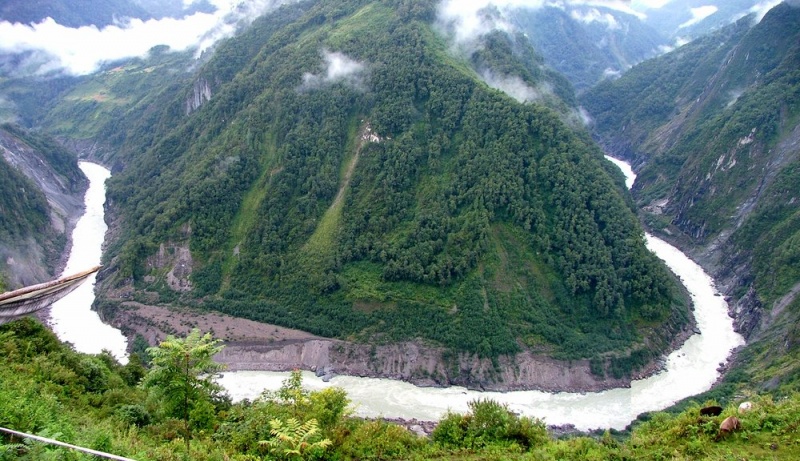
The Brahmaputra River originates from the Kailash range of the Himalayas at an elevation of 5,300 m. It flows through China (known as Yarlung Tsangpo), India, and Bangladesh (known as Jamuna), and its basin also includes Bhutan. It is the ninth-largest river in the world by discharge and the 15th longest. Its average depth is 30 m, and the maximum depth is 135 m at Sadiya town of Assam. It supports about 130 million people across the four nations.
Significance of the River
In India, the Brahmaputra basin extends through the states of Arunachal Pradesh, Assam, Meghalaya, West Bengal, Nagaland, and Sikkim. Nearly 80% of the basin area is covered by Arunachal Pradesh and Assam alone. The river is a major source of livelihood for most of the people of this region. The river supports agriculture, fisheries, aquaculture, tourism, and sand mining. It also helps connect regions through inland navigation and transportation of goods through National Waterway 2. It helps in hydroelectricity generation for the country.
Ecologically, it is a key environmental hotspot in South Asia. It supports diverse ecosystems, rich biodiversity, and essential hydrological functions. The basin is a part of two biodiversity hotspots—the Himalaya and the Indo-Burma, which are two of 34 such hotspots of mega biodiversity on the planet recognized by the World Conservation Union (IUCN). It is home to India’s most significant wildlife protected areas, including Kaziranga National Park and Manas National Park. The river has more than 217 fish species belonging to 35 families. It also supports several endangered aquatic animals, including the Gangetic turtle, soft-leathered turtle, river dolphin, and Indian gharial.
Challenges in the basin
Besides its importance, there are a lot of challenges present in the basin. These can be divided into 3 major categories- environmental challenges, socio-economic challenges, and geo-political challenges.
- Environmentally, the region is prone to frequent flooding, severe riverbank erosion, sedimentation, and increasing pollution. These issues are being intensified by climate change, which is making extreme weather events more common and unpredictable.
- Socio-economically, the area struggles with poor infrastructure, high population pressure, poverty, and unsustainable fishing practices, all of which add stress to the ecosystem and the people depending on it.
- Geopolitically, the situation is complicated by transboundary disputes, the construction of upstream dams, and limited regional cooperation, especially between the neighboring countries.
Chinese Interventions and Regional Concerns
Tensions around the Brahmaputra have escalated due to China’s unilateral interventions upstream. Some of the incidents observed are mentioned below.
- In June 2000, it was observed that the Siang River, which is the Brahmaputra’s name in Arunachal Pradesh, rose by 30 meters and flooded almost the entire town. Due to this, a lot of property was destroyed, and several lives were lost. It happened due to the collapse of a hydropower dam in Tibet.
- In February 2012, the Siang River experienced a significant drop in water level. Investigations carried out by the district authorities found that the Siang River was dry because the Chinese authorities had blocked the Yarlung Tsangpo river.
- In 2016, China blocked the Xiabuqu River, which is a tributary of the Yarlung Tsangpo (Brahmaputra) River, as part of a hydro project. China’s Ministry of Foreign Affairs has clarified that the reservoir capacity of the project is less than 0.02% of the average annual runoff of the Yarlung Tsangpo River.
“Recently, China has started the construction of the Medog Hydropower Project at the Great Bend region of the Yarlung Tsangpo. It is proposed to be the World’s largest hydropower project. It is expected to generate 300 billion kilowatt-hours of electricity annually.”

The dam has raised serious concerns in India and Bangladesh about reduced water flow and downstream ecological damage. In India, the river runs through the northeastern states, which are sensitive border areas. This makes controlling and managing its waters important for national security and regional stability. This raises concerns that the dam could be weaponized and could be used strategically to manipulate water flow during times of conflict or tension. Such a dam could increase the risk of artificial floods or droughts in northeast India, especially during times of conflict.
China has previously been accused of leveraging upstream dams to serve political agendas. In 2021, the water flow of the Mekong River was cut by 50% for three weeks. It was justified for maintaining the power line, but it affected the millions of people living along the waterways in the Southeast Asian countries of Cambodia, Laos, Myanmar, Thailand, and Vietnam. There will also be a negative impact on agriculture in India due to this dam. The fertile silt can be retained by the dam, which is useful for agriculture. The dam could disrupt the fragile Himalayan ecosystem, home to critically endangered species. Overall, this hydropower dam can be harmful to India.
India’s Strategic Response
In response, India is fast-tracking its own hydropower infrastructure to counterbalance China’s control and manage the Brahmaputra’s volatile flow.
- The Subansiri Lower Hydroelectric Project, located near the border of Arunachal Pradesh and Assam on the Subansiri River, is India’s largest run-of-the-river hydroelectric plant. With an installed capacity of 2,000 MW, it is expected to generate approximately 7,420–7,500 million units of electricity annually. Apart from power generation, the dam will help regulate river flows and contribute to flood moderation downstream, especially during the monsoon.
- The Dibang Multipurpose Project, located in the Lower Dibang Valley district of Arunachal Pradesh, is another critical infrastructure being developed. With a proposed capacity of 2,880 MW, it includes the construction of a 288-meter-high concrete gravity dam, which will be the tallest in India upon completion. Scheduled to be commissioned by 2032, the Dibang project is designed not only to produce substantial hydroelectric power but also to play a key role in flood moderation and water management, helping reduce the adverse impacts of climate variability in the Brahmaputra basin.
Despite the strategic importance of these Indian dam projects, they have faced strong opposition from local communities, environmentalists, and civil society groups.
The project was stalled for nearly a decade due to sustained protests led by organizations such as the All Assam Students’ Union (AASU) and Krishak Mukti Sangram Samiti (KMSS). Similarly, the Dibang Multipurpose Project has been criticized for its potential impact on tribal communities, forests, and biodiversity in Arunachal Pradesh. Environmental impact assessments have been challenged for underreporting the risks, and activists warn that such large-scale infrastructure could permanently alter the region’s fragile ecological balance.
Regional Cooperation and Diplomacy
Despite ongoing tensions, the Brahmaputra River presents an opportunity for fostering regional cooperation. There are existing frameworks like the Bangladesh-China-India-Myanmar (BCIM) Economic Corridor and the South Asian Association for Regional Cooperation (SAARC), but none focus directly on the Brahmaputra basin. India and China have signed a Memorandum of Understanding (MoU) on hydrological data sharing during the monsoon season, but this agreement is often suspended during periods of political strain, as witnessed in 2017 during the Doklam standoff.
There is an urgent need for a more robust and transparent multilateral framework that promotes data sharing, joint research, and integrated water resource management across borders. Collaborative initiatives such as flood forecasting, early warning systems, and ecosystem preservation efforts can go a long way in building trust and resilience among the riparian nations. The lessons from the Mekong River Commission, which includes multiple Southeast Asian countries, could be a model for the Brahmaputra basin.
Role of Underwater Domain Awareness (UDA)
A structured UDA framework, aligned with regional cooperation initiatives, can empower India and its neighbors to manage the Brahmaputra more effectively, ensuring ecological and strategic stability in the region.
Conclusion
The Brahmaputra River, a lifeline for millions, is increasingly becoming a geopolitical flashpoint. The unchecked race to build dams and control their flow threatens not just ecosystems and livelihoods but also regional peace. While infrastructure development and national security are valid concerns, they must not come at the cost of ecological stability and human well-being. The future of the Brahmaputra must be guided by cooperation, not competition; by shared responsibility, not unilateral ambition.

Atul Mangal
About Author
Atul Mangal is pursuing his B.Tech. in Chemical Engineering from IIT Delhi. As a Summer Intern at MRC, he contributed to a research project on ‘Modelling and Simulation for the Brahmaputra River,’ where he worked on scientific analysis and computational modelling to support riverine domain research.