underwater_noise Science and Technology

The current scenario of Underwater Radiated Noise Management in India  and the World

  • May 31, 2022
  • 0 Comments

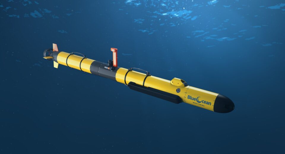
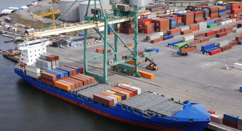
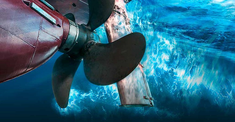
Heading The release of dangerous chemical, biological, or physical substances into the world’s seas is not the only source of ocean pollution but it also includes an increase in underwater noise caused by a variety of human factors. The concept of underwater radiated noise first emerged during the Cold War, when its reduction had a strictly militaristic application, to ensure acoustic stealth of submarines. In the current scenario, however, Underwater Radiated Noise (URN) is a growing cause of environmental and socio-economic concern. However, unlike the other forms of ‘material’ pollutants, noise is a form of energy hence it is quickly dissipated and thus has to be quantified at the source. Another issue with imposing limits on the amount of emitted noise is that for the same intensity of noise severity may vary depending on the time and location. As a  result, there is a lack of research and regulation when it comes to noise pollution in comparison of air or water pollution. Shipping is the primary cause of underwater radiated noise. Global sea-borne trade has increased at a rate of 2.5% and 1.4% in the short and long term respectively. As a result, the underwater noise levels in some of the world’s oceans have nearly doubled every decade over the past 60 years and this is directly proportional to the Gross Domestic Product (GDP) of these nations. “The underwater radiated noise from a ship has got 3 main sources, namely the propeller machinery and the hull. The propeller is the dominant source, accounting for about 80%-85% of the generated noise, the reason being propeller cavitation. Cavitation contributes to both tonal and broadband noise. The noise from the machinery and hull is mainly produced due to vibrations. Noise levels at higher frequency (above some hundreds of Hz) will tend to decrease with increasing frequency. Therefore, the predominant noise is in the low-frequency band which affects the ambient noise over a large ocean area.” Higher levels of underwater noise impact the marine species as well as disrupts the economic development of people inhabiting the coastal regions. The audible range of marine fishes and mammals range from 5 Hertz to around 200 Kilohertz. Underwater radiated noise effects over 66 species of fish, almost all marine mammals and 36 species of invertebrates, and can severely hamper intraspecies and interspecies interactions. Hearing is the key sense for these creatures, and they rely heavily on it for navigation, communication, food acquisition, breeding, and threat detection. As a result, these animals are  more prone to be affected by an increase in ambient noise and it affects their interaction with the environment. This is termed ‘Acoustic Degradation’. ‘Acoustic Masking’ occurs when the presence of noise disrupts an animal’s capacity to hear a sound of interest, like the location of a prey through echolocation or a potential mate. Acoustic masking is thought to pose a hazard to marine life, particularly animals that communicate at low frequencies, such as baleen whales.  As a result, an excessively high amount of low frequency ambient noise might have a deleterious influence on their population, like reducing their ability to hunt and wandering too close to the shore. Apart from these, higher level of underwater noise also has severe socioeconomic impacts. It reduces the yield of fishing, impacts the marine tourism industry, and also has consequences on the health of divers. This disrupts the economic development of  people inhabiting the coastal regions and can lead of loss of employment. “As a result, in the recent times a number of organizations both governmental and private have concentrated efforts to find out ways to effectively manage underwater radiated noise. The International Maritime Organization (IMO) has introduced the MARPOL Convention to reduce the pollution from ships. The United Nation’s Environment Program (UNEP) has also made efforts in this regard such as linking it to the UN-SDGs and the formation of the Mediterranean Action Plan (MAP).” A number of countries across the American Continents and the European Union have also laid     down regulation to combat the rise of underwater noise. Researchers are also focusing to come up with technological interventions and determine the efficiency and cost effectiveness of URN management techniques. The Indian scenario of the underwater radiated noise management: However, when it comes to the Indian scenario much of the effort is still in progress. As India  shifts its focus to effectively utilize its oceans for economic advantage, sustainability becomes a concern due the predicted rise in pollutant levels including underwater noise. The primary reason behind this might be the lack of country specific research and knowledge hub containing scientific data establishing the ill-effects of underwater radiated noise and the uncertainty around the cost effectiveness and efficiency of management techniques. There is also the factor of noise being an ‘energy’ pollutant, absence of standardized methods for measurement of underwater radiated noise and lack of noise emission limits for shipping vessels, which have hindered the formation of appropriate policy framework “As a result, in the recent times a number of organizations both governmental and private have concentrated efforts to find out ways to effectively manage underwater radiated noise. The International Maritime Organization (IMO) has introduced the MARPOL Convention to reduce the pollution from ships. The United Nation’s Environment Program (UNEP) has also made efforts in this regard such as linking it to the UN-SDGs and the formation of the Mediterranean Action Plan (MAP).” Conclusion and recommendation: Since authorities like the Central Pollution Control Board already have policies in place to combat air and water pollution, similar methods  can be applied to manage noise pollution as well, such as a ship specific certificate for ‘noise emission in limit’. The policies can guide administrators, ship owners and operators on principles of design and operation to effectively reduce URN. Its aim is to encourage stakeholders to prevent, control, monitor, and manage underwater radiated noise. “This regulatory document can provide a set of ship-based noise limits, which could be phased in and implemented over time. The introduced technologies and policies should

PM at the 2nd India-Nordic Summit, in Copenhagen Blue Economy Geopolitics and IR

The 2nd Nordic Summit and key takeaways – A New Perspective Based on the UDA Framework

  • May 31, 2022
  • 0 Comments

Heading Prime Minister Shri Narendra Modi participated in the 2nd India-Nordic Summit on 04 May 2022 in Copenhagen, along with Prime Ministers of Denmark, Iceland, Norway, Sweden and Finland. The India-Nordic Summit was first held in 2018 at Stockholm, and this was an opportunity to review the progress on multilateral cooperation on the post pandemic economic recovery, climate change, sustainable development, innovation, digitization and green & clean growth. The maritime sector, prominently figured in the discussions with focus on sustainable ocean management and Blue economic participation of the Nordic companies, especially in India’s Sagarmala project and the Inland Water Transport (IWT) project. The Honourable Prime Minister also invited the Sovereign Wealth Funds of the Nordic countries to invest in India. India in the 21st century, has seen a strategic policy shift towards the maritime domain and the Government of India has given very clear message to all its instruments to work towards the blue economic growth. Right from the ‘Security And Growth for All in the Region’ (SAGAR), declaration as a regional framework, to multiple other measures to support such ambitious vision, there has been numerous mega projects that have been announced. Sagarmala, Bharatmala, Gati Shakti, Inland Water Transport (IWT), Deep Ocean Mission are some such announcements. The maritime capacity & capability building has been a major focus area that is being pushed at all the Summit level interactions. The Nordic countries have been world leaders in the maritime sector. They enjoy long maritime tradition, high level of competence, substantial focus on innovation & sustainability, mature skilling & education infrastructure and above all willingness to collaborate with others. These nations have been able to leverage their brand value and global network to reach out to the emerging nations. Though these nations are now facing significant headwinds from their Asian competitors, who are far more cost effective and flexible. In the global matrix, India is being seen as aspirational with significant demographic bulge. The growth rate has to be high, and they have to ensure that the aspirational Young India is meaningfully skilled and knowledgeable to be able to contribute meaningfully to the growth story. India with its geostrategic and geopolitical location and over 7,500 km coastline and equally large freshwater systems has no choice but to focus on the maritime domain and the blue economy for its leap into the next level. The Government of India has announced multiple mega schemes like Digital India, Skill India, Start-up India and many more to support the capacity & capability building. In-spite of multiple efforts to collaborate with global experts and building strategic partnerships with leading nations, we are way short of the desired expectations. “It may be important to note here that we were a global maritime power in the medieval period and the entire world was looking at us for leadership. The Industrial Revolution and the continued onslaught of the European powers to subjugate us economically and culturally, ensured a complete collapse of our indigenous capabilities and erosion of the traditional knowledge.” The decision makers need to appreciate the difference between products and solutions. The western powers are only interested in selling their products and not providing us the desired solutions. Products should not drive the solution, but the solution should determine the required product. The tropical littoral waters of the Indian Ocean Region (IOR) are very different from the polar deep waters of the Nordic region as shown in figure below. The knowhow developed by them is for their region and now they are trying to dump their excess to us as products. Customizing the same to our conditions is extremely cost intensive and thus unviable for them. “The demographic advantage we have needs to be utilized to build our own capacity & capability. We should build the solution customized to our waters and we only buy the specific hardware products required from them to build the system designed by us. Software customized to our conditions has to be our own.” The tropical littoral waters present very unique characteristics as far as underwater acoustic propagation is concerned and also as far as the sediment transport goes. The oceanic activities and the undersea resources need to be monitored before we can attempt any extraction or exploitation. “The sediment at the bottom of the water body both in the marine or freshwaters, will determine the navigability of the waters. The collective situational awareness, that we call Underwater Domain Awareness (UDA) is the key for effective management of the challenges & opportunities. ” The sonar performance in the tropical littoral waters gets degraded by 70%, compared to the polar region. The underwater acoustic propagation in the tropical littoral waters ensure such significant degradation, which is not factored in any of our decision making. The complete deployment mechanism goes out of gear when we deploy the same sonars with the same level of knowhow in our waters. From a strategic sense, the entire asset deployment in the tropical littoral waters is close to eight times due to such poor performance of the sonars for UDA. This will have serious repercussion on the effectiveness and economic viability of the project. Enhancing acoustic capacity & capability building backed by local site-specific Research & Development (R&D) is the key for effective sonar deployment. The tropical littoral waters also are unique in terms of the sediment transport. The monsoons in the tropical waters are concentrated within three months, so the flow of water is extremely high resulting in high sediment flow and massive siltation. The navigability of the waterways and the ports is an unimaginable challenge to ensure continuous availability of water below keel. The heavy dredging equipment available with the western partners and the high cost of dredging activities is a significant motivator to push for dredging as the only solution. To give a sense of the enormity of the issue, during the monsoon from May to October, the Brahmaputra transports 95% of the annual suspended load at Pandu at an average daily rate of 2.12

blue ocean monitoring add Science and Technology

Measuring Underwater Noise? Here’s how AUVs can help

  • May 19, 2022
  • 0 Comments

Heading The ocean is a gigantic, complex ecosystem comprising life forms ranging from small enough to be invisible to the naked eye to giant enough to be compared with commercial jets. The oceans cover ~70% of the Earth’s surface, and to nobody’s surprise, have a tremendous variation in geology across the globe. This  incredible variety in marine life and bathymetry, coupled with precipitation and winds, generates random underwater noise that cannot be modelled deterministically. Anthropogenic activities like commercial shipping, coastal activities, and seismic explorations add to the noise. Why must we measure underwater noise? Outside the realm of textbooks which have the freedom to make ideal assumptions (often dubbed ‘the real world’), no signal can be ‘noise-less.’ Communication systems are cursed with the problem of addressing noise and finding clever solutions to minimise them. To establish effective underwater communication, we must understand the noise soundscape we are working with. Research suggests that for tropical littoral waters like that of the Indian Ocean Region (IOR), commercial shipping is the most significant contributor to the ambient noise profile of the ocean. Anthropogenic noise originating from sources  like these is generally in the frequency range of < 100Hz and harms marine life. For instance, whale strandings have been reported with origins traced to noise generated by commercial ships. “Effective noise measurement is vital for creating  technology and policy interventions to contain noise and protect the marine environment.” Concerns for the Indian Ocean Region Electromagnetic waves are easily absorbed by water and practically useless for long-range signal transfer underwater. Acoustic waves become the default option  for underwater communications. Commercial off-the-shelf (COTS) sonar technology was designed and prototyped during the Cold War era. Naturally, it is suited for the deep, temperate waters of the Atlantic. “The IOR is a tropical, shallow water body, and COTS sonar is ineffective for acoustic measurements. Research and development to create custom sonar sensors capable of performing in tropical shallow waters is necessary.” How do we measure noise? Mathematical models have been developed to approximately map ambient underwater noise-based on data from commercial ships. Shipping data can be   obtained from the Automated Identification System (AIS). However, these ambient maps are theoretical and require validation through experimental measurements. Hydrophones are underwater analogues to microphones and can measure sound underwater. They can be deployed from boats or moors, but surface waves intrinsically introduce noise. “Surface waves can be avoided by deploying hydrophones via Remotely Operated Vehicles (ROVs) or Autonomous Underwater Vehicles (AUVs). AUVs are not encumbered by tethers and provide an intrinsic advantage over ROVs.” Autonomous Underwater Vehicles (AUVs) An AUV is a self-propelled, unmanned, untethered underwater vehicle capable of  being utilized as a survey platform to map the seafloor or characterize the water’s physical, chemical, or biological properties. AUVs can scan shallower waters than boats can. AUVs can also venture into areas unsafe for human divers. Due to their modular design, various sensors can be attached or removed, giving the designer the ability to use them for various purposes. AUVs have been used to search for crashed aero planes like the Malaysian Airlines MH370. Oil-drilling companies also use them commercially to map the bathymetry before beginning operations. “AUVs are an attractive choice for ambient noise measurement. They can perform identical experiments multiple times, are shielded from bad weather, and perform underwater for an extended time.” Designing an AUV for noise measurement An AUV uses a variety of sensors for dynamics (IMU, DVL, Depth Sensors), acoustics (Hydrophones), and vision (Cameras). This data is used for localization, navigation, experimentation or any specific task that an AUV might be designed for. The vessels (hulls) that house the sensors and electronics are waterproof (obviously) and extremely hydrodynamic for deep-sea missions. Methods for designing hydrophone arrays for high-resolution ambient noise mapping are actively researched. Literature suggests the possibility of using an array of hydrophones attached to a streamer, which can be towed using an AUV.  Using this apparatus allows us to take multiple measurements in the same locality, and interpolating the data can help in receiving higher resolution maps. “Another method that researchers are looking into is using multiple AUV formations (leader-follower formations or swarm formations). Inspired by swarm-forming animals like ants, bees, fishes, etc., hydrophones can be deployed on numerous AUVs designed to work in synergy and record high-resolution maps of underwater ambient noise to validate theoretical data.” Sarthak Raj About Author Sarthak has completed his internship at MRC, Pune. His research project revolved around the design and development of Autonomous Underwater Vehicles (AUVs) for underwater ambient noise validation. He is currently completing his studies at Indian Institute of Technology (IIT), Bombay.

The deck lay barge Science and Technology

Noise and vibration management for marine vessels

  • May 17, 2022
  • 0 Comments

Heading The Noise and Vibration management (N&V) for marine vessel has multiple dimensions, right from the identification of vibration sources, transmission paths through the diverse vessel structure and then the coupling with the water medium as noise transmitted to the environment. Multiple stakeholders have their specific application related requirements and thus it is important to understand these varied requirements to satisfy all parties involved. Firstly, the human resource on-board marine vessels i.e., the passengers and the crew are significantly affected because of the excessive noise and vibration levels produced by the propulsion and auxiliary machinery. On a global scale, 16% of the disabling hearing loss in adults is attributed to occupational noise of which around 5% is due to the shipping industry. According to official statistics, an estimated $242 million is spent annually on workers’ compensation for hearing loss disability. Thus, it is crucial to maintain a safe work environment to ensure proper safety for all. Secondly, fatigue failure is the formation and propagation of cracks due to a repetitive or cyclic load. Propulsion-induced loads and vibrations are among main causes of fatigue on ships. Higher frequent loads caused by engines and propellers result in forced vibrations with high number of load cycles, are main cause of fatigue. Thirdly, in naval applications, excessive noise can cause a ship to be detected by enemies and unnecessary vibrations may pop up on radar detection systems. Acoustic mines are in place at various locations underwater and they may be triggered by unwanted noise levels. The navies throughout the world give very high priority to acoustic stealth and after World War II, massive progress has been made in this field. Finally, the most critical application of these studies is the Underwater Radiated Noise (URN). A detrimental, low-frequency ambient noise radiated by maritime sub-systems because of different machines and experimental activities carried out to the surrounding aquatic environment is called URN. This anthropogenic ocean noise is the cumulative result of the human maritime activities including seismic exploration by the oil and gas industries, military and commercial use of sonar, recreational boating and shipping traffic. This noise harms the peaceful aquatic eco-system for all living beings underwater, reduces the available dissolved oxygen and creates a plethora of impactful problems. A brief understanding on how noise and vibration gets generated : Energy is found in nature in various forms such as mechanical, thermal, electrical etc. Sound is a medium through which energy propagates by means of oscillation of particles. Vibrations are mechanical oscillations or the intermittent motion of a particle or body, resulting when it is moved from its equilibrium condition. The necessary conditions for oscillatory motion are elasticity and inertia. Elasticity is the ability of a body to return its equilibrium position, after it is displaced while inertia is the measure of tendency of a body to resist change in its current state of motion. In order for the particles to fluctuate around their default position, the medium in which sound waves propagate must have both inertia and elasticity. Noise is defined as being unwanted sound and is generally a result of vibrations. By measuring the amplitude of noise, we can identify the precise force or energy of the sound wave and the measure of amplitude indicates the intensity of noise. Noise and vibration (N&V) analysis is a combination of computational and experimental procedures to measure noise and vibration levels for a system, compare the obtained values with a standard reference and monitor these real-time values over a period of time to detect any possible failure within the system. The marine vessel represents a very complex system of N&V sources determined by the operation of numerous on-board installations and specific activities of crew and passengers. Source: Marine Insight – Underwater Radiated Noise. The above figure shows the different sources of noise which are radiated below the water surface “Vibration in ships not only causes structural fatigue but also ruins the experience of the passengers as well as the crew due to discomfort. Thus, it is extremely important to understand what are the sources of these vibrations.” Classification of vibrations The classification of vibrations is done on the basis of the components which cause these vibrations. The first classification is machinery vibrations. Engines, propulsion shafts, gearboxes, propellers, pumps, diesel generators etc. have various moving parts that can induce vibration while operating. These machinery vibrations may be further classified into the following three types. Torsional vibration can be defined as the angular vibration of an object along its axis of rotation. The main propulsion system of a ship consists of the main engine and a marine shaft which consists of an intermediate shaft and a propeller shaft, which are connected by means of coupling flanges. The presence of connections, like coupling flanges, thrust block, engine connection flange, and the cylinder-piston system in the main diesel engine creates torsion in the rotating shaft system and thus it creates an excitation. Axial or longitudinal vibrations of the propulsion system are one of the most interesting cases of machinery vibration and also possibly the likeliest to cause vibration. The velocity of the water incident to the propeller blades determines the thrust generated by the propellers also called as wake. Since the hull has a curvature at the aft, the wake on the top propeller disc is different from that on the bottom propeller disc. This change is repeated with every revolution of the propeller. Thus, this periodic thrust generated by the propeller is known as alternative thrust which acts as the exciting force resulting in the axial vibration of the propulsion system. Lateral or transverse vibration is perpendicular to the axis of the shaft’s rotation. Because of the curvature of the shafts, the ideal centreline of the shaft and its center of gravity do not coincide with each other. Hence, when the shaft rotates its shifts away from the ideal center line because of the centrifugal force on the center of gravity resulting in a vibratory motion called whirling of shafts. The second main classification

IndusRiver-Fullsize ESG and Climate Risk Science and Technology

The Indus Basin’s Treaty: Culture, Communities, Conflicts and Collaborations

  • May 17, 2022
  • 0 Comments

Heading The Indus basin is shared between four riparian states – India (39%), Pakistan (47%), Afghanistan (6%) and China (8%). This river basin supported the Indus valley civilization which was one of the largest human settlements approximately from 3300 BC to 1900 BC.  Since then, people occupying the basin had developed techniques and traditions to successfully farm the land, graze their animals, use the river for trade and prevent impacts of periodic flood. The history of the basin shows that it has been a coveted land where various communities have thrived amidst conflicts and collaborations. A period that marked a changing relation between state, science and nature. Before the interference of British, the Indus valley was managed in a generalist, qualitative fashion based on local knowledge and relationships. British initially introduced engineering principals to control and manage flood in the Sindh region. Then, in the late nineteenth century, the British started undertaking large scale irrigation projects in the Indus Basin. The outcome was the conversion of about 3-million-acre arid land into irrigated land in western Punjab. The confluence of science and politics at the time resulted in water engineering projects to control and commodify water resources. This also resulted in the emergence of Punjab ‘canal colonies’ where the farmers were intricately subjected to state’s power and plans for enhanced agricultural income. The villages were mapped thoroughly and local village communities were defined based on genealogy. But the British state conceptualized these communities in a different space from the science of engineering, thus making administration and water cooperation between local communities and engineers difficult. This period marked a changing relation between state, science and nature. During this time, various legal instruments for water sharing between the state of Punjab and Princely states such as the Srihind canal agreement (1873) and the tri-partite agreement (1920) were present. When the time for independence and partition approached, the congress, the Muslim league, the rulers of princely states, Sikhs and other actors actively claimed parts of canal and canal irrigated land. Each with their own interests, they were now concerned about losing land and population transfers after partition. The partition grossly put most of the head works of the canal system in India which supplied water to the fields in Pakistan. “In India, the partition resulted in many refugees particularly Sikhs who were now putting tremendous political pressure on the Indian Government for their share of agricultural land and water. The Eastern Punjab region was susceptible to famine and hunger without irrigation.  This made the government ideate a new canal system in the Indian part of Punjab drawing waters away from the canals feeding the Pakistan network.” For a year under a ‘standstill agreement’, the engineers in India supplied water to the canals in Pakistan which expired in March 1948. After this, the agreement wasn’t renewed and water was shut off by India. The Indian and Pakistan representatives met a few times to arrive at a solution but they were only temporary respites such as the ‘inter dominion agreement’. Pakistan recognized that India as an upper riparian could control the Indus water to develop its own canal system which will adversely impact the already existing canals in Pakistan. Pakistan wanted to relive itself of this control. “Pakistan’s agriculture economy was dependent on India for its survival. Both the countries asserted their legal rights to the water – India arguing for complete authority over water that flows through it (doctrine of territorial sovereignty) and for equitable distribution. Pakistan, on the other hand, claimed prior appropriation rights. At the same time, the competition for access to water among Indian states of Rajasthan, Punjab and princely states was also creating internal tension. ” Signing of the Indus Water Treaty (IWT): Amidst this conflict of interest, Indian Prime Minister Jawaharlal Nehru invited David E. Lilienthal for advice on water issues in India. Lilienthal was instrumental in leading seven U.S. riparian states to share Tennessee and Mississippi river basins. He was a proponent of water sharing and not water division. After analyzing the situation in India and Pakistan, he suggested joint management of the basin with financial support from the World Bank. This impressed upon World Bank the idea to act as a mediator between India and Pakistan to resolve this issue. After about ten years of back and forth of proposals and meetings, in 1960 the Indus Waters Treaty (IWT) was signed. The Treaty consists of a Preamble, twelve article and Annexure A – H. “According to the Treaty, India gets exclusive rights to use the waters of the Ravi, the Beas and the Sutlej Rivers also dubbed as the ‘eastern rivers’ (33 MAF). On the other hand, Pakistan received exclusive rights to the ‘western rivers’ – the Indus, the Chenab, and the Jhelum rivers.” In the upper reaches of the western rivers, India is allowed domestic, non-consumptive and agricultural uses. The development of hydroelectricity on the western rivers by India was recognized in the Treaty and thus provisions were specified. After relinquishing its claim on eastern rivers, Pakistan received funds from India, the World Bank and other donors to construct replacement canals on western rivers. The Treaty also made provision for the establishment of a Permanent Indus Commission (PIC) with two competent engineers, one from each country. The role of PIC ranged from monitoring and reporting treaty violations to conflict resolution. If the PIC fails to address the differences between the parties, the case is referred to either a neutral expert or the Court of Arbitration appointed by the World Bank. Resolution of various hydel power projects between India-Pakistan:  Various differences, including the Salal dam issue, were resolved through PIC. In 2005, a neutral expert was requested by Pakistan for resolving the case of Baglihar Hydel Power project on Chenab River. The verdict cleared the project in favour of India but asked to make a few changes in the design. Similarly, in 2010, Pakistan opposed the construction of Kishanganga Hydel Power Project (KHEP) and requested a Court

India-Sri-Lanka- Blue Economy Geopolitics and IR Maritime Security

Indo-Sri Lankan Relations: A New Perspective Based on the Underwater Domain Awareness (UDA) Framework

  • April 27, 2022
  • 0 Comments

Heading The Island nation of Sri Lanka is going through the worst political and economic crisis, since its independence in 1948. The severe economic devastation, with shortage of food, energy, medicines and essentials has hit the common man on the streets. This has led to massive public anger and political unrest, with people demanding change of leadership. The crisis is blamed at multiple internal and external factors. The breakdown of governance mechanism does not need to be overstated. The reconstruction has to be multipronged, on one end the economic situation has to look up, but the communities also have to be seamlessly integrated into the inclusive development plan. “Time is running out, but nuanced way forward is inescapable, otherwise we will again run into further mess, in no time. The international community is already not very convinced about the track record of Sri Lankan governance mechanism in the past.””Time is running out, but nuanced way forward is inescapable, otherwise we will again run into further mess, in no time. The international community is already not very convinced about the track record of Sri Lankan governance mechanism in the past.” Sri Lanka, as part of the Indian sub-continent has a rich maritime heritage of a 5,000 years old civilization that has thrived and influenced many cultures across the globe. Maritime culture for an island nation, could be the indomitable asset. Blue economy in the tropical littoral water of the Indian Ocean Region (IOR), can have no match to prosperity. The central location of Sri Lanka in the IOR, makes it mandatory for them to have a mature blue economic policy. The major advantages are its location that allows access to the trade routes and accessibility to tropical ocean resources and also sovereignty over a significant area of sea, due to the long coastline. A diverse range of coastal & marine ecosystem around the Sri Lankan coast also gives advantage for tourism and marine industry. The flipside of the location is also vulnerability to political instability both at the domestic and regional level. The oceans around, are highly contested and makes it extremely attractive for the extra-regional powers to keep a hawk’s eye, both on the internal and external activities.  The global community is pushing for sustainable blue economy on multiple fronts. The sustainable blue economy for an island nation like Sri Lanka, will facilitate conservation and development. It will encourage varied economic activities for inclusive growth, such as ocean-based renewable energy, fisheries, aquaculture, mari-culture, maritime transport, tourism and water management. To get integrated to the global community and the international systems, Sri Lanka has to take steps to meet global norms. The Government of Sri Lanka has already acknowledged in the national policy framework, ‘Vistas of Prosperity and Splendour,’ which commits to “sustainable ocean resource management for a blue-green economy.” The blue economic push also aligns directly with the Sustainable Development Goals as well as the UN Decade of Ocean Science for Sustainable Development and the UN Decade on Ecosystem Restoration, both of which started in 2021. Furthermore, Sri Lanka is part of the Commonwealth Blue Charter and a member of the Indian Ocean Rim Association, which has a blue economy priority focus area. The biggest challenge faced by such announcements is the capacity and capability building. Specialized and skilled human resource is not easy to come by. Too much dependence on outside help, comes with strings attached. “The Underwater Domain Awareness (UDA) framework proposed by the Maritime Research Centre (MRC), recognizes the site-specific local challenges and opportunities of the IOR. The pooling of resources and synergising of efforts across stakeholders will optimize the resource deployment for Science & Technology development and also R&D. The Digital Oceans construct driven by the UDA framework will allow significant transparency for effective governance mechanism to take roots. The confidence building with the international community will also be easier. The under mentioned aspects will explain the seamless realization of the Digital Oceans construct for Sri Lanka, driven by the UDA framework.” APY Analysis Tool for Management of Living Resources: The APY (Area under cultivation, productivity and yield) analysis is an effective tool used in agriculture to ensure efficiency and effectiveness of interventions. The same can be used in the underwater domain to manage the living resources in a sustainable and optimal manner. The environmental parameters that impact the growth and wellbeing of these living resources can be fed into a Science & Technology (S&T) backed tool to generate the entire Modelling & Simulation (M&S) structure. This tool will allow a deeper understanding and seamless management of the activities related to the underwater domain. These activities will include aquaculture, fisheries, mari-culture, bio-energy and more. Such tools will allow timely interventions at multiple levels to effectively manage these activities. The communities will benefit, not just in terms of their operational management and enhancing the efficiency of their practices, but also in bringing down the uncertainty in their outputs. Such maturity in their practices will allow financial institutions to also get involved and bring more investments and financing models to these activities. Even the marine spatial planning will be better managed with such tools and the coastal and riverine communities will get better returns for their land holdings and livelihood practices. Sustainable Development Goal, SDG-14 that involves life below water is better served with tools like these. Underwater Radiated Noise Management Tool: Sri Lanka is strategically located next to the most important Sea Lane. The global trade passes through these sea lanes, ensuring energy security to the growing economies of South East Asia and on the return leg, it carries the finished goods to the markets in the west. The underwater radiated noise from the shipping traffic is the single ubiquitous source of low frequency ambient noise. Low frequency ambient noise below 1 kHz, interferes with multiple biologically critical functions for numerous marine mammal species. The marine mammals use sound for navigation, communication, foraging, breeding and more. So Acoustic Habitat Degradation is a serious threat to the

aeril Blue Economy

Blue Economy: Challenges & Opportunities

  • April 15, 2022
  • 0 Comments

Blue Economy, in the context of Marine Domain Awareness (MDA) and its critical component, the Underwater Domain Awareness (UDA) and the contemporary relevance to BIMSTEC, involves bringing together several perspectives. My own area of work being the Law of the Sea, my few observations herein are from a legal perspective. The essential focus of Marine Domain Awareness and Underwater Domain Awareness is on matters of security. Blue Economy, on the other hand, is essentially resource oriented. Blue Economy refers to harnessing of ocean resources for economic benefits.   The Bay of Bengal Initiative for Multi-Sectoral Technical and Economic Cooperation (BIMSTEC) has included Blue Economy in its agenda since 2016. BIMSTEC emphasizes the importance of cooperation in the region and includes Maritime security, safety, and regulatory enforcement. SAGAR, Security and Growth for All in the Region, is India’s vision and geopolitical framework of maritime cooperation in the Indian Ocean region, and apart from security concerns also includes the development of maritime resources, support capacity building and resource sharing.   In the overall context of all these, and from a legal point of view, all activities in the sea whether that be harnessing the resources or security initiatives, need to be undertaken in a legal framework and with respect to maritime jurisdictional rights. The existing legal framework that confers sovereign rights and jurisdictional rights is contained in the 1982 United Nations Convention on the Law of the Sea (UNCLOS) and its related instruments. In the present international scenario and rapidly advancing scientific discoveries and technological developments, a major question that arises is: “Is the existing legal framework adequate?” “The Underwater Domain Awareness is a relatively new subject and requires serious thinking. Security includes use of advance scientific knowledge as well as deployment of highly sophisticated technical devices and instruments. UNCLOS needs to be revisited to accommodate UDA jurisdictions. The important thing to note here is that the Agenda of the Third United Nations Conference on the Law of the Sea that drafted the UNCLOS, did not include military uses of the sea.” Maritime jurisdictions have until today been addressed in terms of distance from the baselines as well as areas covered in square units. A new rethinking involves the volume covered in coastal State jurisdictions beyond territorial sea. From a security related point of view this new rethinking may have some significance. The entire conventional concept of sovereignty and sovereign rights may undergo dramatic change. In fact, UNCLOS also incorporates the use of depth criteria and geometry in specific situations. In the context of ocean resources, the need to revisit UNCLOS framework has already gained much momentum. In some areas, such as marine biodiversity and genetic resources, or deep seabed mining several new initiatives have come up. It is important to examine how far these new developments deviate from UNCLOS and how the interests of developing States are affected adversely due to lack of scientific information, technology, and technical know-how.   The most significant achievement of UNCLOS is that it brings precision to limits of national and international jurisdictions as well as clarity in terms of the exercise of sovereignty, sovereign rights, and jurisdiction by States. For the first time in the history of the Law of the Sea, developing countries stand to benefit from a legal framework concerning the oceans. UNCLOS is widely acclaimed as the “Constitution for the Oceans”. Even those countries that have not yet acceded to the Convention consider the maritime zones and rights established in the Convention are now part of customary international law.  It is important to note that UNCLOS governs all aspects of ocean space, including the delimitation and delineation of maritime boundaries, exploration and exploitation of living and non-living resources, protection and preservation of the marine environment, marine scientific research, and the settlement of disputes. If any new instrument were to be developed, it should be so under UNCLOS framework and not override its provisions. “For BIMSTEC, both security concerns and management of resources are of immense importance. Addressing security issues, that includes non-traditional challenges, requires unified regional vision, institutional and regulatory framework, governance instruments, scientific and technical collaboration, and monitoring mechanisms.” The term “Blue Economy” stems from the 2012 UN Conference on Sustainable Development (Rio+20) and refers to food, jobs and opportunities for development provided by ocean and coastal assets. Blue Economy is a developing concept. Different institutions have adopted varying definitions of the term in accordance with their own focus of work. While there is a divergence of views on what that concept includes, there appears to be a common denominator that there would be an increasing use of the resources of the oceans in the coming years. The resources of the oceans include fish, and other living resources, minerals and other non- living resources of the submarine areas, seabed and subsoil, energy from water, currents and winds, marine organisms, and genetic resources. Resources include both within and beyond national jurisdiction. In harnessing these resources, apart from inherent security issues, the question of sustainability, economic business opportunities as well as wider aspects such as environmental protection and climate change are also involved. BIMSTEC in these areas could go a long way in adding peace and stability in the region, apart from significant economic benefits. It may be of interest to recall that in 2015, the Federation of Indian Chambers of Commerce and Industry (FICCI) had set up a 16-Member Force to address these matters. That Task Force brought out its first report in 2017 that focused on business potentials for India and its international partners. Thereafter, FICCI constituted a Six Member Core Group from amongst the Task Force that brought out the second report on takeaways for India and its partner nations. “I was privileged to be a member of both the Task Force and the Core Group. These reports are very comprehensive and very well focused on the subject. These reports contain valuable suggestions and recommendations for partnership and cooperation. These reports are relevant for BIMSTEC.” Lastly, a matter that is of

setu Blue Economy Geopolitics and IR

Sri Lanka’s Maritime Cooperation for regional growth and prosperity

  • April 15, 2022
  • 0 Comments

International Maritime Boundary Line India and Sri Lanka are very closely located countries, divided by 24 nautical miles Palk Strait. The Adams’s Bridge between Danuskodi in India and Talimannar in Sri Lanka has islets and sand dunes which are changing with current flow. This area is shallow and there are no ships, other than small fishing boats that can cross. Therefore, any ship moving from East to West or West to East of India has to go around Sri Lanka. “The Palk Strait and Palk Bay are enclosed seas, which are considered to be very rich fishing grounds. India’s economic growth has helped Sri Lanka for its growth and prosperity.” The Colombo harbour in Sri Lanka has become hub port in the region due to handling of trans-shipment containers, especially those coming from India. Colombo handle around 7 million TEU (TEU – Twenty Equal Units) and India is a leader in providing these trans-shipment businesses. Colombo is a harbour which can handle world’s largest container carriers, known as ‘Triple E Ships’ which can carry more than 18000 TEU, more than 400 meters in length and a fraught of 15 meters. Colombo Harbour Expansion Project Renowned Indian Shipping Company, Adani investment, is developing and operating western terminal of new Colombo harbour and this is a welcome signal. However, as Colombo is running at almost full capacity, of its five container terminals, namely Jaya Container terminal, South Asia Gateway terminal, Unity container terminal, CICT- Colombo International Container terminal run by Chinese company in new Colombo harbour and Eastern Container terminal in new Colombo harbour. With all these terminals other than Eastern terminal running almost full capacity, Adani’s investment is very timely. “ADANI Colombo West International Terminal with quay length of 1400 meters, alongside depth with 20 meters will allow Ultra Large Container Carriers and triple E ships to berth. There is an aim to process about 3.5 million TEU on transshipment in this new terminal.” Shipping density in Indian ocean PORTS ARE INCREASINGLY VIEWED MORE AS STRATEGIC ASSETS THAN MERE COMMERCIAL ASSETS India’s footprint in Colombo is very important event with Chinese presence in Colombo harbour. With ever expanding Indian economy and imports/exports, I am still of the view, the present Colombo port development will not be sufficient to handle containers from India in 2030. As Indian exports have increased by 46% by last two years, Colombo harbour will not be sufficient. “Therefore, India should see favorably to develop Vizanjum deep water harbour closer to Thiruvananthapuram in Kerala by 2030. The location selected to this deep-water harbour is closer to main East-West main shipping lane.” India and Sri Lanka already taken initiative to have a larger Maritime Cooperation Agreement signed between India, Sri Lanka and Maldives on 6th March 2014 when present Sri Lankan President Hon Gotabaya Rajapaksa was Secretary of Defense to institutionalized already existing mutual cooperation.  During Colombo Security Conclave this year at Malé, Maldives, where National Security Advisers, Defense Ministers and Defense Secretaries met, the stakeholder had decided to enhance agreement to take Mauritius and Seychelles onboard. Bangladesh has also shown its interest to join in. Trilateral Maritime Cooperation agreement Maritime Domain Awareness (MDA) is the main topic in this agreement. Sharing details of White Shipping and Automatic Identification Systems (AIS) data shared from Sri Lanka and Maldives has enhanced MDA picture at Maritime Fusion Center at Gurugon. The oil spill response and disaster relief coordination are the other factors covered in this agreement. India, Sri Lanka and Maldives will purchase oil spill response equipment compatible so that in any major event of oil spill, they can pool their equipment and Indian Coast Guard being most equipped will take the lead. The quick response when super tanker MT New Diamond carrying 270,000 Tons of crude oil from Kuwait to India (Vizag) had caught fire off SE coast of Sri Lanka on 3rd September last year, it was a classic example of how these arrangements work. The fire was doused in no time, and major oil spill disaster was stopped. Fire on Board Super tanker MT New Diamond Naval Exercise “Dhosthi’ is another important exercise where all nations’ capability was tested. Further, table top exercises and frequent ship visits have enhanced the cooperation between these countries. Training of all most all Sri Lankan Naval officers on professional Naval courses from Sub Lieutenant Technical Courses to National Defense College courses is done by Indian government with no cost to Sri Lanka. Sri Lanka has bought two 100- meters in length Off Shore Patrol vessels (OPVs) from Goa Shipyard on Defense Credit Line extended by India. These are the largest War ships India has built for any other country. Providing a 4000-ton floating dock and two Donier Maritime Surveillance aircraft to Sri Lanka Navy and Air Force is in the final stages of discussions. US $ 6 million support to upgrade Maritime Search and Rescue Centre (Colombo) is already agreed. With these developments and recent economic support by PM Modi’s to Sri Lanka to come out of economic difficulties, has been highly appreciated by Sri Lankan public and government. India can use oil tank farm in Sri Lanka port in Trincomalee to stock strategic reserve of oil, when crude oil prices are low. “It is important to note Sri Lanka Navy does not have ANY underwater detection and underwater deter capabilities. Even if a submarine is few meters away from busy Colombo port, Sri Lanka does not have capabilities of detect it.” China’s “String of Pearls” and India Therefore, enhancement in Underwater Domain Awareness (UDA) is a subject that India and Sri Lanka should jointly look into, with Bangladesh and Myanmar acquiring submarines and Australia’s ambitious plan on acquiring nuclear submarines with new alliances with United Kingdoms and the United States of America. Sri Lanka has already shown their interesting in the UDA Framework. China’s view of Regional Security When Australia had developed new submarine base next to Perth harbour and Japan supported India to lay underwater listening devices in Andaman and Nicobar Island

brahma ESG and Climate Risk Science and Technology

The Brahmaputra’s riparian: the communities, culture, conflicts, and collaborations

  • April 15, 2022
  • 0 Comments

Rivers hold a special significance as they have constructed and deconstructed civilizations, apart from being an essential element for survival. There is also a sense of longing among the ones who have lived away from the river, their memories of childhood along the river, the river fills them with nostalgia, homesickness. This often signifying the everlasting bond between the river and its people, and the integral nature of the river in the lives of its people. The meandering and shifting river find its association with the people, spanning from the public (leisure to livelihood) to private (domestic water use).  Brahmaputra is one of the major rivers in Asia originating from China inflowing to India and Bangladesh while its basin also including Bhutan. It is a converted source of water for China, India and Bangladesh for variety of purposes ranging from livelihoods, fisheries, agriculture, hydropower and navigation making this river very important to the fast-growing economies of this region. India shares the second largest basin of Brahmaputra River, spread over states of Arunachal Pradesh, Assam, West Bengal, Meghalaya, Nagaland and Sikkim. Brahmaputra has a drainage area of 1944 13 square kilometre, nearly 5.9% of total geographical area of the country. “Brahmaputra have various tributaries divided into its North and South banks is one of the major tributaries know as namely the Tista, the Sankosh, the Raidak-I, the Raidak-II, the Torsa.” The brahmaputra river in its origin in Tibet is most pristine, often seeming mystical as the gorges of the Yarlung Tsangpo Grand Canyon might have inspired the idea of Shangri-La in James Hilton’s book Lost Horizon. The river then flows to Arunachal Pradesh, where the indigenous communities worship the river as integral to their animist beliefs, before flowing through the floodplains of Assam and Bangladesh. The people living in the different sections of the Brahmaputra valley are of diverse origin and culture. This region could also be considered an ethnic transition zone between India and bhutan, Tibet, Burma, and Bangladesh. “Locally, more than 130 million people , in China, India, and Bangladesh depends on the Brahmaputra, with diverse origin and culture. This region could also be considered an ethnic transition zone between India and Bhutan, Tibet, Burma, and Bangladesh as the north-eastern region is home to over 166 different tribes, 160 scheduled tribes, and more than 400 other tribal and sub tribal communities, and it is estimated that there are 220 languages spoken in the region. ” Throughout its basin, the Brahmaputra is considered a Mystical River. The Tibetans believe that the great waterfalls of the valley are a doorway to heaven while Hindus consider the river to be god’s child. While the communities dwelling along the upper reaches of Assam imitate the culture of Tibet and Arunachal Pradesh, although gradually evolving, the communities in the lower reaches of the state have cultural similarities to Bangladesh. These myths and stories greatly influence the culture of the riparian and the travel to this place as pilgrims and are considered as once in lifetime accomplishment. The Buddhists, Hindus, the Jains, and the Bonpas of Tibet too, all respect this river with great fervor and devotion.   The river has also been key in the civilization of the Tibeto-Burman communities that have been living along for centuries, agriculture and fishing forming an integral practice to their life and livelihood, as Along with socio-cultural influence, the river is also a key economic and livelihood resource to the local population, while contributing to the nation’s GDP. As PM Modi states, “The Brahmaputra is not just a river, it is the manifestation of the great saga of Northeast’s ethnic diversity and the region’s harmonious coexistence and is in fact the nerve-centre of the state’s possibility, potentiality and prosperity”. Paddy, being the main crop other than wheat, maize, sorghum, and millets with Cash crops like sugarcane and jute. Other crops include Black gram, Sesamum, Arhar, Rapeseed, and Mustard. Along with agriculture being the dominant livelihood sector, the resource also helps the locals in fishing, wading of cattle, and riverine transport along with employment opportunities from Hydropower plants. “However, in recent years due to climate change the basin have suffered Increasing flash flooding, soil erosion, over-exploitation of water surface as well as ground, excessive fishing, degradation of habitat and fragmentation, degradation of flood plains. ” Moreover, due to its numerous tributaries and the seismically active hill ranges surrounding the Basin, the Brahmaputra River accumulates an extremely high volume of sediment, which accelerates bank erosion, which is evident in studies about land was lost to bank erosion; averaging 10.3 km2 of area lost per year. (Pahuja, 2006) “This has led to numerous impacts such as biodiversity loss, as well as loss of habitat and housing, infrastructure destruction,  followed by population displacement and involuntary migration which is now creating ethnic tension and political instability.” Along with absence of integrated basin wide management, and lack of transboundary cooperation are major challenges for the present and future sustainability of Brahmaputra river. As the Brahmaputra floods each year, it subsumes big chunks of land, erodes river islands, displaces their people and puts paid to their livelihoods. The communities residing on low-lying land are the most affected. Mostly as climatic risk increases the frequency of floods in north eastern states of India also increases. Assam is now stated as a critical level state due to almost annual flooding conditions, while another huge challenge upcoming in Brahmaputra River is the slowing off its runoff rate. Brahmaputra is one of the major rivers in Asia, However Brahmaputra also comes with its fair share of challenges and has been ranked lowest in the river basin management capacity because off its mismatched transboundary development plans and agreements due to concerns over river development for current and future resource security purposes. “While India as a middle riparian country, India’s decision for Brahmaputra concerns an interest the upper riparian China and the lower riparian Bangladesh and provides a whole basin of perspective.” While the river and its course know no boundaries,

final Blue Economy Geopolitics and IR Maritime Security

India-Sri Lanka relations and the BIMSTEC: A new perspective based on Underwater Domain Awareness (UDA) Framework

  • April 15, 2022
  • 0 Comments

Our Webinar is unique in many ways. Firstly, it is the first joint venture on the subject between two think-tanks on a subject of national interest for India and Sri Lanka. Secondly, it recognizes Sri Lanka’s strategic position in the region and in India’s immediate vicinity from the maritime security point of view. Thirdly, it has opened vistas to stakeholders on both sides on importance of Underwater Domain Awareness (UDA) framework from traditional and non-traditional points of view. Fourthly, it has pointed to existence of opportunities for greater collaboration in UDA, as distinct from Maritime Domain Awareness (MDA), in fields of education, management, technology, Research and Development. “This webinar on BIMSTEC has given Sri Lanka the prime position as a Centre of Excellence (COE) in UDA whereby it could straddle both BIMSTEC and IOR.  ” The Unique Selling Point (USP) of the webinar lay in the galaxy of eminent speakers and subject matter experts from all walks of life who shared their knowledge, expertise and experience. “This has enhanced the value, image and gave visibility to the subject as also in limited way to the hosts namely Pathfinder Foundation, Colombo, Sri Lanka and its two Indian cohosts, namely Maritime Research Centre (MRC) Pune and Institute of Contemporary Studies Bangalore (ICSB) Bangalore.” The webinar was designed to be curtain raiser for the 5th Summit of BIMSTEC (Mar 31, 2022) hosted by Sri Lanka especially with maritime and connectivity issues figuring on its agenda. Two events hosted earlier by the Pathfinder Foundation namely Pathfinder Indian Ocean Security Conference Phase-II (March 04, 2022) and Second Bay of Bengal Maritime Dialogue (Feb 14-15, 2022). The visit by Victoria Nuland, the US Undersecretary of State has helped create the right ambience for the webinar. “India-Sri Lanka relations are built on strong foundation and these have withstood periodic disruptions. India has abiding interest in stability of Sri Lanka and in recent past has taken several measures to put relations on even keel to ensure smooth sailing.” In my view, national security in India is no longer understood in its narrow military terms. There are more stakeholders in this space now than before. The Corona virus pandemic has had unprecedented effect and exposed the fault-lines in political governance and national security framework. The pandemic has upended the status quo-ante that presided over administrative and operational work in both government and corporate sector.  Further, it has called for an end to the “silo” systems of management wherein our existing systems are unable to deliver responses to national or international emergencies. Each country has faced this situation and there are no exceptions. “The thin line between traditional and non-traditional national security has blurred, which has thereby created a demand for capacity building, skills development, technology, investments, research and development.” This is equally true in the case of UDA and MDA and placing it on same platform as Cyber-security, security of pharmaceutical industry and others. In my assessment, UDA is the new kid on the block and has to be given due attention. Most nations suffer from “Sea-blindness” and have consequently suffered in the bargain. The recent appointment of the National Maritime Security Coordinator (NMSC) is one of the many initiatives of Prime Minister Narendra Modi. The government can become a net security provider with the help of the private sector, academia, research organizations and like-minded institutions in India and overseas. It is in this quest that we have eminent speakers from across the spectrum on our webinar today. “The collaboration between India and Sri Lanka on UDA is an excellent vessel to commence our journey and through it we will travel to destinations in BIMSTEC and onto IOR.” The road map is clear and we hope to traverse it smoothly. “MRC has in the past few years focused on this subject, ICSB has been offering training in coastal security to government and private sector in India and we are ready to welcome Sri Lankan entities to participate in our activities.” In this direction, PF is an important partner as witnessed by high level participation in today’s event. The next step is to create a road map for collaboration and moving things forward. Mr Pratap M Heblikar About Author He is the former Special Secretary, Government of India. He is also the Emeritus Resource Faculty at School of International Cooperation, Security and Strategic Languages (SICSSL). He was decorated by the Government of India for Distinguished and Meritorious Service respectively during his career. During his government service, he specialized in insurgency and counter-insurgency developments in India’s northeast region. Mr. Heblikar has held several important and sensitive posts in the central government dealing with external security related issues.