artical ESG and Climate Risk Science and Technology

Soundscape Mapping for Snapping Shrimp Noise in the Indian Ocean Region (IOR)

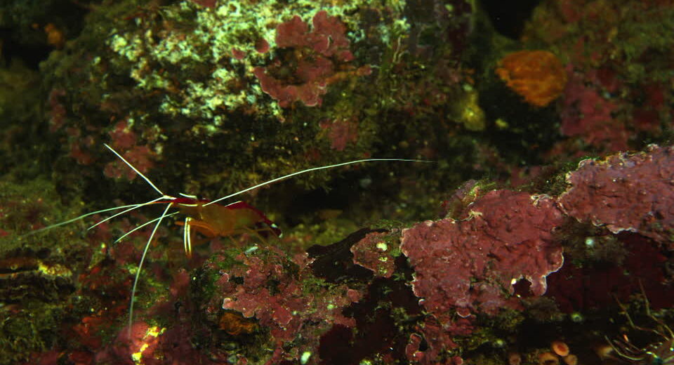
Soundscape Mapping for Snapping Shrimp Noise in the Indian Ocean Region (IOR)​ “Snapping Shrimps are very unique creatures that generate high intensity sound of the order of 180 dB re 1μPa at 1 m, which is louder than the big whales that are much larger in size.” Snapping Shrimps are very unique creatures that generate high intensity sound of the order of 180 dB re 1μPa at 1 m, which is louder than the big whales that are much larger in size. Another distinction is that these snapping shrimps are in large numbers within a shrimp bed (of the order of few thousands), compared to the single digits of the big whales. The mechanism of generating sound in these creatures is Cavitation which occurs due to snapping of their claws. The bursting of the cavitation bubbles generates sound in the frequency band from 2 to 250 kHz. The combined broadband sound of a snapping shrimp bed has its peak in the frequency band of 2-15 kHz with intensity of the order of 200 dB re 1μPa at 1 m. Such loud noise can impact multiple underwater systems including sonars deployed onboard Submarines and for coastal surveillance. The snapping shrimps are warm water creatures that have their habitat in the tropical and sub-tropical littoral waters. Their habitat is described by temperatures greater than 11o and depths less than 55 m with bottoms of corals, hard rocks or sponges to enable protection from preys. They stun their preys with the high intensity sound to meet their foraging requirements. The size of their population in any colony depends on the habitat favouring the above conditions. The colonies have sufficient adult population as their breeding is spread across the entire year, so the sound generated is reasonably stable. “The ongoing geopolitical developments, make the IOR extremely critical from a geostrategic perspective and thus Maritime Domain Awareness (MDA), or more specifically Underwater Domain Awareness (UDA) becomes the most important component of maritime capacity building. The loud noise from these snapping shrimps is a major impediment for effective UDA in the IOR. This creates a strong case to map the soundscape due to snapping shrimp noise in the IOR.” The Indian Ocean Region (IOR), presents very favourable conditions for their breeding and thus it is a hotspot. The ongoing geopolitical developments, make the IOR extremely critical from a geostrategic perspective and thus Maritime Domain Awareness (MDA), or more specifically Underwater Domain Awareness (UDA) becomes the most important component of maritime capacity building. The loud noise from these snapping shrimps is a major impediment for effective UDA in the IOR. This creates a strong case to map the soundscape due to snapping shrimp noise in the IOR.The urgency of such studies comes from the fact that Submarine proliferations in the IOR is on the rise and the snapping shrimp noise can significantly limit the deployment of submarine in the tropical littoral water. The way forward for such studies start from identification of the hotspots, based on the habitat conditions. The sensitivity to the habitat conditions is well established and there is a requirement of monitoring the diurnal as well as seasonal changes and then correlating them to the soundscape impact. There is also the aspect of application specific generation of noise. These species are known to be active during night for foraging. The mapping efforts will require a spatio-temporal analysis of the habitat followed by the soundscape mapping. The conducive temperature conditions in the IOR with an average sea surface temperature, ranging between 27o to 32o C, makes it a favourable habitat for the snapping shrimps. The depth also is largely below 70m in most parts of the region and the seabed provides shelters like crevices and caves in corals, rocky seabed and shells, enabling these species to flourish. The snapping shrimps have tolerance levels for wide variation of salinity levels ranging from the mesohaline (5-18 ppt) to hyperhaline (>40 ppt), but are found abundantly in the range of 35 ppt. The IOR has salinity variation in the range of 32 to 37 ppt with large local variations within. The Arabian Sea has high salinity closer to 37 ppt due to high evaporation, whereas the Bay of Bengal has low salinity of the order of 32 ppt due to high freshwater drainage from the river systems. The diurnal variations are also very interesting. The noise levels have been found to be approximately 3-6 dB higher during the night-time with maximum values during dawn and dusk due to predatory activities. The seasonal variations are not very profound, however observed to be louder during warm climate and could certainly get louder with global warming. Habitat mapping leads us to the next step of soundscape mapping. The ambient noise due to snapping shrimps has been found to have a log-normal distribution from the actual field recording. Two physical models have been developed to-date to estimate the noise due to snapping shrimp. The first is based on geometric consideration and assumes that individual shrimps snap independently. The second is based on behavioural consideration that assumes that individual shrimp snapping is inter-dependent. Both the methods are able to provide the spatio-temporal distribution of the snapping shrimp noise. “The frequency band from 2 to 15 kHz, where the snapping shrimp noise is seen to be peaking, has multiple other competing sources as well and needs to be accounted for while undertaking the soundscape mapping.” The frequency band from 2 to 15 kHz, where the snapping shrimp noise is seen to be peaking, has multiple other competing sources as well and needs to be accounted for while undertaking the soundscape mapping. The wind noise also overlaps in the same frequency band and can be estimated from the sea state (more specifically the wind speed) upto 10 kHz, beyond which the snapping shrimp noise dominates the spectrum. Heavy precipitation levels can also raise the ambient noise levels in the frequency band of 1-100 kHz, however it can be estimated based on the sea surface

MS Geopolitics and IR Maritime Security Science and Technology

Dark Ship Detection in the Indian Ocean Region

  • February 14, 2022
  • 0 Comments

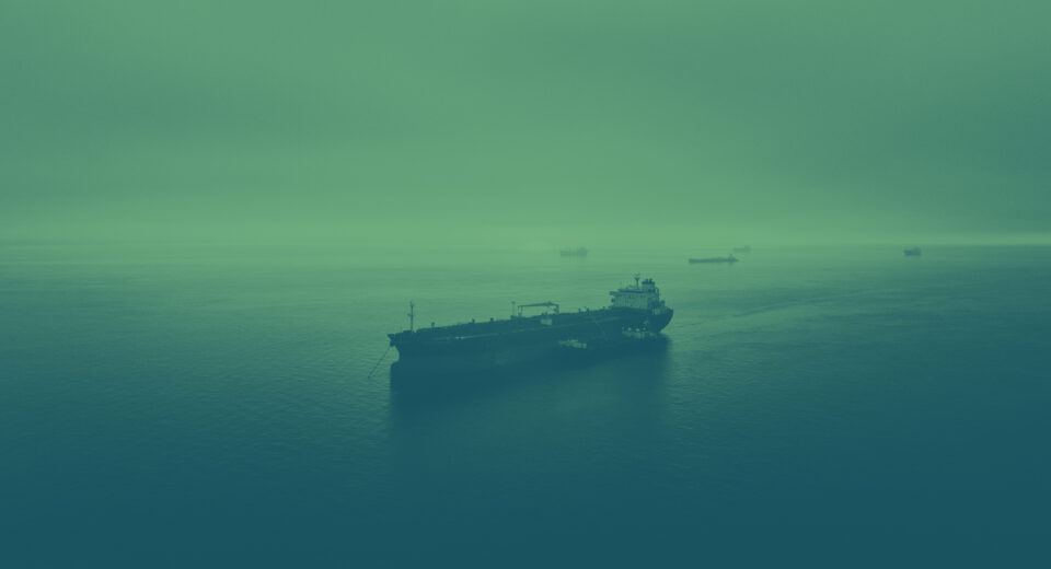
Dark Ship Detection in the Indian Ocean Region (IOR)​ The Indian Ocean Region (IOR), is gaining strategic relevance in the 21st century with more and more extra-regional powers maintaining strategic presence in the region. The political instability in the IOR, is also ensuring security concerns and particularly the state and non-state actors being equally active and at times in cahoots, ensuring a deadly cocktail for maritime forces to counter. The state-of-the-art underwater technology available even with the subversive elements is a matter of serious concern and the security establishment needs to up the ante to always remain on top of the game. “The rising submarine proliferation in the IOR, is one dimension that demands serious consideration by our security establishment and cannot be countered by conventional means.” The rising submarine proliferation in the IOR, is one dimension that demands serious consideration by our security establishment and cannot be countered by conventional means. The area coverage required for the entire Exclusive Economic Zone (EEZ) and beyond is massive, to be able to monitor, presence of dark ships through the ongoing conventional methods. The tropical littoral waters of the IOR further add to the challenges as the sonars deployed for underwater surveillance present substantial sub-optimal performance due to the acoustic propagation fluctuations. “The dark ships are the general category of platforms including surface and sub-surface vessels that could potentially cause disruption to Good Order at Sea.” The dark ships are the general category of platforms including surface and sub-surface vessels that could potentially cause disruption to Good Order at Sea. The Automatic Identification System (AIS), is a system that provides details of the surface vessels and their voyage based on the regulations of the International Maritime Organization (IMO). The AIS data has been extensively used for generating Maritime Domain Awareness (MDA) to counter multiple security concerns. Any vessel not maintaining expected course and speed, as per certain predetermined norms are put under the suspected category and then segregated by the security forces for scrutiny. The conventional means for generating MDA can only detect surface ships with AIS data feed. However, it is grossly inadequate for sub-surface targets like Submarines and also other submersibles. The Underwater Domain Awareness (UDA) requires far different efforts to overcome the limitations of the ongoing MDA and also the tropical littoral challenges of sonar deployment. “The dark ship detection has been a matter of concern globally post the 9/11 incident in the US and more locally in the IOR, post the 26/11 incident in Mumbai.” The dark ship detection has been a matter of concern globally post the 9/11 incident in the US and more locally in the IOR, post the 26/11 incident in Mumbai. There have been multiple techniques proposed by various agencies globally to detect dark ships, however, none of them could comprehensively undertake the task. Some of these techniques are as follows: AIS based high end data analytics for MDA. An Israel based company is the market leader for this technique, however it suffers from the limitation of being able to detect only surface platforms with AIS data inputs. Synthetic Aperture Radar Image Analysis, combined with AIS data analysis supported by Machine Learning and Artificial Intelligence algorithms. A Finnish company is promoting this technique with lot of success. This again contributes to the MDA only and fails in effective UDA. Visible Infrared Imaging Radiometer Suite (VIIRS) mounted on satellites for monitoring of Illegal, Unreported and Unregulated (IUU) fishing activities. These IUU fishing vessels often double up as vessels of opportunity for the non-state actors determined to mount large scale damage. VIIRS combined with AIS data analysis has also been attempted to enhance dark ship detection accuracy. This again is limited to IUU fishing only and fails in case of UDA. Radio Frequency (RF) Analysis through a constellation of satellite monitoring varied RF emissions from the surface vessels. The company promoting this technology has been accused of privacy breach, and also only enhances the MDA capabilities and is limited for effective UDA. Passive Acoustic Monitoring (PAM) uses acoustic hydrophones to record emissions from the vessels and data analytics along with signal processing to detect the dark ships. This although can undertake UDA but gets overwhelmed by the underwater signal distortions particularly in the tropical littoral waters of the IOR and also the high volume of shipping traffic. “The Maritime Research Centre (MRC), Pune has developed a very unique technique for dark ship detection that can comprehensively address the challenges of effective UDA in the IOR. The method has been validated with limited real data with encouraging results.” All these techniques are unable to address the specific requirement of the IOR and demand an alternate look at the way ahead. The Maritime Research Centre (MRC), Pune has developed a very unique technique for dark ship detection that can comprehensively address the challenges of effective UDA in the IOR. It is a two stage model that extensively uses the data analytics algorithms and passive acoustic sensing to identify the dark ships. The first stage is the spatio-temporal low frequency mapping using the AIS data feed in the region combined with the site specific underwater channel model. The entire region is divided into grids of specific size, depending upon the desired spatial resolution and the shipping traffic data is extracted from the AIS data base for each grid. The radiated noise from each grid is computed and passed through the underwater channel model to obtain the low frequency ambient noise of the region. The low frequency ambient noise map, thus generated accounts for the background noise levels at the specific location. The ambient noise so generated gets updated every six minutes (the minimum update rate of the AIS input) thus creating the realistic spatio-temporal map. This also provides the Signal-to-Noise Ratio (SNR) in the region that can be used to deploy the hydrophones at the appropriate location. In the second stage, the acoustic sensor is deployed at the location with minimal SNR to ensure effective range of detection.

MS Geopolitics and IR Maritime Security

Underwater Domain Awareness – A New Perspective in the Indo Pacific

  • February 14, 2022
  • 0 Comments

Underwater Domain Awareness – A New Perspective in the Indo Pacific​ Abstract The 21 st century India is emerging as a maritime nation with significant strategic push for maritime capability and capacity building. The apex level shift from a continental outlook to a maritime power, ready to assert itself in regional and global geo-strategic and geo-political formulations is a welcome change. The growing recognition of the Indo-Pacific as a single strategic space and a construct to counter growing Chinese dominance in the region, also recognizes India’s centrality to the global influences and increasing role of India in America’s strategic calculations. The domain awareness is always the first step towards any effective capability and capacity building initiative. Thus, effective Maritime Domain Awareness (MDA) would be the pre-requisite for any such initiative. The Americans who originated this term, have used MDA as an enabler for the Maritime Operational Threat Response Plan. The National Plan to achieve MDA, declared in Oct 2005 by the US, was part of the National Strategy for Maritime Security. The underwater component of the MDA that may be referred as Underwater Domain Awareness (UDA), has somehow not been given enough attention that it deserves particularly in the IOR, given the security threats that exists, perpetuated by the non-state actors. The first reference of the term Underwater Domain Awareness (UDA) is seen in a paper by Lt Cdr David Finch, titled “Comprehensive Underwater Domain Awareness: A Concept Model” in fall 2011, published in Canadian Naval Review. Now here, he makes no reference of MDA while discussing UDA. When we look at India in the Indian Ocean Region (IOR), there are multiple unique challenges to achieve effective UDA, both socio-economic and science & technology driven, that are rooted in its geo-strategic origin. Thus, efforts to import technology and strategy from the west have offered limited outcomes. The present understanding in many strategic discourse is that UDA is an extension of MDA, more focussed on security requirements given the volatile regional dynamics. However, the sub-optimal performance of the sonar systems that may be deployed for any situational awareness efforts, in the tropical littoral waters of the IOR will present significant challenges. Thus massive acoustic capability and capacity building would be the core requirement for any UDA framework. The fragmented approach by the stakeholders namely the national security apparatus, the blue economic entities, the environment & the disaster management authorities and the science & technology providers has always limited the resource availability for any indigenous efforts to overcome local challenges. The UDA framework proposed in this work goes beyond being a mere underwater extension of the MDA formulation as understood so far, and attempts to bring a more comprehensive formulation that facilitates pooling of resources and synergising of efforts across stakeholders both at the national as well as regional level to be able to truly participate in the Indo-Pacific strategic space. The proposed UDA framework ensures Safe, Secure, Sustainable Growth model for all in the region to complement the Security And Growth for All in the Region (SAGAR) vision announced in Mar 2015. “Many experts regret that the IWT generally disregards issues relating to water quality, pollution, environmental flows, and ecological protections.” Introduction The MDA in its present form needs to be understood before we attempt to connect UDA to it or define UDA from a new perspective. The MDA framework as declared in the Oct 2005 document “National Plan to Achieve Maritime Domain Awareness for the National Strategy for Maritime Security” has no mention of the underwater threat or its mitigation strategy [1]. The Americans did not consider the underwater threat to be substantial while formulating the MDA framework in early 21 st century. Though post 9/11 the US administration did recognize the possibility of other avenues the terrorists may use to harm American interests, however the underwater threat did not explicitly figure in their strategic formulations [2]. The author Cdr Steven C Boraz, brings out the myths and realities of the era and recognizes the limitations of a Navy driven MDA [2]. As late as Feb 2015, the academic literature recognizes the limitations of the US MDA capabilities in terms of dealing with underwater threats [3]. The US Coast Guard that is the primary agency responsible for MDA through the Ports, Waterways, and Coastal Security (PWCS) mission has made significant investments for surface and air assets along with increased command and control capabilities, however little has been done to expand the PWCS mission to the underwater domain. The underwater threat from nation states, terrorist groups and criminal organizations is on the rise and multiple outfits are acquiring capabilities far outwitting the risk mitigation strategies by the security establishments. Nation states like US, Japan, Germany, North Korea and Iran have credible submersible capabilities that can be deployed to carry out large scale damage to maritime assets. These states have also been seen to assist non-state actors against targeted adversaries or generic terrorist activities. Moro Islamic Liberation Front (MILF), Revolutionary Armed Forces of Columbia (FARC) and the Liberation Tigers of Tamil Eelam (LTTE) have been documented for their submersible capabilities and its deployment against their stated adversaries [4]. The Underwater Wireless Sensor Networks (UWSNs) that may be deployed for multiple underwater surveillance applications have their unique challenges in terms of harsh underwater channel behaviour with low bandwidth, high propagation delays and higher bit error rates. In addition, the variable speed of sound, and the non-negligible node mobility due to water currents pose a unique set of challenges for localization in UWSNs [5]. These underwater channel distortions and unique site specific challenges require focussed mitigation strategy that limit their deployment for broader MDA applications. The underwater technology development and more specifically acoustic technology development matured during the cold war period when the super powers i.e., the US and the Russians invested heavily in the deep waters and achieved significant success in stabilizing sonar performance. Massive experiments were undertaken at sea to validate the algorithms and minimize the medium uncertainties [6]. Post the

MS Geopolitics and IR Maritime Security

Naval History of South Asia and Underwater Domain Awareness

  • February 14, 2022
  • 0 Comments

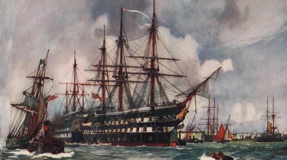
Naval History of South Asia and Underwater Domain Awareness​ Prithwiraj Gupta speculates whether communities involved in the pearl fishing process along the Indian coast had a role to play in the naval history of those regions The Indian Ocean has been one of the most important oceans in the world, given its role in connecting the continents of Asia and Europe for at least 2,000 years. The 21st century has seen a resurgence in its significance due to the important trade routes that pass through it, connecting the oil belt of the Middle East with the rapidly developing powers of South and East Asia. The current geopolitics of the region has been the subject of numerous studies by think tanks, academia and governments over the past several years. Many of these have gone on to analyse the growing naval forces in the region as well. However, there have been far fewer studies on how naval forces in this region have been shaped throughout history and if there is anything that can be learnt from historic developments in the art of naval operations in the waters off the Indian subcontinent. Since the 20th century, the operational space for naval forces has included both the surface as well as the depths of the oceans. This has led to an increased requirement for knowledge of what lies below the surface of the oceans and how best to utilise ocean resources to safeguard national interests, ensure international stability, and promote a more sustainable ocean environment. Keeping in mind the UDA Framework, this essay attempts to see if such a concept can be linked in any way to the past. “Much of the current study of South Asian maritime and naval history has been carried out by the naval establishment itself, leading to some factually detailed volumes on the subject. Over the last decade, the maritime history of South Asia has been researched by academics looking at maritime South Asia from the perspective of economic and social history, including issues of piracy.” John B. Hattendorf remarks in his book Doing Naval History that ‘Naval history needs to appear in a new, corrected and amended model, linking it to general history while also improving methods for the specialised study of the subject.’ In case of the naval history of South Asia, the field however needs to establish itself as a prominent area in the study of South Asian history, before it moves forward in the direction which Hattendorf envisaged in his book. So far, the study of naval history of this region has been fairly restricted in scope. The foundations for such a study were laid in the early 20th century with Radhakumud Mookeri’s pioneering work titled Indian Shipping. However, with the exception of one significantly shorter volume of the same name, authored by Ashok Mehta, the field remains untouched by academics to a significant extent. Much of the current study of South Asian maritime and naval history has been carried out by the naval establishment itself, leading to some factually detailed volumes on the subject. Over the last decade, the maritime history of South Asia has been researched by academics looking at maritime South Asia from the perspective of economic and social history, including issues of piracy. Research in naval history has been more limited, with Amarendra Kumar’s research on the Maratha navy of the 17th and 18th centuries, some essays by military historian Kaushik Roy, and some essays that can be found in the Proceedings of the Indian History Congress. Such a lack of research has left a significant gap in the knowledge of past naval capabilities and achievements from a pan-Indian perspective. Furthermore, it would lead to the development of a new model for the study of naval history, specific to the Indian Ocean region and linking it to the wider maritime environment. Such a perspective is essential for two reasons. First, it would allow for an integrated study of the histories of capabilities of naval forces into a unified historical narrative and look for specific regional variations. Secondly, with the IOR assuming an increasing geopolitical significance, it is imperative for India to attempt to show its longstanding presence in the region from a historical perspective. “With the IOR assuming an increasing geopolitical significance, it is imperative for India to attempt to show its longstanding presence in the region from a historical perspective.” Underwater Domain Awareness is very much a 21st century concept, although with the advent of submarine warfare in the 20th century, there must have been a requirement to know more about the new operational environment. It is hard to find a parallel for the same in historical times when underwater technologies were limited to the ability of the human body to adapt to the underwater environment. One of the few occupations involving underwater activity to some degree was that of pearl fishing, wherein divers from certain maritime communities in parts of the world would dive underwater to extract oysters. Pearls have been an important trade commodity since times immemorial and have been readily available in certain parts of the world. In South Asia, pearls were harvested primarily from the far south – Malabar and Coromandel. The Gulf of Mannar was a particularly prominent location for pearl fisheries and attracted numerous merchants. Pearls were also obtained from Sopara, according to Al Idrisi. “One of the few occupations involving underwater activity to some degree was that of pearl fishing, wherein divers from certain maritime communities in parts of the world would dive underwater to extract oysters.” Pearl fishing methods were similar in Indian and Arabian coasts, according to early European statements. Off the Arab coast, pearls were collected at a depth of six fathoms. It was a test of the divers’ physical endurance and skill underwater and was facilitated by a number of improvisations to protect and aid them in their jobs, given that they had to stay under water for as long as two hours at a stretch with no,

MS ESG and Climate Risk Science and Technology

Underwater Domain Awareness (UDA) Framework for River Systems in the North East

  • February 14, 2022
  • 0 Comments

Underwater Domain Awareness (UDA) Framework for River Systems in the North East​ “We seek a future for the Indian Ocean that lives up to the name of SAGAR – Security and Growth for All in the Region.” – Shri Narendra Modi, March 2015 The Brahmaputra and the Barak rivers have played a critical role in shaping the culture, heritage and economy of the North East. There is potential for more, and it is essential that we build capabilities and capacities for the safe, secure and sustainable growth of the region with optimum utilization of the resources in the rivers. The ‘safe’ aspect addresses the disaster management efforts originating from the river – it could mean prevention and post event rehabilitation. The ‘secure’ aspect represents the security concerns that may originate from the river or even endanger assets in the river. The volatile security situation in the region does demand fresh initiatives that are able to comprehensively address the security concerns. ‘Sustainable growth’ pertains to economic growth with minimal degradation to the river flora and fauna. Underwater Domain Awareness (UDA) is a concept that addresses our ability to monitor all the developments in the underwater region and possibly prevent adverse events. The UDA represents the following stakeholders: The disaster management authorities responsible for ensuring safe surroundings. Preventing a disaster may not be always possible, but with better awareness the loss of life and property can be minimized. The security apparatus responsible for providing a secure atmosphere that can minimize subversive activities on the river both by external and internal elements. The economic activities driven by the river, like inland water transport, fishing, underwater resource exploration and exploitation, etc., can be efficiently managed with effective UDA. The acoustic habitat degradation originating from such activities can also be better managed with enhanced UDA, leading to sustainable growth. The scientific and the research community needs to engage and continuously update our knowledge and access of the multiple aspects of the underwater domain. The regulators on the other hand need to know the pattern of exploitation to manage a sustainable plan. “The underlying requirement for all the stakeholders is to know the developments in the underwater domain, make sense out of these developments and then respond effectively and efficiently to them before they take the shape of an event.” The comprehensive UDA framework is presented in Fig. 1. The underlying requirement for all the stakeholders is to know the developments in the underwater domain, make sense out of these developments and then respond effectively and efficiently to them before they take the shape of an event. The UDA needs to be understood on a comprehensive scale in its horizontal and vertical construct. The horizontal construct would be the resource availability in terms of technology, infrastructure, capability and capacity specific to the stakeholders or otherwise. The four sides represented by the stakeholders may vary based on their specific requirements. However, the core acoustic capacity and capability would remain the same for all of them, thus helping to overcome the challenges of the tropical littoral waters. The vertical construct is the hierarchy of establishing a comprehensive UDA. The first level or the ground level would be the sensing of the underwater domain for threats, resources and activities. The second level would be making sense of the data generated to plan security strategies, conservation plans and resource utilization plans. The next level would be to formulate and monitor a regulatory framework at the national, regional and global level. Figure-1 Comprehensive Persepective of Undersea Domain Awareness The figure above gives a comprehensive way forward for the stakeholders to engage and interact. The individual cubes represent specific aspects that need to be addressed. The User-Academia-Industry partnership can be seamlessly formulated based on the user requirement, academic inputs and the industry interface represented by the specific cube. It will enable a more focused approach and a well defined interactive framework. Given the appropriate impetus, the UDA framework can address multiple challenges being faced by the nation today, particularly when we are at the cusp of embarking on an ambitious national waterway project. Multi-disciplinary and multi-functional entities can interact and contribute to seamlessly synergize their efforts towards a larger goal. “Given the appropriate impetus, the UDA framework can address multiple challenges being faced by the nation today, particularly when we are at the cusp of embarking on an ambitious national waterway project.” The concerns of the stakeholders need to be looked at from a techno-strategic framework. The science and technology aspects that can aid strategy formulation need to be discussed. The rivers in the North East deserve far more attention from multiple aspects, and knowledge of acoustic habitat and UDA do add another dimension to our understanding of the river ecosystem. “The rivers in the North East deserve far more attention from multiple aspects, and knowledge of acoustic habitat and UDA do add another dimension to our understanding of the river ecosystem.” There is a critical requirement to address the following aspects: Underwater Domain Awareness (UDA) perspective regarding safe, secure and sustainable growth of the river systems in the North East. Identification of the security concerns arising from the river systems and possible mitigation strategies. Identification of economic opportunities to boost the socio-economic status of the local population and make them aware of the importance of the rivers. Capacity building and capability building directions for effective UDA to ensure safe, secure, sustainable growth for all in the region. Qualitative and quantitative assessment of acoustic habitat degradation (broadly for Shihu, the river dolphin, and other species) in the river ecosystem due to human intervention. “The effective UDA framework being a new initiative will require efforts in all the dimensions: Policy Support, Infrastructure Creation, Know-how Build-up and Human Resource Development.” UDA is very well aligned to the Security and Growth for All in the Region (SAGAR) vision of the honourable PM. It encompasses the ideas of a smart digital India with high end technology integration to overcome the specific challenges of the river

indian Geopolitics and IR

UDA and Indian Diplomacy for Maritime Cooperation

  • February 12, 2022
  • 0 Comments

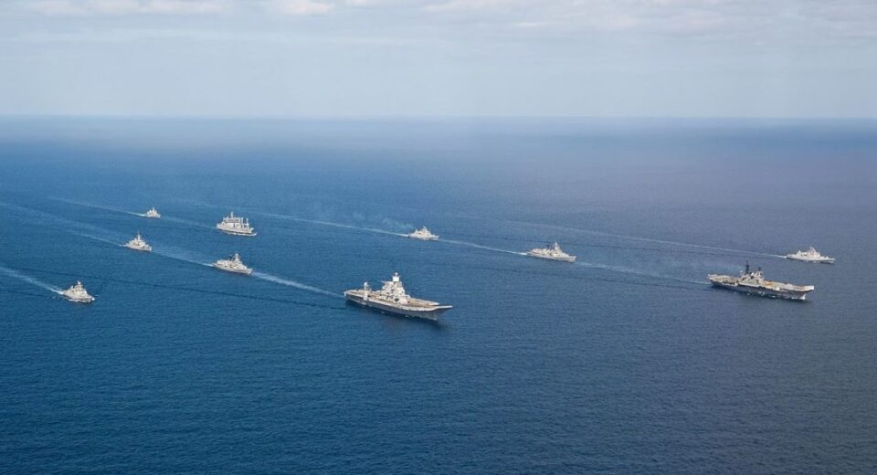
Key Highlights Even though there are many internal and external criticisms, IWT has managed to survive several wars and military standoffs between India and Pakistan. By hindering economic growth, the IWT has increased the domestic dispute over Kashmir. Kashmiris have grievances against the pact since it forbids India from using the western rivers for cultivation, hydroelectric generation, or navigation. The scientific community in India emphasizes the need for additional research and evaluations as a basis for debates on transboundary water management in the country. The treaty offers outdated technical guidance that is unable to address the ongoing technological disputes with Indus. The IWT is a permanent agreement that has no expiration date, in contrast to treaties like the 1964 Columbia River Treaty between the US and Canada, which allows either of its signatories to choose to renegotiate it after 50 years. Heading Ambassador (retired) Yogendra Kumar believes that greater focus on underwater domain awareness can boost the nation’s diplomatic effectiveness. Maritime cooperation has emerged, in more recent times, as the centrepiece of India’s diplomacy. The Indo-Pacific region has assumed dimensions of a grand strategy for sustaining a certain power equilibrium in both the Indian and Pacific oceans in all its hard and soft power aspects. With the geopolitical and geo-economic centre of gravity shifting to Asia, its engagements with other powers, including those from outside the region, have a significant maritime character for the same reasons. The maritime domain has a salience in the era of globalisation as global trade is predominantly carried out at sea and an increased international scramble for the enormous, yet inadequately tapped, marine resources is in evidence. Thus, the challenges of creating or sustaining maritime governance mechanisms are the focus of international diplomacy where security of sea lines of communication (SLOCs), balance of power equilibrium, maritime safety, piracy and transnational crime, and good order at sea are considered as critical determinants. “The maritime domain has a salience in the era of globalisation as global trade is predominantly carried out at sea and an increased international scramble for the enormous, yet inadequately tapped, marine resources is in evidence.” No less importance can be ascribed to other challenges. Climate change is pressing enough to negatively affect any type of maritime governance mechanism. This includes ocean warming and the impact of acidification on maritime environment for sustainable use of this space for navigation or exploitation of resources. The growing frequency and intensity of cyclones and storm surges present considerable threat to the viability of the vast coastal communities and economies. These threats aggravate the already fragile economies of island states dependent mostly on a single commodity or service which, in turn, puts pressure on the political systems and governments there. The robustness of any maritime governance mechanism cannot be developed unless these ‘non-traditional’ challenges are factored in and consequent stakes of these island and littoral countries secured through such action by these mechanisms. “Maritime domain awareness (MDA) is a critical basis for effective functioning of any maritime mechanism.” Situational awareness not only enhances capacity, its sharing also generates mutual confidence. Maritime domain awareness (MDA) is, thus, a critical basis for effective functioning of any maritime mechanism. Through a wide spectrum MDA most of the above challenges can be tackled in a significant measure. Such MDA capacity can be the result of collective effort of the participating countries as also the national effort of a single country; collective and collaborative effort also enhances the capacity of the countries which require it. This is, therefore, an important contribution to the technological and socio-economic progress of the country concerned. MDA, in its current status, has a missing dimension in underwater domain awareness (UDA) since it is largely confined to situational awareness on the water surface. UDA, having its origin in the Cold War era of superpower confrontation, is now a significant capacity-multiplier due to the dual-use nature of technological revolution in this area. It is adding to better stewardship of marine resources for the much-needed, vital impetus for developing the blue economy sector of the national – and, indeed, global – economy. UDA provides a substantial capability for the monitoring of the manifestations of ocean warming and acidification, including the state of ‘dead zones’ which represent potential climate change ‘tipping points’ from the point of view of food chain, ocean currents, and monsoon patterns. In the strategic and economic perspectives, this is an imperative domain for achieving the state of ‘digital ocean’ through the leveraging of artificial intelligence (AI), communications and robotics, a system of underwater drones powered by sun, wind and waves, advanced sensors, cameras and acoustics for a real-time UDA; this has important bearing on big data, analytics, and regulatory frameworks. Thus, UDA is critical for maritime system stability, technological progress, and high-end and low-end economic cooperation for Indian diplomacy in both the multilateral and bilateral formats. “UDA is critical for maritime system stability, technological progress, and high-end and low-end economic cooperation for Indian diplomacy in both the multilateral and bilateral formats.” UDA is not possible without acoustics and sonar capabilities. The science of underwater sound propagation is an effective way of determining underwater geo-physical features, hydrological characteristics, and the state of marine biodiversity. It provides an early alert capability against security threats from state and non-state actors, environmental disasters such as oil spillage, ecological degradation of living and non-living resources, and the mapping of hydrocarbon/poly-metallic reserves. India’s major articulation was Prime Minister Modi’s SAGAR speech (March 2015) on the Indian Ocean wherein he not only laid emphasis on littoral nations’ cooperation in peace and security but also on strengthening maritime capacities and regional integration based on sustainable development and blue economy. In his keynote speech at the Shangri-La dialogue (June 2018), he spoke of ‘common pursuit of progress and prosperity’ in the entire Indo-Pacific region. At the East Asia Summit (November 2019), he outlined the Indo-Pacific Ocean Initiative for safe, secure and stable maritime domain: its seven pillars comprise maritime security, maritime ecology, maritime resources, capacity building