UDA Digest Headers Science and Technology

Disseminating to Mitigate Oil Spillages: A UDA Perspective

  • October 10, 2023
  • 0 Comments

Key Highlights The negative effects of oil spills do not halt with the local flora and fauna, which is often showcased, but instead extend deep up the food chain, and where a disaster reaches the food chain, it also reaches humans. Policy regulations can be made to ensure that fishing of a certain species or in certain areas is banned for the time following an oil spill to ensure the safety of consumers. The international trade of fish and shrimp may also be suspended, leading to massive GDP losses for those countries that bank on this aspect of trade. Effective UDA strategies that complement the three pillars of UDA applications – Policy, Technology and Innovation, and Human Resource Development- could train professionals to deal with oil spillages and ensure a professional clean-up and recovery standard. With the UDA’s strong confluence of scientific intervention and policy recommendations, the issue of oil spillages and their aftermath is one that the UDA can manage effectively. Introduction Both large and small oil spills have become a recurring environmental nightmare that devastates marine ecosystems and disrupts aquatic life. It does not end there either, as even humans can be directly or much more commonly indirectly affected by these oil disasters. When these oil spills are covered by the news, we commonly get to see the immediate aftermath that it has on the surrounding ecosystem, such as pictures of birds covered in oil and too heavy to fly. The negative effects of these oil spills do not halt with the local flora and fauna, which is often showcased, but instead extend deep up the food chain, and where a disaster reaches the food chain, it also reaches humans. The economic impact of an oil spill is very costly and commonly costs way more than the settlement that is paid by the corporations that let the oil spill happen. This article explores the intricate web of effects that oil spills have on marine life, the subsequent impact on humans, and the imperative need for preventative measures and efficient cleanup strategies. “The UDA Framework proposed by the Maritime Research Center, Pune, is a multidimensional approach that surrounds four stakeholders, one of which is environmental regulators, to ensure the conservation of the marine environment.” This article will explore how the UDA framework emerges as important in assisting the mitigation of the man-made disaster of oil spills that hampers marine biosystems and other cascading effects that will be explored further. Effects of Oil Spills on Marine and Avian Life The effects of these massive ecological disasters can be divided into two parts, the first part being the immediate effects of the spill and the second being the long-term impact of the oil spill on the marine life in the area and the local species’ recoveries. The most visible result of the effects of oil spills on animals is the animals we observe covered in oil. This commonly happens to birds that land on oil-covered water surfaces, but it can also happen to aquatic mammals that come up to breathe. When these animals get covered in oil, their fur and feathers insulating properties significantly decrease, leading to hypothermia. It also handicaps a bird’s ability to fly and chokes out the mammals that are trying to breathe. And it’s not just the mammals that need to come up to the surface to breathe that suffer. The fish and other small organisms that exist under the oil layer can also struggle to breathe due to the oil layer restricting oxygen exchange along the ocean’s surface. Hence, marine and avian biodiversity are impacted negatively. These can be some of the short-term effects or some immediate effects resulting from the oil that floats on the ocean surface. It is also possible, however, for oil to travel down to the ocean floor and settle as sediment that covers the seabed, including all of the plants and coral that exist there. Oil is lighter than water, so usually, it should only float on the top of the surface. This is true, and most of the oil does end up at the surface, but water columns, which reduce pressure in the water, can help oil travel down with the current, smothering coral reefs and other life on the seabed in the process (Gilbert, 2021). “The following picture was retrieved from the 2010 Deepwater Horizon Disaster in the Gulf of Mexico, the largest oil spill of recent times occurring due to an industrial disaster.” Figure 1. Sediment cores from the seabed preserve evidence of settled oil on the seafloor of the Gulf of Mexico (Gilbert, 2021) These detrimental effects on marine life can impact the local ecosystem’s biodiversity and reduce the ecosystem’s ability to recover. Further long-term effects of the oil spill will also hinder the ecosystem’s survivability, such as the toxic hydrocarbons that are released from the oil that poison the fish living in the ocean. Here, we must monitor what species of fish are affected, the current and flow of the ocean, and the extent of the toxic exposure to establish how far the toxicity has spread. For this, the UDA framework becomes integral as it directly informs the scientific intervention necessary for mapping this requirement during an oil spill disaster. Cascading Effects on Humans and the Economy Toxicity does not only spread between one species of fish. It can also contaminate other species of fish due to the accumulation of toxins when the fish are eaten by other fish higher up in the food chain. This food chain contamination is of great importance to humans, as we need to ensure that fish containing toxins are not consumed. Policy regulations can be made to ensure that fishing of a certain species or in certain areas is banned for the time following an oil spill to ensure the safety of consumers. However, the larger point is that an avenue of human sustenance essentially turns contaminated. If humans were to consume these contaminated fish, they could develop various

matsya Blue Economy Commentaries ESG and Climate Risk Science and Technology

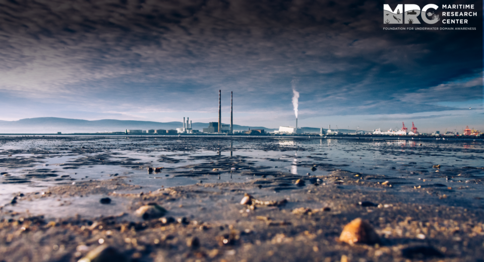
India’s Samudrayan Seabed Mission Holds Promise for Clean Energy and Blue Economy

  • October 5, 2023
  • 0 Comments

Key Highlights Build ships that can extract large volumes of nodules from the ocean floor. Indiginise or collaborate with global companies for extraction equipment. Develop in-house technology for extraction of metals from seabed nodules. Identify industries that can process these nodules and extract critical metals. India joined the elite club of manned self-propelled comprising China, France, Japan, Russia, and the USA in October 2021 with the launch of Matsya 6000 to a depth of 500 meters. However, this is inadequate for seabed mining in sites allotted by the International Seabed Authority (ISA). Source: National Institute of Ocean Technology Most deposits of polymetallic nodules (PMN), polymetallic sulphides (PMS), and Cobalt-rich ferromanganese crusts (CFC) are found at depths between 4000 and 6000 meters in the Ocean. Under the Samudrayan mission, three personnel will be launched in a self-propelled human-occupied vessel (HOV) called the Matsya-6000 to six kilometres in 2026. The PMNs, PMSs, CFCs nodules, and crusts strewn on the seabed have far higher concentrations of critical earth minerals than those found in continental ores. Commercialising deep seabed extractions can significantly boost India’s pursuit of blue economy and clean energy and hold promise for offsetting imports. Ministry of Mines has identified 30 minerals that are critical to our country.   Ironically, the OceanGate tragedy in June this year has brought the spotlight back on undersea exploration. It also raises questions about the need to undertake risky manned missions when remotely operated vehicles (ROVs) can perform all the functions. Manned submersibles aren’t risky if standards and certification procedures are followed. William Bebee and Otis Barton were the first to dive on 15 August 1934 to a depth of 923 meters in their vessel, Bathysphere. In 1960, Jacques Piccard and Don Walsh explored the Challenger Deep to a depth of 10,740 m in their vessel Trieste. There have been numerous crewed missions since in ocean submersibles. Deep sea exploration intrigues us because it conflates geology, biology, energy, chemistry, or simply mystery. William Bebee and Otis Barton with Bathysphere Source: Wildlife Conservation Society Library The Ocean is needlessly neglected. Less than five per cent of it has been explored. Even worse, we don’t care about what we don’t know. Cognizant of the immense hidden potential in the Ocean, the government of India approved the Deep Ocean Mission at a total budget of ₹4,077 crore ($480 mn) for five years. For the first phase, spanning three years from 2021 to 2024,  a budget of ₹2,823.4 crore ($ 332 mn) has been earmarked. Manned Submersible is critical for conforming to environmental norms, especially when commercial exploitation is outsourced to contractors. Seabed resources are a common preserve of humanity, and every nation is obligated to conform to the UNCLOS. “All seabed activities undertaken by contractors outside the continental shelf are regulated by the ISA and sponsored by states. Hence, manned submersibles like the Matsya 6000 will play a critical role for State agencies to monitor the compliance of contracts, which may not be feasible with ROVs. ” Matsya 6000 has been developed by the National Institute of Ocean Technology (NIOT), Chennai, an autonomous institute under the Ministry of Earth Science (MoES). Established in November 1993, NIOT has an enviable spectrum of mandates. Virtually all domains of ocean research is undertaken, including ocean-based renewable energies, ambient noise measurements, underwater communication, coastal surveillance, acoustic imaging, marine biotechnology, met-ocean and tsunami observation, beach restoration and shoreline management. However, deepsea mining is the most cutting-edge of them all, as it provides solutions for Indian industry and helps them conflate the Prime Minister’s vision of “Blue Economy” and “Clean Energy”. But NIOT alone cannot achieve this vision. Critical metals will have to be extracted from PMNs and PMSs. Countries in possession of such niche technology do not normally share them. Hence, India will have to develop its own extraction technology and plants. For minerals and materials research, a Common Research and Technology Development Hub (CRTDH) has been created in the CSIR-IMMT (Institute of Minerals & Materials Technology) at Bhubaneswar. CSIR-IMMT has procured a Transmission Electron Microscope (TEM) that will help characterise magnetic nanoparticles by evaluating the material structures, phase composition, and texture. Once the extraction technologies are proven, private industries must create profitable ventures for the mass production of critical metals. Incidentally, a Udaipur-based company, Hindustan Zinc Limited, has already demonstrated the capacity to extract copper, nickel and cobalt from 500 kg nodules daily. The estimated potential of polymetallic nodule resources is 380 million tonnes. It is expected to contain 4.7 million tons of nickel, 4.29 million tons of copper, 0.55 million tons of cobalt and 92.59 million tons of manganese. India renewed its PMN contract with the ISA for another five years in 2022 to tap the immense wealth lying on the seabed. A contract to explore PMSs from Central and South-West Indian Ridges (SWIR) was signed with the ISA in 2017 for 15 years. Hence, launching India’s Matsya 6000 vehicle to a depth of six kilometres will be a significant milestone. However, several other challenges are ahead before India realises a viable seabed-based blue economy and clean energy. The way forward would be to: Build ships that can extract large volumes of nodules from the ocean floor. Indiginise or collaborate with global companies for extraction equipment. Develop in-house technology for extraction of metals from seabed nodules. Identify industries that can process these nodules and extract critical metals. Integrate a financially viable subsea mining value chain that will link ocean extraction, transportation, onshore production and markets. Expand exploration to other known areas in the Pacific, like the Northwest Pacific Ocean and Clarion-Clipperton Zone (CCZ). Kindly note that this article was originally published in the energy section of The Economic Times and has gained wide publicity and appreciation across multiple stakeholders. View Original Article Dr Somen Banerjee Commentary By Dr Somen Banerjee is a Former Senior Research Fellow at Vivekanand International Foundation. He is currently associated with the MRC as a Senior Research Fellow.

ships Science and Technology Skilling India

Collision Avoidance & Navigation System using AIS

  • September 9, 2023
  • 0 Comments

Key Highlights AIS offers real-time data about vessels, such as their location, direction, speed, and identification. The proposed AIS-based Collision Avoidance and Navigation System has substantial potential to elevate safety in busy maritime conditions. After converting AIS data into a CSV format, I created visual representations of vessel paths. The goal of the Collision Avoidance and Navigation System utilizing the Automatic Identification System (AIS) is to improve safety in maritime settings by harnessing AIS technology. AIS offers real-time data about vessels, such as their location, direction, speed, and identification. This information can be harnessed to create a smart system for avoiding collisions and navigating in busy maritime areas. This study suggests an extensive approach that combines AIS data with advanced algorithms and decision-making methods to foresee collision risks and assist in safe navigation. The system uses past AIS data to study trends and pinpoint potential collision scenarios based on factors like vessel proximity, converging courses, and relative speeds. By integrating machine learning and data analysis, the system can generate a Collision Risk Index (CRI) for each vessel, indicating the level of collision risk it faces. This data can then be used to offer early alerts and suggestions to ship operators, enabling them to take proactive steps to prevent collisions. Furthermore, the system incorporates clever routing algorithms that incorporate the predicted collision risks to propose safer and more efficient vessel routes. By considering real-time AIS data, weather conditions, and traffic density, the system can optimize routes to decrease collision risks and enhance overall maritime safety. The proposed AIS-based Collision Avoidance and Navigation System has substantial potential to elevate safety in busy maritime conditions. By using AIS data and advanced algorithms, it empowers proactive collision avoidance and wise routing choices, diminishing the chances of collisions and enhancing the effectiveness of vessel navigation. Further study and development are necessary to verify and refine the system’s performance in real-world situations. Collisions in inland waterways pose the most significant threat to inland water transportation. Research indicates that a substantial portion of maritime accidents, around 80%, and ship collisions, ranging from 86% to 95%, result from human error. As a result, quantifying the impact of human error is crucial for maritime safety. The European Maritime Safety Agency (EMSA) documented over 20,000 maritime casualties and incidents globally between 2011 and 2017. Some of these conflicts have led to severe accidents that had a notable environmental impact and sadly resulted in loss of life. Therefore, it is vital for ship captains engaged in maneuvers to accurately predict their future position relative to target ships within a specific timeframe to effectively handle close encounter situations. Therefore, it becomes paramount for ship captains engaged in maneuvers to accurately anticipate their forthcoming position relative to other vessels within a designated time frame. This foresight enables them to effectively address close encounter situations. Several fundamental components and features constitute a Collision Avoidance System  within the maritime sector: Radar: Utilized to detect and track nearby vessels, radar provides crucial information about their positions and Automatic Identification System (AIS): AIS offers real-time data on vessel identification, position, course, and speed, aiding in situational awareness and collision Electronic Chart Display and Information System (ECDIS): ECDIS provides electronic navigational charts and related data, helping mariners navigate accurately and avoid potentia Alarm Systems: These systems notify the crew of impending dangers, allowing swift reactions to potential collisions or hazardous Collision Avoidance Algorithms and Maneuvering Assistance: These algorithms analyze data from various sources and provide suggestions for safe maneuvers to avoid While the Collision Avoidance System significantly elevates safety and collision prevention, the ultimate responsibility for sound seamanship and appropriate decision-making rests with the ship’s crew. They must interpret and act upon the information provided by these systems to ensure safe navigation and effective collision avoidance. Current Scenarios: ManhCuong Nguyen, Shufang Zhang, and Xiaoye Wang’s research aimed to create a mathematical framework for predicting the likelihood of vessel collisions using AIS They identified limitations in relying solely on the Distance of the Closest Point of Approach (DCPA) and Time to the Closest Point of Approach (TCPA) for collision estimation. Their study highlighted scenarios where DCPA is always zero, leading to incorrect immediate collision predictions in the same lane, and situations where slower-moving ships are inaccurately deemed collision-free. To address these issues, they introduced the Collision Risk Index (CRI), a comprehensive metric considering factors such as TCPA, distance, speed, and angle between vessels. Their dynamic visualization results demonstrated the practicality of this collision risk assessment model. The authors proposed integrating the model into AIS to enable sailors to assess collision risk promptly and accurately, facilitating the application of COLREGS-72 collision avoidance principles. They suggested implementing a compact embedded system with the assessment model on smaller vessels and fishing boats lacking ARPA systems. Furthermore, the model could be employed at base stations, VTS centers, and NoC for monitoring, management, and issuing hazard warnings within operational zones. Haiqing Shen’s study utilized deep reinforcement learning (DRL) to automate collision avoidance for multiple ships. Their methodology incorporated ship maneuverability, human expertise, and navigation rules, leveraging AIS Through numerical simulations and model experiments involving three self-propelled ships, they thoroughly evaluated their approach. They harnessed deep-learning libraries, Theano and Keras, along with real-time visual representations using Pygame to expedite learning and develop an efficient RL (Reinforcement Learning) model. This approach holds promise for achieving autonomous collision avoidance in ships, contributing to the advancement of autonomous ship technology. A novel visual analytic tool based on AIS data was introduced to analyze maritime traffic in a spatio-temporal context, as presented by a study. This tool offered an innovative perspective on the macroscopic safety structure of fairways and individual vessels, supported by microscopic evidence. Using a 7-day AIS trajectory dataset from the Mexican Gulf, the tool effectively demonstrated its capability to analyze spatio-temporal ship positions and identify areas of potential The tool was able to detect real accident cases, providing valuable insights into navigational safety behavior for both vessels and water areas. Perera’s assessment involved a collision

Sediment 2 ESG and Climate Risk Skilling India

Identification of Skilling Areas in Sediment Transport Research Development– Under Skill Development based on UDA Framework

  • August 20, 2023
  • 0 Comments

Key Highlights The challenges of the Maritime industry in the current times Identification of the need for skilling and the skilling areas is the first step in skill development The 3 dimensions of skilling and knowledge requirement of the UDA framework: Acoustic Survey, Underwater Bioscience & Biotechnology, and Underwater Artificial Intelligence & Robotics. Importance of surveying in sediment transport studies, the potential of the acoustic survey to accelerate the data collection with high accuracy. Relationship of benthic habitats with sediment transport dynamics and how they play a key role in determining sediment stability. Increasing automation and lack of skilled workers negatively impact the workforce in any industry and the maritime sector is no exception. With unpreparedness for changes, unresolved workforce issues, and a shortage of quality seafarers, the maritime industry is least prepared to resettle the workforce displaced by automation and digital transformation. The table below gives an overview of how much the global maritime industry is prepared to deal with the major challenges of the sector. The other dimension challenge faced by the industry is the employee diversity issue and the gender ratio. Even though with time there has been increased enrolment of women in education and training, their engagement, retention, and promotion numbers still lag far behind. Also in recent years, many places are witnessing a quick transfer of skills and best talents from one industry to another due to digitalization. To deal with these challenges and attain positive results, there is a need to develop a holistic skill development program that not only identifies the challenges in the maritime industry but also provides the solution and tools of implementation for the same. The skilling and knowledge requirement of the UDA framework can be divided into three broad categories: Acoustic Survey, Underwater Bioscience & Biotechnology, and Underwater Artificial Intelligence & Robotics. In this article, we explore, in-depth, the importance of surveying in sediment transport studies with special emphasis on the acoustic survey as it has a potential future in UDA research along with understanding the role of benthic habitats in sediment stabilization and transport dynamics. Surveying for Sediment Transport Sediment transport is the summation of bedload transport and suspended load transport. The suspended load can be measured reliably using acoustic and physical sampling methods from water mixture samples above the bed as a function of time. Bedload however is difficult to measure directly and is estimated either using mechanical traps or by bed form tracking. Sediment transport measurements in rivers differ from estuaries and coastal areas and hence different techniques need to be employed. In the isolated field sites in rivers, where there isn’t much turbulence, simple mechanical samplers such as bottle-type, trap-type, and pump-type are feasible due to their easy handling and robustness. The accuracy of the measured parameters from them can be increased by increasing the number of samples collected. However, analysis costs with increasing samples may shoot beyond the available budget. So, when large numbers of data need to be collected, optical and acoustic instruments become an attractive option. These instruments require calibration, and their accuracy depends upon the quality of calibration curves used. For this purpose, skilled personnel are required to collect many calibration samples using a pump sampler keeping its nozzle as close as possible to the acoustic/optical sensor. Correct knowledge and operation skills become crucial for obtaining accurate measurements. In estuaries mechanical instruments do not work well due to the short sampling times involved whose accuracy can’t be improved by collecting more samples as the sediment concentrations keep varying with each tidal cycle. Point samples are taken over the entire water column during strong tides as sediments are well distributed over the entire water column at that time. Flocculation, which refers to the aggregate formation of cohesive sediments of sizes 100-200 µm, is a dominant process in estuaries making the sediments settle at the bottom. Due to this, the data sampling can be confined to the bottom region during weak tidal flows. In coastal waters, many samples at the same location are required due to high fluctuations. A wide variety of instruments are available including mechanical traps, pump samplers as well as optical and acoustic samplers. The latter measure instantaneous sediment concentrations and are usually placed on a platform or stand-alone tripod in the seabed. Optical instruments require mud concentrations to be < 50mg/l as they are sensitive to fine mud particles. Acoustic sensors fail to work in the presence of air bubbles in the waters. The Acoustic Doppler Current Profiler is a very well-known instrument used to measure water movement as waves and currents. It generally measures the total water transport across rivers or water channels. However, it also has applications in quantifying suspended sediment concentrations. This is accomplished by measuring the frequency shift via a physical phenomenon known as the “Doppler Effect”, of sound backscattered from suspended sediment particles in water. This intensity of sound which is backscattered off the particles is related to suspended sediment concentration through a calibration procedure. The calibration method varies from research to research. Some utilize the sonar equation principle to calibrate the intensity while some papers calibrate against real-time data obtained from optical backscattering. Either way, the accuracy of the method is measured by comparing the results with laboratory-analyzed data or optical backscatter measurements. Researchers have reported very good estimates from the acoustic method, within the range of 8-10% of the comparing data from the lab or optical methods. Role of Underwater bioscience for sediment transport dynamics Studies have shown a strong correlation between seafloor benthic habitats and seabed composition. Benthos term describes all animals living on or within the sea floor. Morphodynamical studies propose that benthos is one of the leading factors in determining sediment stability in shallow waters. We know already that benthic flora exerts stabilizing effects of sediment by working against the erosion effects of tides, wind, and waves in coastal lands and marshes.  But the contribution of benthos in sediment stabilization hasn’t been studied as extensively as flora and remains largely unexplored. The effect of

Aradhya UDA Digest Headers ESG and Climate Risk Experts' Articles

The Reemergence of Tyranny of Small Decisions- Collapse of Marine Ecosystem

  • July 8, 2023
  • 0 Comments

Key Highlights The tyranny of small decisions leads to undesirable outcomes when individual choices prioritize self-interest over the common good. The cumulative effects of human activities harm marine ecosystems, deplete resources, and disrupt ecological balance. Examples include the degradation of marine habitats due to acoustic habitat degradation, plastic pollution, overfishing, and shift in water consumption patterns. Effective governance, raising awareness, enforcing regulations, encouraging community collaboration, investing in research, and establishing monitoring and evaluation mechanisms to promote sustainable decision-making. Oceans are a storehouse of a variety of services ranging from serving as the source of food, pharmaceuticals, and climate change regulation to being the largest carbon sinks and livelihoods. However, human actions have severely impacted the overall health of the oceans. The following incidents illustrate the dire consequences we are creating for our future. “A recent incident on January 12 shook Tiruchendar beach in Tamil Nadu as 250 baleen whales and 30 carcasses were tragically discovered stranded in shallow waters.” Adding to this distress, Puri Beach in Odisha witnessed the lifeless bodies of 150 olive ridley turtles. Such distressing events serve as stark reminders of the grave consequences of marine habitat degradation that cannot be ignored.According to Aristotle, the care for a common resource diminishes as more people share it. Individuals often prioritize their interests and overlook the common good unless they are directly impacted. Economist Alfred E. Kahn introduced the concept of the “Tyranny of small decisions” in 1966, highlighting how rational choices can result in the irreversible destruction of desired alternatives. The decline of the railway system in the 1950s in Ithaca, New York exemplifies this phenomenon. Despite its reliability, people chose alternative cars, buses, and flights, causing the railway’s closure due to declining usage and revenue. Unintentionally, commuters contributed to the loss of a vital transportation option for adverse weather conditions. These choices, while individually rational, failed to align with the community’s long-term interests. The tyranny of small decisions extends beyond economics, impacting areas such as environmental degradation, politics, and health outcomes. Natural resources like food, coal, and water are shared by everyone, yet no one protects them. Unfortunately, these resources are often left vulnerable to exploitation and degradation. In a 1968 paper, environmentalist Garrett Hardin introduced the analogy of the commons to depict the escalating pressures on finite resources resulting from increasing human populations at national and global levels jeopardizing sustainability. He illustrated this phenomenon using the analogy of sheep grazing land, emphasizing the contrasting outcomes between private and communal management. While private grazing lands are carefully maintained to preserve their value and the health of the herd, communal grazing lands suffer from overpopulation as all herdsmen exploit the shared resources. Hardin argued that the tragedy of the commons is an inevitable consequence driven by individual gains, leading to detrimental outcomes for all involved. This phenomenon was termed as “Tragedy of Commons” which states that individuals exploit shared resources outweighing demand over supply subsequently leading to overconsumption and the depletion of resources. Currently, the protection of commons has become a challenge, not just locally but at national and international levels. As humans rush toward their self-interest, the path to ruin looms ahead. The interplay of human activities and climate-related factors has intensified the occurrence of catastrophic events, which are highly undesirable and have far-reaching consequences. “Immediate attention must be given to addressing and mitigating the underlying causes of these occurrences and finding sustainable solutions to ensure the preservation and equitable distribution of these vital resources. ” To address and mitigate the repercussions stemming from seemingly insignificant choices, let us delve into several instances exemplifying the concept known as the tyranny of decision. Examples of Tyranny of Decisions Increasing acoustic habitat degradation is an example of the tyranny of small decisions due to the cumulative impact of individual actions that harm the marine environment. Sound travels at a faster speed underwater than air, and hence it is used for communication for mating, foraging (detecting prey), and locating objects to navigate easily. Lately, ocean noise levels have been rising at a rate of 0.55 db per year. This phenomenon is termed Acoustic habitat degradation which refers to the negative alteration of soundscapes in natural habitats, primarily caused by human activities such as noise pollution. Rising anthropogenic activities for individual gains are the driving factors for degradation- Underwater noise from shipping vessels has increased substantially in recent years due to global trade growth for economic profits. Exploration and exploitation of oil and gas reserves through seismic surveys. Seismic air-gun arrays are used to create intense sound waves that penetrate the seabed, allowing researchers to map subsurface structures. Recreational activities, such as boating and water sports, including motorized watercraft which are also used for fishing to generate income are major contributors. Individually, the decision to operate a motorized watercraft, conduct seismic surveys, or increase shipping activities may not be seen as significant. However, the cumulative effect of these actions results in a degradation of the underwater soundscape, negatively affecting marine organisms’ ability to thrive and maintain healthy populations with a resultant altered ecosystem. The ever-increasing noise from human activities leads to noise pollution which impedes acoustic communication owing to auditory masking, where one sound interferes with the perception of another sound. It may lead to reduced auditory sensitivity owing to physiological damage to the epithelial membrane of auditory systems in marine animals. It has the potential to impact their mating behavior, and navigational capabilities with diminished defense capabilities in predator-prey interactions. Plastics in Marine Ecosystems “Approximately 80% of marine litter consists of plastic, with over 6.5 million tons of plastic making its way into the ocean each year. Daily, a staggering 15,343 tons of waste is dumped into the South Asian seas, originating from 60 major cities in India. The annual generation of municipal plastic waste amounts to approximately 55 million tons, according to the Central Pollution Board. Out of this total, only 37% is recycled, while the remaining portion is not properly accounted for.” What has led us to

Divya RAi UDA Digest Headers Experts' Articles Geopolitics and IR

Underwater Domain Awareness in BIMSTEC: Towards a Sustainable Bay of Bengal

  • July 5, 2023
  • 0 Comments

Key Highlights Indian Ocean region requires long-term regional treaties and agreements for socio-economic development. The regulations and policies of the coastal nations create a complex system of marine governance. India should use its position as the emerging leader of the global south to come up with a plan for increased scientific and economic cooperation. Investment in capacity building and inter-disciplinary expertise is the need of the hour. The recent shift to the Indo-Pacific region has far-reaching implications for regional and global politics and economies, and countries in the region will have to cope with complex geopolitical dynamics and reconcile economic possibilities and security concerns. The oceans are a vital part of the global ecosystem, and the need for resilient oceans has become especially necessary, in the face of climate change. Knowledge of the underwater domain becomes essential to the stability of the maritime system, to technological advances, and high-end and low-end economic cooperation for, both multilateral and bilateral. The Underwater Domain Awareness (UDA) framework proposed by the Maritime Research Centre (MRC), seeks to address the requirement for policy and technology intervention, along with acoustic capacity and capability enhancement. With the world shifting its focus towards the maritime domain, particularly the Indian Ocean region, the Bay of Bengal assumes a strategic position. Knowledge of the domain is always the first step toward effective capacity and capacity development. The need for UDA in the Bay of Bengal is mostly driven by the importance of marine resources in the region and the need to protect these resources from potential threats and risks. Our future depends on healthy oceans around the world; maybe we must look at the subsea area separately from the surface marine activity. Why do oceans matter?  The oceans cover more than 70 percent of the Earth’s surface and are a significant contributor to the global economy. As per the World Economic Forum data, the total GDP contribution is approx. $70 trillion, and the value of ecosystem services is $38 trillion annually. Moreover, the oceans facilitate 90 percent of global trade by volume and around 40 percent by value. With 40 percent of the world’s population living near coastal areas, billions of people depend on the ocean’ – as their primary source of food and livelihood, which highlights the need for sustainable utilization of the oceans. Apart from their economic value, the oceans have the richest biodiversity, supporting more than 50 percent of species ranging from vulnerable to endangered to critically endangered. Moreover, oceans are the largest carbon sink, absorbing nearly one-quarter of the world’s annual carbon dioxide (CO2) emissions, mitigating climate change, and alleviating its impact. As a large portion of CO2 is absorbed by the deep sea, the continental shelf and microorganisms in the deep sea play a major role in sustainable carbon storage. Consequently, deep-sea ecology prevents greenhouse gases from resurfacing and accelerating climate change impacts but deep-sea ecology remains a young science. The oceans are a treasure, possessing unique characteristics, hiding secret phenomena, different marine environments, and much more. Realizing the economic, environmental, and geopolitical potential of the oceans, the world has shifted its focus toward the maritime domain vis-à-vis the Indo-Pacific Region.  India is located at the heart of the Indo-Pacific, envisioning an open, free, and inclusive Indo-Pacific with respect for territorial integrity and sovereignty. And to steer its vision, India, through various regional engagements, is pushing for economic development and shaping the security narratives in the wider Indo-Pacific. BIMSTEC, as a regional organization, acts as an important platform for consolidating regional cooperation among its neighbors. In recent years, China has relatively increased its presence in the region through various infrastructure projects coupled with a growing military presence by way of the People’s Liberation Army Navy (PLAN), which has alarmed the regional powers. China has been deploying vessel and submarine patrols, particularly in the Indian Ocean, near the Andaman and Nicobar Islands, which is of utmost significance to India. Chinese increased forays in the region have instigated strategic competition with regional as well as extra-regional powers.   Understanding the criticality of the situation, India shifted its focus towards the Indian Ocean and envisaged taking on the role of security guarantor for the region. As a result, Prime Minister Modi’s articulated the SAGAR vision, which stands for Security And Growth for All in the Region, at the annual Shangri-La Dialogue in 2018. In his speech, he highlighted three objectives: ‘safe’, ‘secure’, and ‘sustainable growth’ in the region, against the background of the emergence of the Indo-Pacific as a new theatre. These objectives can be achieved through: (a)          Maintaining stability and strengthening regional cooperation in the region (b)          Safeguarding maritime security (c)           Promoting Sustainable Growth  (d)          Ensuring environmental protection through the conservation of coastal and marine ecosystems  “Underwater Domain Awareness (UDA) is very well aligned with the SAGAR vision of the PM. It encompasses the ideas of a smart digital India with high-end technology integration to overcome the specific challenges of the IOR. The effective UDA framework, being a new initiative, will require efforts in all dimensions, namely – policy support, infrastructure creation, and human resource development. “ Pooling of resources and synergy of efforts is the only way forward, and to achieve that strategic vision, stakeholders such as the national security apparatus, economic entities, environmental regulators, disaster management authorities, and science and technology providers have to come together. The term UDA was first coined by Lt Cdr David Finch in his paper entitled “Comprehensive Underwater Domain Awareness: A Conceptual Model”, published in the Canadian Naval Review.  He defined UDA as an aspect of Maritime Domain Awareness (MDA), focusing on events in the underwater environment. However, Lt Cdr Finch does not refer to the MDA. MDA and UDA might be related, but they are two distant concepts. MDA refers to the ability to monitor, track, and understand the activities in the maritime domain ‘in’, ‘under’, and ‘over’, the sea, whereas UDA, on the other hand, specifically refers to the ability to monitor, track, and understand the activities

be Geopolitics and IR Maritime Security

The Future of the Indus Water Treaty: Review of Indus Waters Treaty through Socio-political, Environmental, and Technical lens

  • June 29, 2023
  • 0 Comments

Key Highlights Even though there are many internal and external criticisms, IWT has managed to survive several wars and military standoffs between India and Pakistan. By hindering economic growth, the IWT has increased the domestic dispute over Kashmir. Kashmiris have grievances against the pact since it forbids India from using the western rivers for cultivation, hydroelectric generation, or navigation. The scientific community in India emphasizes the need for additional research and evaluations as a basis for debates on transboundary water management in the country. The treaty offers outdated technical guidance that is unable to address the ongoing technological disputes with Indus. The IWT is a permanent agreement that has no expiration date, in contrast to treaties like the 1964 Columbia River Treaty between the US and Canada, which allows either of its signatories to choose to renegotiate it after 50 years. Introduction India and Pakistan signed a water-sharing agreement in 1960 to peacefully share the waters of the Indus Basin. The uncertain water-sharing scenario between the two countries that had existed since the 1947 partition came to an end with this agreement. Of the several transboundary water agreements, the treaty has been a landmark agreement. It has survived successive wars and military standoffs between India and Pakistan despite numerous internal criticisms. India has recently submitted a formal notice to the government of Pakistan via the Indus Commissioners inviting a round of review of the treaty after observing it for many years. Article XII of the IWT’s Final Provisions permits “a properly ratified treaty concluded for that purpose between the two governments” to modify the treaty “from time to time.” In the notice, India outlined several treaty-related issues that had either not been addressed or were being interpreted differently by the two parties. The primary topics of the next discussion will be, in particular, the treaty’s conflict resolution mechanism, environmental protection principles, and adaptability to technological advancements. Socio-Political Review First of all, the treaty’s conflict settlement process sounds simple. Any violation of the treaty must first be reviewed by the Indus Commission, according to Article IX of the agreement. If the Commission is unable to come to a consensus, either a neutral expert or an arbitration court will handle the issue. When one party wants an arbitration court and the other wants a neutral expert, a problem arises. During the Kishanganga and Rattle HEP trials, this is what took place. According to Article IX, any breach of the Treaty shall first be examined by the Commission. A difference will be considered to have occurred if the Commission cannot agree on any of the questions, and it will be resolved as follows: A neutral expert will handle it at either commissioner’s request. If the disagreement is unlikely to be resolved by dialogue or mediation, a court of arbitration shall be created to determine it following the parties. India was granted the right to “non-consumptive” usage under the Indus Waters Treaty, but Pakistan “has virtually prevented India from exploiting the non-consumptive uses, hydropower in particular, effectively.” By hindering economic growth, the IWT has increased the domestic dispute over Kashmir. Kashmiris have grievances against the pact since it forbids India from using the western rivers for cultivation, hydroelectric generation, or navigation. There may be room for India and Pakistan to lessen their reliance on Indus waters if possible changes in the economic structure of the basin take place, such as a widespread move away from water-intensive agriculture. Power deficits: In Pakistan and north-western India, intensive urban economic expansion has resulted in electricity shortfalls (manifested as “load shedding,” or planned blackouts), which is likely to increase friction over water. Environmental Review The current regional precipitation patterns that support the basin’s water resources are in danger of being disrupted by global warming, which would change the seasonal timing and spatial distribution of rain and snow. The Indus depends more than any other significant river system on the mountain glaciers that surround its headwaters. In the Indus Basin, meltwater makes up around 35–40% of the overall flow, with almost equal contributions from seasonal snowmelt and glacial runoff. Indus Basin glaciers are thought to have lost 7 billion metric tonnes of ice annually between 2003 and 2008, according to recent analyses. Initially, increased melting can increase river flows, escalating the risk of flooding. Meltwater flows will decrease as deglaciation progresses, reducing the downstream resources available for drinking, sanitation, agriculture, hydropower, industry, and ecosystems. “Many experts regret that the IWT generally disregards issues relating to water quality, pollution, environmental flows, and ecological protections.” Each year, wastewater from towns, farms, and industry flows into the Indus. The IWT offers only a hortatory clause expressing the parties’ “intention” to prevent excessive contamination “as far as practical,” with no specific or legally obligatory provisions regarding water quality (Art. 4[10]). The flow downstream has significantly diminished over the past 60 years, and as a result, flood plains have sucked up fresh water flowing to mangroves and diverted it for use in agriculture, industry, and reservoirs. As a result, there are now only about 100 MT of the 400 MT of nutrient-rich soil that once yearly fed the delta. Fisheries that are dying off, coastal erosion, the destruction of mangroves, and a rise in seawater intrusion are some additional potentially severe effects. Due to the existence of a distinct knowledge system dominated by engineers, these issues were not taken into account during the IWT negotiations. Only the Indus River system in Pakistan and India is home to the freshwater cetacean known as the Indus River dolphin (Platanista gangetica minor). Dolphins were present along 3500 km of the Indus River system before the Indus Irrigation System’s development. Due to the barrages’ fragmentation of the river habitat and the widespread water diversion for irrigated agriculture, their range has already shrunk by 80%. In 2011, it was estimated that there were roughly 1450 members of the subspecies, which has six subpopulations, three of which are probably too tiny to survive. Dolphin movement via barrages must be evaluated immediately

Romit UDA Digest Headers ESG and Climate Risk Science and Technology

Governance in the Indian Ocean Region: Sustainability of sediment classification applications

  • June 27, 2023
  • 0 Comments

Key Highlights Indian Ocean region requires long-term regional treaties and agreements for socio-economic development. The regulations and policies of the coastal nations create a complex system of marine governance. India should use its position as the emerging leader of the global south to come up with a plan for increased scientific and economic cooperation. Investment in capacity building and inter-disciplinary expertise is the need of the hour. The Indian Ocean has helped people, products, ideas, and countries trade by connecting numerous regions. It connected the East and West, making it a crucial trade route. Cultures have developed, traded, and flourished through the waters of the Indian Ocean and it is still a busy waterbody. It facilitates global commerce. The Indian Ocean is significant geopolitically because it is a major trading route, contains oil resources, is strategically located, and has security challenges. These factors have made the Indian Ocean a focus for significant powers, impacting their policies, interests, and conflict. Thus, we must better understand the seabed to meet social, economic, and scientific requirements. Technology has made marine information, statistics, and tracking simpler. However, they are just words on paper unless ideas are accepted, implemented, and made commercially viable. With expanded reach and usage, locating key stakeholders and incorporating them in a holistic development strategy is more crucial than ever. This would require identifying gaps in global, regional, and national governing frameworks and building capacity and skill development frameworks incorporating value addition fulfilling economic demands and UN Sustainable Development Goals. Thus, governments must assist in sediment classification in critical regions to make it successful, cost-effective, and large-scale. Current status of policy regulations in the IOR After World War II, the United Nations (UN) set up the nation-state and international order still in place today. This is how the seas are governed on a national and global scale. The United Nations Convention on the Law of the Sea (UNCLOS) sets the rules for protecting and controlling sea resources in places where no one country has jurisdiction. The UNCLOS also sets rules for how member countries can use their power in an area of 200 nautical miles, i.e. the Exclusive Economic Zone (EEZ). For instance, part XII of UNCLOS has a rule that helps protect the sea environment. While article 207 talks about what the states must do to clean up and care for the sea environment. In 1973, the International Maritime Organisation institutionalized MARPOL, or the International Convention on Preventing Marine Pollution from Ships. This is the international tool for cutting down on pollution in the ocean caused by ships. Moreover, the UNCLOS led to the creation of the International Seabed Authority (ISA) in 1995 as an international group to set rules for marine exploration and exploitation, including the seabed, ocean floor, and groundwater not controlled by the state. These rules cover many things, like studies of how human interventions affect the environment, tracking and reporting requirements, and worker safety standards. In addition, the International Union for the Conservation of Nature, or IUCN, works primarily to protect environments on land, in water, and the air worldwide. Concerning saving marine life, the IUCN focuses on “Ocean Governance,” which includes rules and agreements for protecting areas beyond state jurisdiction. Regarding the Indian policies and regulations, the Environmental Protection Act of 1986, and the Coastal Regulation Zone (CRZ) Notification of 2011 control many activities along the coast, including those in the EEZ. It has rules about how to build in a certain way and how to get environmental approvals. The Environmental Impact Assessment (EIA) Notification, 2006, says that any building project that could affect the EIA must get permission first. This includes things like building in the EEZ. Furthermore, the National Green Tribunal (NGT) oversees making sure environmental protection and conservation rules are followed. This includes projects like building in the EEZ. Likewise, article 48-A of the Indian Constitution mandates the government to protect the country’s forests and animals. On the other hand, article 51A (g) states that every Indian citizen must do the same thing.  The Water Act of 1974, the Marine Zones of India Act of 1976, the Coast Guard Act of 1978, and the Environmental Protection Act of 1986 also protect the marine areas of India. The Ministry of Environment, Forests, and Climate Change (MoEF&CC) has also released the Plastic Garbage Management Regulations, 2016, which will aid people in handling plastic trash in the country. As of July 1, 2022, it won’t make, import, keep, share, sell, or use things made of single-use plastic (SUP) that usually end up in the trash. Current Policy Developments Recently, the government of India has been changing old rules and policies and reviewing old articles. But still, there are critical gaps in India’s sea security system that these new legal tools are meant to fill. The new government is putting a lot of emphasis on “Make in India” and “ indigenization” to improve national security. The theory came out in 2015 and is about working together and making a case for India’s role as a “net security provider” in the coastal region. India is also trying to make these things part of a larger security plan by having joint goals and working together on the blue economy. In 2018, 2019, and 2021, the National Centre for Coastal Research (NCCR) under the Ministry of Earth Sciences led initiatives to clean up beaches, raise awareness, and study how much trash is on shores. “In August 2021, when Prime Minister Narendra Modi was chair of the UN Security Council, he spoke at the UNSC Open Debate on “Enhancing Maritime Security: A Case for International Cooperation” and proposed five principles to ensure global maritime security: Removing Obstacles to Legal Maritime Trade, Promoting Responsible Maritime Connectivity, Resolving Maritime Conflicts Peacefully in Line with International Law, and Working Together to Deal with Natural Disasters. ” Challenges in governance The IOR, home to several of the most unstable, poorly governed, and conflict-prone sovereign entities, has long been the site of international rivalries,

PM visit UDA Digest Headers Commentaries Geopolitics and IR

PM Modi’s state visit to the US in June 2023: Underscores India’s Strategic Autonomy

  • June 27, 2023
  • 0 Comments

Key Highlights Aquaculture and Agriculture can go hand in hand, boosting the overall cultivation sector. In India, aquaculture requires huge investment in terms of skill assistance for the farmers, as most of the population of farmers are unfamiliar with cultivation procedures. Technology can reduce the guesstimates involved in cultivation methods and provide accurate estimates. Uplifting poor sections of society can be done by opening new job opportunities and aquaculture is one such industry to go with. Chairing the newly appointed USA House Select Committee on Strategic Competition in February, Mike Gallagher remarked that the competition between the U.S. and the Chinese Communist Party (CCP) is “not a polite tennis match. Rather it is existential, where most fundamental freedoms are at stake”. The Committee’s concerns can be gauged by its recent endorsement for admitting India into the NATO-Plus, ahead of Prime Minister Narendra Modi’s visit to the U.S. The other existing members of NATO-Plus are Australia, Israel, Japan, New Zealand, and South Korea. India’s response was on expected lines by outrightly spurning the Committee’s proposal. Its relentless pursuit of strategic autonomy and safe distance from any US-led security alliances is motivated by two complementary foreign policy drivers – national interest and multi-polarity. National Interest:   Prime Minister Narendra Modi and President Joe Biden described this visit as a new stage in the India-U.S. relationship. They reiterated their commitment to climate change and world peace and exalted their shared value of democracy. Nevertheless, India used this opportunity to rebalance its strategic, economic, and diaspora interests. Signing an MoU between General Electric and Hindustan Aeronautical Limited will facilitate the co-production of GE 414 Jet Engines in India for the indigenously developed Tejas Mk2 light combat aircraft. The deal also holds promise for some technology transfer on jet engines. The innovation platform, ‘INDUS-X’, launched in Washington DC on June 21, got a boost from Micron Technology, a U.S. semiconductor technology and chip maker agreeing to invest up to $825 million in a new chip assembly and test facility in Gujarat. It is a giant leap towards integrating India into the semiconductor value chain for the first time. China has been part of this value chain for decades. In addition, the 27th signatory of the Artemis Accords enables India to learn and participate in the US-led human mission to the moon, expanding space exploration to Mars and beyond and building space stations. More importantly, it will help India to catch up with other space powers.  The U.S. has also announced a pilot project on renewing visas domestically without having to travel outside. This program will cover H1b and L-skilled visas by 2024 and could eventually be extended to other categories. The U.S. has also expected to open two new consulates in Bengaluru and Ahmedabad. Multi-polarity: NATO-Plus can arguably be framed in the world’s two most virulent geopolitical spaces – Europe and Indo-Pacific. By eschewing NATO-Plus, India has restated its proclivity for multi-polarity. Exporting more than 360,000 oil barrels daily to Europe, India has overtaken Saudi Arabia – even if India does this by being a crude oil ‘laundromat‘ that buys Russian oil and sells processed products to sidestep European sanctions against Russia. In doing so, India has sought to bridle a mushrooming trade deficit and protect the economic interests of 1.4 billion people. However, India’s abstentions at the UNSC on nearly every resolution condemning Russian aggression vindicates its staunch advocacy for multi-polarity in Europe. Russia’s survival as a major power is essential for a multipolar Europe. Thus, deftly defending its position against sharp international criticism, India has demonstrated that its long-term strategic interest in multi-polarity complements the short-term economics of oil imports from Russia. The late Alastair Buchan, a former Director of the International Institute for Strategic Studies (IISS), observed that Southeast Asia is “the most dangerous area of the world. If a major conflict should ever occur again, its casus belli will be found somewhere between the Khyber Pass and the China sea[s]”. However, substantial obstacles exist to realising a viable balance of power against China in the Indo-Pacific without the U.S. Firstly, Japan, South Korea and Australia lack nuclear capability and human resources. Secondly, India lacks the economic, technological, and industrial capacity to sustain a prolonged war. It calls for collective action against the common threat. However, India’s shunning of the NATO-Plus shows its desire for multi-polarity in Asia and confidence in deterring Chinese threat on the Line of Actual Control. India-U.S. defence cooperation is an essential enabler to achieve this deterrence. Raja Mohan has recently argued that true multi-polarity in the Indo-Pacific is a myth. Yet, the Indian security establishment feels that multi-polarity is essential for strategic autonomy and a plausible strategy in the Indo-Pacific. India will achieve it by balancing threat, not power. Disclaimer The views expressed are that of the authors and do not reflect that of the Maritime Research Centre. Dr Somen Banerjee About Author Dr Somen Banerjee, Commodore (Retd) (@BanerjeeSomen1), is a Senior Research Fellow at the Maritime Research Centre (Geopolitics and International Relations)

hw Science and Technology

“Riding the waves of Prosperity”: Aquaculture transforming people’s Lives

  • June 22, 2023
  • 0 Comments

Key Highlights Aquaculture and Agriculture can go hand in hand, boosting the overall cultivation sector. In India, aquaculture requires huge investment in terms of skill assistance for the farmers, as most of the population of farmers are unfamiliar with cultivation procedures. Technology can reduce the guesstimates involved in cultivation methods and provide accurate estimates. Uplifting poor sections of society can be done by opening new job opportunities and aquaculture is one such industry to go with. Economic Demography of India ‘Without farmers, no country can progress’ Such a statement is strictly true for a country with a significantly high contribution from farming activities to the nation’s GDP. Agriculture is the dominant sector of India, in terms of the number of citizens involved directly or indirectly with agricultural activities. Not only in economic terms (Gross Domestic Product) but also Agriculture is supporting India socially by providing a stable source of income to more than 50% of India’s current workforce. It is an important point to ponder upon how the climatic variabilities and climate change are going to affect the agriculture sector and what will be the short-term and long-term impacts of such scenarios. To mitigate such effects, by reducing the dependence on only agriculture, aquaculture and/or aquafarming provides a wide range of opportunities in Indian waters and have the potential that can be harnessed to diversify crops to aquatic plants and marine creatures. Aquaculture involves the cultivation of marine plants and animals (creatures) for further processing in various value-added products (for example the use of seaweeds in pharmaceuticals) and/or for human consumption (for example the use of Shrimps in human delicacies). Developing a complete aquaculture Industry supports women’s empowerment, farmers’ support, ample employment opportunities, and a diversified raw material sector. Let’s look at some of the case studies that cover how rural communities adapting to aquaculture helped them sail smoothly on the way leading to prosperous lives and healthy community relations. Figure depicting the Blue economy of aquaculture, or the economy around waters, and farming of aquatic lives. Fig src: https://www.globalseafood.org/advocate/the-blue-dimensions-of-aquaculture/ Social Prospects associated with aquaculture Social inclusion and empowerment: By giving underrepresented groups, such as women and young people, the chance to participate in farming operations, aquaculture can foster social inclusion. Aquaculture can be advantageous for women in particular because many of the duties involved are compatible with their strengths and skills. Social obstacles can be removed and marginalized groups can gain power through increased participation in aquaculture, resulting in more inclusive and equitable communities. Aquaculture projects frequently entail community participation and cooperation, which promotes community development. Farmers get together to share resources, trade information, and work as a team to solve problems. This cooperation encourages social cohesion among farmers and builds a sense of community. The Case Studies of Indian Farmers Orrisa, India The case study of a rural area Kodalguri, orissa is a prime example of how aquaculture has transformed the lives of farmers and socially and economically uplifted them. The city of Kodalguri is in the Khariar block and is 80 Km away from the (nearest) Nuapada district headquarters. The city is dominated by the tribal people, looking for a stable source of jobs and income. The project launched to initiate aquaculture farming in the city showed the following optimistic results: Given that most homes now receive fish through free distribution as well as purchase, fish consumption has significantly increased as of late. Fish was offered to the villagers at a 20% discount, which was considerably less than the market price. Consequently, the household fish intake has increased from roughly 2 kg per capita to 6 kg per capita per year as a result of the improvement in fish output. About 25% of the village’s total income was made available to the people as net income from aquaculture. The program’s formation of a 14-member fishing group whose primary source of income is fish catching was a noteworthy accomplishment. They were now regularly engaged in fishing across numerous villages. Also, about 10 unemployed youngsters in the hamlet have started selling fish as routine harvesting operations, allowing them to sell fish by bicycle in the outlying villages. Each person traded 25 to 30 kg of fish per day, making between Rs 300 and Rs 400 in profit, which is a substantial amount for them, considering their earlier income irregularities. Such success depicts that an investment in terms of education to tribal families can bring prosperity to their lives. There is a lot of potential in these tribal people that can be harnessed for their own and their country’s benefit. Assam, India Assam, a part of the seven sisters (the name for the cluster of northeastern states of India) has a subtropical climate and abundant aquatic bodies to support aquaculture. Despite the availability of the above-mentioned vast aquatic resources, the share of the state to total fisheries production is not up to the mark comparatively. To address the low production and achieve higher economic security, A pilot project was launched with a group of tribal farmers, who were resource-poor and not having a stable source of income. The study of their economic status revealed that more than 80% of the participating farmers were leaving below the poverty line (BPL). Figure showing how over the next decade the exports percentage is going to increase. To cater to the demand, it is important to maintain production levels as per the desired targets Src: https://ariesagro.com/rise-of-aqua-culture-in-india/ Aquaculture and economic prospects It is not hard to argue how the development of any industry supports not only the growth of the nation but also benefits the citizens of the nation. This growth phenomenon is interleaved and positively supports each other. The immense opportunities associated with aquaculture in terms of economic returns can be justified by the following points: Ensuring Food production and security: Aquaculture plays a vital role in meeting the growing demand for seafood products. As wild fish stocks face increasing pressure from overfishing and environmental factors, aquaculture provides a sustainable and reliable source